Lindsay, Nebraska

Last updated

Lindsay, Nebraska
Lindsay, Nebraska from W.JPG
Lindsay, seen from the west on
Nebraska Highway 91, September 2010
Platte County Nebraska Incorporated and Unincorporated areas Lindsay Highlighted.svg
Location of Lindsay, Nebraska
Coordinates: 41°41′57″N97°41′38″W / 41.69917°N 97.69389°W / 41.69917; -97.69389
Country United States
State Nebraska
County Platte
Area
[1]
  Total0.48 sq mi (1.24 km2)
  Land0.47 sq mi (1.23 km2)
  Water0.01 sq mi (0.02 km2)
Elevation
[2]
1,680 ft (510 m)
Population
 (2020)
  Total283
  Density597.05/sq mi (230.59/km2)
Time zone UTC-6 (Central (CST))
  Summer (DST) UTC-5 (CDT)
ZIP code
68644
Area code 402
FIPS code 31-28105 [3]
GNIS feature ID2398445 [2]

Lindsay is a village in Platte County, Nebraska, United States. The population was 255 at the 2010 census.

Contents

Geography

According to the United States Census Bureau, the village has a total area of 0.34 square miles (0.88 km2), all land. [4]

History

Founding and naming

In 1862, subject to the provisions of the Homestead Act, Families began settling in the fertile land near Shell Creek. Lindsay was platted in 1886. [5] A large share of the early settlers being natives of Lindsay, Ontario, Canada caused the name to be selected. Lindsay was incorporated as a village on March 7, 1888. [6]

Early 20th century

By the early 20th century, Lindsay had an electric utility and water system comprising a 100-ft well and a 60,000-gallon tank. [6]

The Chicago and North Western Railroad's Albion Line consisted of 115 miles of tracks through Lindsay, on which were operated four freight trains and two passenger trains daily. By 1917, the population of Lindsay had grown to almost 500 people. [6]

Lindsay Corporation

Lindsay Manufacturing plant in Lindsay Lindsay Manufacturing 1.JPG
Lindsay Manufacturing plant in Lindsay

What is now the Lindsay Corporation was founded in the village in 1955 by Paul Zimmerer as the Lindsay Manufacturing Company to be a maker of irrigation and farm automation equipment. The company has retained a manufacturing facility in Lindsay, but is now headquartered in Omaha, Nebraska and its stock is traded on the New York Stock Exchange with a ticker symbol of LNN. [6] In 2005, the company accounted for 80% of employment in Lindsay, employing about 460 persons of the village's total employment of 577. [7]

Demographics

Historical population
CensusPop.Note
1890 125
1900 316152.8%
1910 46547.2%
1920 4905.4%
1930 456−6.9%
1940 332−27.2%
1950 247−25.6%
1960 218−11.7%
1970 29133.5%
1980 38331.6%
1990 321−16.2%
2000 276−14.0%
2010 255−7.6%
2020 28311.0%
U.S. Decennial Census [8]

2010 census

As of the census [9] of 2010, there were 255 people, 111 households, and 77 families residing in the village. The population density was 750.0 inhabitants per square mile (289.6/km2). There were 127 housing units at an average density of 373.5 per square mile (144.2/km2). The racial makeup of the village was 98.0% White, 1.2% from other races, and 0.8% from two or more races. Hispanic or Latino of any race were 1.6% of the population.

There were 111 households, of which 27.9% had children under the age of 18 living with them, 62.2% were married couples living together, 5.4% had a female householder with no husband present, 1.8% had a male householder with no wife present, and 30.6% were non-families. 28.8% of all households were made up of individuals, and 17.1% had someone living alone who was 65 years of age or older. The average household size was 2.30 and the average family size was 2.77.

The median age in the village was 48.2 years. 22% of residents were under the age of 18; 4.6% were between the ages of 18 and 24; 19.2% were from 25 to 44; 30.6% were from 45 to 64; and 23.5% were 65 years of age or older. The gender makeup of the village was 50.2% male and 49.8% female.

2000 census

As of the census [3] of 2000, there were 276 people, 124 households, and 73 families residing in the village. The population density was 808.0 inhabitants per square mile (312.0/km2). There were 136 housing units at an average density of 398.1 per square mile (153.7/km2). The racial makeup of the village was 100.00% White. Hispanic or Latino of any race were 0.36% of the population.

There were 124 households, out of which 25.0% had children under the age of 18 living with them, 54.8% were married couples living together, 3.2% had a female householder with no husband present, and 41.1% were non-families. 40.3% of all households were made up of individuals, and 19.4% had someone living alone who was 65 years of age or older. The average household size was 2.23 and the average family size was 3.07.

In the village, the population was spread out, with 24.6% under the age of 18, 6.9% from 18 to 24, 21.4% from 25 to 44, 23.2% from 45 to 64, and 23.9% who were 65 years of age or older. The median age was 43 years. For every 100 females, there were 112.3 males. For every 100 females age 18 and over, there were 110.1 males.

As of 2000 the median income for a household in the village was $32,232, and the median income for a family was $45,313. Males had a median income of $28,750 versus $17,500 for females. The per capita income for the village was $17,103. About 3.7% of families and 10.6% of the population were below the poverty line, including 10.5% of those under the age of eighteen and 13.2% of those 65 or over.

See also

Related Research Articles

<span class="mw-page-title-main">Ulysses, Nebraska</span> Village in Nebraska, United States

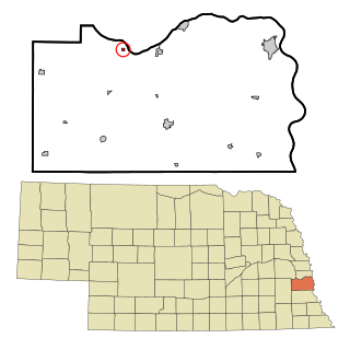
Ulysses is a village in Butler County, Nebraska, United States. The population was 171 at the 2010 census.

<span class="mw-page-title-main">Cedar Creek, Nebraska</span> Village in Nebraska, United States

Cedar Creek is a village in Cass County, Nebraska, United States. The population was 465 at the 2020 census.

<span class="mw-page-title-main">Greenwood, Nebraska</span> Village in Nebraska, United States

Greenwood is a village in northwest Cass County, Nebraska, United States. The population was 595 at the 2020 census.

<span class="mw-page-title-main">Manley, Nebraska</span> Village in Nebraska, United States

Manley is a village in Cass County, Nebraska, United States. The population was 167 at the 2020 census.

<span class="mw-page-title-main">Murray, Nebraska</span> Village in Nebraska, United States

Murray is a village in Cass County, Nebraska, United States. The population was 480 at the 2020 census.

<span class="mw-page-title-main">South Bend, Nebraska</span> Village in Nebraska, United States

South Bend is a village in Cass County, Nebraska, United States. The population was 92 at the 2020 census. The main landmark is a pedestrian bridge across the Platte River which leads to Schramm Park State Recreation Area. It was built in 2004 on the pillars of the abandoned Rock Island Railroad bridge. Thirty-five trains a day—most of them coal trains—still pass through the area on the BNSF Railway main.

<span class="mw-page-title-main">Berwyn, Nebraska</span> Village in Custer County, Nebraska, United States

Berwyn is a village in Custer County, Nebraska, United States. The population was 83 at the 2010 census.

<span class="mw-page-title-main">Callaway, Nebraska</span> Village in Nebraska, United States

Callaway is a village in Custer County, Nebraska, United States. The population was 539 at the 2010 census.

<span class="mw-page-title-main">Waterloo, Nebraska</span> Village in Douglas County, Nebraska, United States

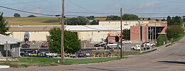
Waterloo is a village in Douglas County, Nebraska, United States. The population was 935 at the 2020 census.

<span class="mw-page-title-main">Chambers, Nebraska</span> Village in Nebraska, United States

Chambers is a village in Holt County, Nebraska, United States. The population was 268 at the 2010 census.

<span class="mw-page-title-main">Page, Nebraska</span> Village in Holt County, Nebraska, United States

Page is a village in Holt County, Nebraska, United States. The population was 166 at the 2010 census.

<span class="mw-page-title-main">Taylor, Nebraska</span> Village in Nebraska, United States

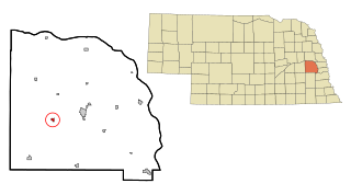
Taylor is a village in, and the county seat of, Loup County, Nebraska, United States. The population was 190 at the 2010 census.

<span class="mw-page-title-main">Ithaca, Nebraska</span> Village in Saunders County, Nebraska, United States

Ithaca is a village in Saunders County, Nebraska, United States. The population was 160 at the 2020 census.

<span class="mw-page-title-main">Malmo, Nebraska</span> Village in Saunders County, Nebraska, United States

Malmo is a village in Saunders County, Nebraska, United States. The population was 94 at the 2020 census.

<span class="mw-page-title-main">Memphis, Nebraska</span> Village in Nebraska, United States

Memphis is a village in Saunders County, Nebraska, United States. The population was 109 at the 2020 census.

<span class="mw-page-title-main">Morse Bluff, Nebraska</span> Village in Saunders County, Nebraska, United States

Morse Bluff is a village in Saunders County, Nebraska, United States. The population was 117 at the 2020 census.

<span class="mw-page-title-main">Valparaiso, Nebraska</span> Village in Saunders County, Nebraska, United States

Valparaiso is a village in Saunders County, Nebraska, United States. The population was 595 at the 2020 census.

<span class="mw-page-title-main">Weston, Nebraska</span> Village in Saunder County, Nebraska, Untied States

Weston is a village in Saunders County, Nebraska, United States. The population was 250 at the 2020 census.

<span class="mw-page-title-main">Washington, Nebraska</span> Village in Washington County, Nebraska, United States

Washington is a village in Washington County, Nebraska, United States. The population was 150 at the 2010 census.

<span class="mw-page-title-main">Bartlett, Nebraska</span> Village in and county seat of Wheeler County, Nebraska, United States

Bartlett is a village in, and the county seat of, Wheeler County, Nebraska, United States. The population was 117 at the 2010 census.

References

  1. "ArcGIS REST Services Directory". United States Census Bureau. Retrieved September 18, 2022.
  2. 1 2 U.S. Geological Survey Geographic Names Information System: Lindsay, Nebraska
  3. 1 2 "U.S. Census website". United States Census Bureau . Retrieved January 31, 2008.
  4. "US Gazetteer files 2010". United States Census Bureau. Archived from the original on July 2, 2012. Retrieved June 24, 2012.
  5. Chicago and North Western Railway Company (1908). A History of the Origin of the Place Names Connected with the Chicago & North Western and Chicago, St. Paul, Minneapolis & Omaha Railways. p. 94.
  6. 1 2 3 4 "A Brief History About Lindsay". Darci Lindgren. Archived from the original on November 19, 2008. Retrieved May 1, 2008.
  7. CenStats Databases Archived 2008-05-09 at the Wayback Machine U.S. Census Bureau, Retrieved on 05-01-2008 for ZIP Code 68644
  8. "Census of Population and Housing". Census.gov. Retrieved June 4, 2015.
  9. "U.S. Census website". United States Census Bureau . Retrieved June 24, 2012.

Commons-logo.svg Media related to Lindsay, Nebraska at Wikimedia Commons