Humphrey, Nebraska | |
---|---|
Coordinates: 41°41′18″N97°29′07″W / 41.68833°N 97.48528°W | |
Country | United States |
State | Nebraska |
County | Platte |
Area | |
• Total | 0.50 sq mi (1.29 km2) |
• Land | 0.49 sq mi (1.28 km2) |
• Water | 0.00 sq mi (0.01 km2) |
Elevation | 1,670 ft (510 m) |
Population (2020) | |
• Total | 857 |
• Density | 1,731.31/sq mi (667.79/km2) |
Time zone | UTC-6 (Central (CST)) |
• Summer (DST) | UTC-5 (CDT) |
ZIP code | 68642 |
Area code | 402 |
FIPS code | 31-23480 [3] |
GNIS feature ID | 2394447 [2] |
Website | www.cityofhumphrey.com |
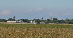
Humphrey is a city in Platte County, Nebraska, United States. The population was 760 at the 2010 census.
Humphrey was platted in 1880 when the Omaha, Niobrara and Black Hills Railroad was extended to that point. [4] It was named after Humphrey, New York, the former hometown of the first postmaster. [5]
According to the United States Census Bureau, the city has a total area of 0.50 square miles (1.29 km2), all land. [6]
Census | Pop. | Note | %± |
---|---|---|---|
1890 | 691 | — | |
1900 | 869 | 25.8% | |
1910 | 868 | −0.1% | |
1920 | 835 | −3.8% | |
1930 | 854 | 2.3% | |
1940 | 841 | −1.5% | |
1950 | 761 | −9.5% | |
1960 | 801 | 5.3% | |
1970 | 862 | 7.6% | |
1980 | 799 | −7.3% | |
1990 | 741 | −7.3% | |
2000 | 786 | 6.1% | |
2010 | 760 | −3.3% | |
2020 | 857 | 12.8% | |
U.S. Decennial Census [7] |
At the 2000 census there were 786 people in 317 households, including 213 families, in the city. The population density was 1,808.4 inhabitants per square mile (698.2/km2). There were 328 housing units at an average density of 754.6 per square mile (291.4/km2). The racial makeup of the city was 98.98% White, 0.25% African American, 0.38% Asian, 0.13% Pacific Islander, and 0.25% from two or more races. Hispanic or Latino of any race were 0.64%. [3]
Of the 317 households 32.5% had children under the age of 18 living with them, 58.7% were married couples living together, 6.0% had a female householder with no husband present, and 32.8% were non-families. 30.9% of households were one person and 21.1% were one person aged 65 or older. The average household size was 2.47 and the average family size was 3.14.
The age distribution was 29.8% under the age of 18, 5.6% from 18 to 24, 23.7% from 25 to 44, 16.7% from 45 to 64, and 24.3% 65 or older. The median age was 39 years. For every 100 females, there were 99.0 males. For every 100 females age 18 and over, there were 88.4 males.
The median household income was $39,250, and the median family income was $46,645. Males had a median income of $32,917 versus $21,719 for females. The per capita income for the city was $18,863. About 4.8% of families and 6.3% of the population were below the poverty line, including 10.3% of those under age 18 and 5.0% of those age 65 or over.
At the 2010 census there were 760 people in 315 households, including 219 families, in the city. The population density was 1,520.0 inhabitants per square mile (586.9/km2). There were 334 housing units at an average density of 668.0 per square mile (257.9/km2). The racial makeup of the city was 98.2% White, 0.4% African American, 0.5% Native American, 0.8% from other races, and 0.1% from two or more races. Hispanic or Latino of any race were 0.7%. [8]
Of the 315 households 31.7% had children under the age of 18 living with them, 59.4% were married couples living together, 7.6% had a female householder with no husband present, 2.5% had a male householder with no wife present, and 30.5% were non-families. 26.7% of households were one person and 15.3% were one person aged 65 or older. The average household size was 2.41 and the average family size was 2.92.
The median age was 40.6 years. 25.7% of residents were under the age of 18; 5% were between the ages of 18 and 24; 22.8% were from 25 to 44; 24% were from 45 to 64; and 22.5% were 65 or older. The gender makeup of the city was 50.8% male and 49.2% female.
Humphrey Public Schools operates the single public school in the town: Humphrey Public School.
Intercity bus service to the city is provided by Express Arrow. [9]
Roseland is a village in Adams County, Nebraska, United States. The population was 260 at the 2020 census. It is part of the Hastings, Nebraska Micropolitan Statistical Area.
Bellwood is a village in Butler County, Nebraska, United States. The population was 435 at the 2010 census.
Rising City is a village in Butler County, Nebraska, United States. The population was 374 at the 2010 census.
Louisville is a city in northern Cass County, Nebraska, United States. The population was 1,319 at the 2020 census.
Mason City is a village in Custer County, Nebraska, United States. The population was 171 at the 2010 census.
Maskell is a village in Dixon County, Nebraska, United States. It is part of the Sioux City, IA–NE–SD Metropolitan Statistical Area. The population was 76 at the 2010 census. It is reportedly home to the smallest city hall in the United States.
Bennington is a city in Douglas County, Nebraska, United States. The population was 2,026 at the 2020 U.S. Census.
Beaver City is a city in Furnas County, on the southern border of Nebraska, United States. The population was 609 at the 2010 census. It is the county seat of Furnas County.
Bloomfield is a city in Knox County, Nebraska, United States. The population was 1,028 at the 2010 census.
Silver Creek is a village in Merrick County, Nebraska, United States. The population was 320 at the 2020 census. It is part of the Grand Island metropolitan area.
Grant is a city and county seat of Perkins County, Nebraska, United States. The population was 1,165 at the 2010 census.
Bassett is a city in Rock County, Nebraska, United States. The population was 538 at the 2020 census. It is the county seat of Rock County.
Malmo is a village in Saunders County, Nebraska, United States. The population was 94 at the 2020 census.
Yutan is a city in Saunders County, Nebraska, United States.
Stanton is a city in Stanton County, Nebraska, United States. The population was 1,577 at the 2010 census. It is the county seat of Stanton County. Stanton was platted in 1870. Both the city and county are named after Edwin Stanton, secretary of war for president Abraham Lincoln during the American Civil War.
Fort Calhoun is a city in Washington County, Nebraska, United States. The population was 1,108 at the 2020 census. The city includes Fort Atkinson, the first fort built west of the Missouri River.
Wayne is a city in Wayne County, Nebraska, United States. The population was 5,660 at the 2010 census. It is the county seat of Wayne County and the home of Wayne State College.
Bartlett is a village in, and the county seat of, Wheeler County, Nebraska, United States. The population was 117 at the 2010 census.
Henderson is a city in York County, Nebraska, United States. The population was 991 at the 2010 census.
Newman Grove is a city in Madison and Platte counties in Nebraska, United States. The population was 667 at the 2020 census.
Media related to Humphrey, Nebraska at Wikimedia Commons