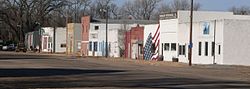
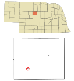
Dunning, Nebraska

Last updated

Dunning, Nebraska
Dunning, Nebraska Jewett Ave 2.JPG
Downtown Dunning: Jewett Avenue
Blaine County Nebraska Incorporated and Unincorporated areas Dunning Highlighted.svg
Location of Dunning, Nebraska
Coordinates: 41°49′37″N100°6′16″W / 41.82694°N 100.10444°W / 41.82694; -100.10444
Country United States
State Nebraska
County Blaine
Area
[1]
  Total0.23 sq mi (0.59 km2)
  Land0.23 sq mi (0.59 km2)
  Water0.00 sq mi (0.00 km2)
Elevation
[2]
2,618 ft (798 m)
Population
 (2020)
  Total80
  Density350.88/sq mi (135.70/km2)
Time zone UTC-6 (Central (CST))
  Summer (DST) UTC-5 (CDT)
ZIP code
68833
Area code 308
FIPS code 31-13960
GNIS feature ID2398758 [2]

Dunning is the most populous village in Blaine County, Nebraska, United States. The population was 80 at the 2020 census.

Contents

History

Dunning was a station on the Chicago, Burlington and Quincy Railroad. [3]

Geography

Dunning is situated at the confluence of the Middle Loup River (to the north) and the Dismal River (to the south).

According to the United States Census Bureau, the village has a total area of 0.23 square miles (0.60 km2), all land. [4]

Demographics

Historical population
CensusPop.Note
1920 289
1930 212−26.6%
1940 27228.3%
1950 254−6.6%
1960 210−17.3%
1970 162−22.9%
1980 18212.3%
1990 131−28.0%
2000 109−16.8%
2010 103−5.5%
2020 80−22.3%
U.S. Decennial Census [5]
2012 Estimate [6]

2010 census

As of the census [7] of 2010, there were 103 people, 44 households, and 29 families residing in the village. The population density was 447.8 inhabitants per square mile (172.9/km2). There were 67 housing units at an average density of 291.3 per square mile (112.5/km2). The racial makeup of the village was 99.0% White and 1.0% African American.

There were 44 households, of which 29.5% had children under the age of 18 living with them, 56.8% were married couples living together, 2.3% had a female householder with no husband present, 6.8% had a male householder with no wife present, and 34.1% were non-families. 34.1% of all households were made up of individuals, and 11.3% had someone living alone who was 65 years of age or older. The average household size was 2.34 and the average family size was 2.90.

The median age in the village was 40.8 years. 26.2% of residents were under the age of 18; 5.9% were between the ages of 18 and 24; 21.4% were from 25 to 44; 30.2% were from 45 to 64; and 16.5% were 65 years of age or older. The gender makeup of the village was 52.4% male and 47.6% female.

2000 census

As of the census of 2000, there were 109 people, 53 households, and 31 families residing in the village. The population density was 480.0 inhabitants per square mile (185.3/km2). There were 70 housing units at an average density of 308.2 per square mile (119.0/km2). The racial makeup of the village was 99.08% White and 0.92% Native American. Hispanic or Latino of any race were 0.92% of the population.

There were 53 households, out of which 26.4% had children under the age of 18 living with them, 45.3% were married couples living together, 9.4% had a female householder with no husband present, and 41.5% were non-families. 39.6% of all households were made up of individuals, and 20.8% had someone living alone who was 65 years of age or older. The average household size was 2.06 and the average family size was 2.71.

In the village, the population was spread out, with 23.9% under the age of 18, 4.6% from 18 to 24, 23.9% from 25 to 44, 29.4% from 45 to 64, and 18.3% who were 65 years of age or older. The median age was 44 years. For every 100 females, there were 84.7 males. For every 100 females age 18 and over, there were 76.6 males.

As of 2000 the median income for a household in the village was $28,500, and the median income for a family was $30,833. Males had a median income of $21,719 versus $19,583 for females. The per capita income for the village was $13,725. There were 5.6% of families and 6.1% of the population living below the poverty line, including 3.8% of under eighteens and 9.1% of those over 64.

Education

Sandhills Public Schools operates area public schools. [8]

See also

Related Research Articles

<span class="mw-page-title-main">Cedar Creek, Nebraska</span> Village in Nebraska, United States

Cedar Creek is a village in Cass County, Nebraska, United States. The population was 465 at the 2020 census.

<span class="mw-page-title-main">Manley, Nebraska</span> Village in Nebraska, United States

Manley is a village in Cass County, Nebraska, United States. The population was 167 at the 2020 census.

<span class="mw-page-title-main">Murray, Nebraska</span> Village in Nebraska, United States

Murray is a village in Cass County, Nebraska, United States. The population was 480 at the 2020 census.

<span class="mw-page-title-main">South Bend, Nebraska</span> Village in Nebraska, United States

South Bend is a village in Cass County, Nebraska, United States. The population was 92 at the 2020 census. The main landmark is a pedestrian bridge across the Platte River which leads to Schramm Park State Recreation Area. It was built in 2004 on the pillars of the abandoned Rock Island Railroad bridge. Thirty-five trains a day—most of them coal trains—still pass through the area on the BNSF Railway main.

<span class="mw-page-title-main">Anselmo, Nebraska</span> Village in Nebraska, United States

Anselmo is a village in Custer County, Nebraska, United States. The population was 145 at the 2010 census.

<span class="mw-page-title-main">Berwyn, Nebraska</span> Village in Custer County, Nebraska, United States

Berwyn is a village in Custer County, Nebraska, United States. The population was 83 at the 2010 census.

<span class="mw-page-title-main">Waterloo, Nebraska</span> Village in Douglas County, Nebraska, United States

Waterloo is a village in Douglas County, Nebraska, United States. The population was 935 at the 2020 census.

<span class="mw-page-title-main">Hyannis, Nebraska</span> Village in and county seat of Hyannis County, Nebraska, United States

Hyannis is a village in Grant County, Nebraska, United States. The population was 165 at the time of the 2020 census. It is the county seat of Grant County. It is centrally located in the extensive, unique, and remote region of grasslands known as the Sandhills of Nebraska at the intersection of two Nebraska State Highways: NSH 61 which runs north and south, and NSH 2, which runs east and west.

<span class="mw-page-title-main">Page, Nebraska</span> Village in Holt County, Nebraska, United States

Page is a village in Holt County, Nebraska, United States. The population was 166 at the 2010 census.

<span class="mw-page-title-main">Mullen, Nebraska</span> Village in Nebraska, United States

Mullen is a village in Hooker County, Nebraska, United States. The population was 509 at the 2010 census. It is the county seat of Hooker County.

<span class="mw-page-title-main">Colon, Nebraska</span> Village in Saunders County, Nebraska, United States

Colon is a village in Saunders County, Nebraska, United States. The population was 107 at the 2020 census. Amenities include a post office and bank branch. Colon is seven miles north of the county seat Wahoo.

<span class="mw-page-title-main">Ithaca, Nebraska</span> Village in Saunders County, Nebraska, United States

Ithaca is a village in Saunders County, Nebraska, United States. The population was 160 at the 2020 census.

<span class="mw-page-title-main">Malmo, Nebraska</span> Village in Saunders County, Nebraska, United States

Malmo is a village in Saunders County, Nebraska, United States. The population was 94 at the 2020 census.

<span class="mw-page-title-main">Memphis, Nebraska</span> Village in Nebraska, United States

Memphis is a village in Saunders County, Nebraska, United States. The population was 109 at the 2020 census.

<span class="mw-page-title-main">Morse Bluff, Nebraska</span> Village in Saunders County, Nebraska, United States

Morse Bluff is a village in Saunders County, Nebraska, United States. The population was 117 at the 2020 census.

<span class="mw-page-title-main">Weston, Nebraska</span> Village in Saunder County, Nebraska, United States

Weston is a village in Saunders County, Nebraska, United States. The population was 250 at the 2020 census.

<span class="mw-page-title-main">Thedford, Nebraska</span> Village in and county seat of Thomas County Nebraska, United States

Thedford is a village and county seat of Thomas County, Nebraska, United States. The population was 188 at the 2010 census.

<span class="mw-page-title-main">Washington, Nebraska</span> Village in Washington County, Nebraska, United States

Washington is a village in Washington County, Nebraska, United States. The population was 150 at the 2010 census.

<span class="mw-page-title-main">Bartlett, Nebraska</span> Village in and county seat of Wheeler County, Nebraska, United States

Bartlett is a village in, and the county seat of, Wheeler County, Nebraska, United States. The population was 117 at the 2010 census.

<span class="mw-page-title-main">Oxford, Nebraska</span> Village in Nebraska, United States

Oxford is a village in Furnas and Harlan counties in the U.S. state of Nebraska. The population was 779 at the 2010 census.

References

  1. "ArcGIS REST Services Directory". United States Census Bureau. Retrieved September 18, 2022.
  2. 1 2 U.S. Geological Survey Geographic Names Information System: Dunning, Nebraska
  3. Fitzpatrick, Lillian L. (1960). Nebraska Place-Names. University of Nebraska Press. p. 18.
  4. "US Gazetteer files 2010". United States Census Bureau. Archived from the original on July 2, 2012. Retrieved June 24, 2012.
  5. United States Census Bureau. "Census of Population and Housing" . Retrieved October 19, 2013.
  6. "Annual Estimates of the Resident Population: April 1, 2010 to July 1, 2012". Archived from the original on October 19, 2013. Retrieved October 19, 2013.
  7. "U.S. Census website". United States Census Bureau . Retrieved June 24, 2012.
  8. Home. Sandhills Public Schools. Retrieved on July 13, 2018. "Sandhills Public Schools 107 Gandy Ave [...] Dunning, NE 68833"

Commons-logo.svg Media related to Dunning, Nebraska at Wikimedia Commons