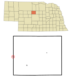
Halsey, Nebraska | |
---|---|
Coordinates: 41°54′12″N100°16′11″W / 41.90333°N 100.26972°W | |
Country | United States |
State | Nebraska |
Counties | Thomas, Blaine |
Area | |
• Total | 0.19 sq mi (0.50 km2) |
• Land | 0.19 sq mi (0.50 km2) |
• Water | 0.00 sq mi (0.00 km2) |
Elevation | 2,700 ft (800 m) |
Population (2020) | |
• Total | 68 |
• Density | 350.52/sq mi (135.67/km2) |
Time zone | UTC-6 (Central (CST)) |
• Summer (DST) | UTC-5 (CDT) |
ZIP code | 69142 |
Area code | 308 |
FIPS code | 31-20680 |
GNIS feature ID | 2398226 [2] |
Halsey is a village in Blaine and Thomas counties in Nebraska, United States. The population was 76 at the 2010 census.
Halsey was established in 1887 when the railroad was extended to that point. [3] It was named for Halsey Yates, a railroad employee. [4]
Halsey is located at 41°54′9″N100°16′5″W / 41.90250°N 100.26806°W (41.902625, -100.268114), [5] mostly in Thomas County.
According to the United States Census Bureau, the village has a total area of 0.19 square miles (0.49 km2), all land. [6]
Census | Pop. | Note | %± |
---|---|---|---|
1960 | 111 | — | |
1970 | 131 | 18.0% | |
1980 | 144 | 9.9% | |
1990 | 110 | −23.6% | |
2000 | 59 | −46.4% | |
2010 | 76 | 28.8% | |
2020 | 68 | −10.5% | |
U.S. Decennial Census [7] 2012 Estimate [8] |
As of the census [9] of 2010, there were 76 people, 35 households, and 24 families residing in the village. The population density was 400.0 inhabitants per square mile (154.4/km2). There were 52 housing units at an average density of 273.7 per square mile (105.7/km2). The racial makeup of the village was 93.4% White, 1.3% Asian, and 5.3% from two or more races.
There were 35 households, of which 22.9% had children under the age of 18 living with them, 57.1% were married couples living together, 5.7% had a female householder with no husband present, 5.7% had a male householder with no wife present, and 31.4% were non-families. 28.6% of all households were made up of individuals, and 14.3% had someone living alone who was 65 years of age or older. The average household size was 2.17 and the average family size was 2.63.
The median age in the village was 54.8 years. 22.4% of residents were under the age of 18; 1.3% were between the ages of 18 and 24; 11.8% were from 25 to 44; 39.4% were from 45 to 64; and 25% were 65 years of age or older. The gender makeup of the village was 46.1% male and 53.9% female.
As of the census of 2000, there were 59 people, 34 households, and 17 families residing in the village. The population density was 299.0 people per square mile (115.4 people/km2). There were 52 housing units at an average density of 263.5 per square mile (101.7/km2). The racial makeup of the village was 100.00% White.
There were 34 households, out of which 14.7% had children under the age of 18 living with them, 50.0% were married couples living together, 2.9% had a female householder with no husband present, and 47.1% were non-families. 47.1% of all households were made up of individuals, and 23.5% had someone living alone who was 65 years of age or older. The average household size was 1.74 and the average family size was 2.39.
In the village, the population was spread out, with 11.9% under the age of 18, 3.4% from 18 to 24, 18.6% from 25 to 44, 35.6% from 45 to 64, and 30.5% who were 65 years of age or older. The median age was 54 years. For every 100 females, there were 73.5 males. For every 100 females age 18 and over, there were 73.3 males.
As of 2000 the median income for a household in the village was $21,250, and the median income for a family was $44,167. Males had a median income of $12,083 versus $0 for females. The per capita income for the village was $20,144. There were 25.0% of families and 19.2% of the population living below the poverty line, including no under eighteens and 26.1% of those over 64.
Owendale is a village in Huron County of the U.S. state of Michigan. The population was 241 at the 2010 census. The village is within Brookfield Township.
Murray is a village in Cass County, Nebraska, United States. The population was 480 at the 2020 census.
Belden is a village in Cedar County, Nebraska, United States. The population was 112 at the 2020 census.
Obert is a village in Cedar County, Nebraska, United States. The population was 23 at the 2020 census.
Deweese is a village in Clay County, Nebraska, United States. The population was 43 at the 2020 census. It is part of the Hastings, Nebraska Micropolitan Statistical Area.
Boys Town is a village in Douglas County, Nebraska, United States. The population was 410 at the 2020 census. Boys Town is an enclave and a suburb of Omaha.
Waterloo is a village in Douglas County, Nebraska, United States. The population was 935 at the 2020 census.
Chambers is a village in Holt County, Nebraska, United States. The population was 268 at the 2010 census.
Page is a village in Holt County, Nebraska, United States. The population was 166 at the 2010 census.
Stapleton is a village in and the county seat of Logan County, Nebraska, United States. The population was 267 at the 2020 census.
Colon is a village in Saunders County, Nebraska, United States. The population was 107 at the 2020 census. Amenities include a post office and bank branch. Colon is seven miles north of the county seat Wahoo.
Malmo is a village in Saunders County, Nebraska, United States. The population was 94 at the 2020 census.
Memphis is a village in Saunders County, Nebraska, United States. The population was 109 at the 2020 census.
Morse Bluff is a village in Saunders County, Nebraska, United States. The population was 117 at the 2020 census.
Weston is a village in Saunders County, Nebraska, United States. The population was 250 at the 2020 census.
Washington is a village in Washington County, Nebraska, United States. The population was 150 at the 2010 census.
Bartlett is a village in, and the county seat of, Wheeler County, Nebraska, United States. The population was 117 at the 2010 census.
Mooreton is a city in Richland County, North Dakota, United States. The population was 177 at the 2020 census. Mooreton was founded in 1884. It is part of the Wahpeton, ND–MN Micropolitan Statistical Area.
South Zanesville is a village in Muskingum County, Ohio, United States, along the Muskingum River near the mouth of the Moxahala Creek. The population was 1,894 at the 2020 census. It is part of the Zanesville micropolitan area.
Weirgor is a town in Sawyer County, Wisconsin, United States. The population was 370 at the 2000 census.
Media related to Halsey, Nebraska at Wikimedia Commons