Harrisburg, South Dakota

Last updated

Harrisburg, South Dakota
City of Harrisburg.jpg
Motto: 
Great Things Are Happening
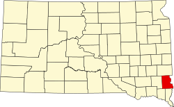
Lincoln County South Dakota Incorporated and Unincorporated areas Harrisburg Highlighted.svg
Location in Lincoln County and the state of South Dakota
Usa edcp location map.svg
Red pog.svg
Harrisburg, South Dakota
Location in the United States
Coordinates: 43°26′04″N96°42′45″W / 43.43444°N 96.71250°W / 43.43444; -96.71250
CountryUnited States
State South Dakota
County Lincoln
FoundedAugust 1, 1879
Government
   Mayor Derick Wenck
Area
[1]
  Total4.69 sq mi (12.16 km2)
  Land4.69 sq mi (12.16 km2)
  Water0.00 sq mi (0.00 km2)
Elevation
[2]
1,424 ft (434 m)
Population
 (2020) [3]
  Total6,732
  Estimate 
(2022) [4]
8,451
  Density1,434.17/sq mi (553.78/km2)
Time zone UTC-6 (Central (CST))
  Summer (DST) UTC-5 (CDT)
ZIP code
57032
Area code 605
FIPS code 46-27260
GNIS feature ID1267411 [2]
Website harrisburgsd.gov

Harrisburg is a city in Lincoln County, South Dakota, United States and is a suburb of Sioux Falls. The population was 6,732 at the 2020 census. [3]

Contents

History

Before the railroad was built through Lincoln County, a stagecoach brought mail to the Johnson Harris Homestead located on Nine Mile Creek in Dayton Township. Johnson Harris named the post office Harrisburg in honor of himself. [5]

The history of Harrisburg started August 1, 1879, when the first train came rolling through the territory. The train went from Sioux City, Iowa, to Sioux Falls, South Dakota. The post office was moved to the Emory J. Darling Homestead, 1 mile south of what is now Harrisburg. The post office was called Salina in honor of Mrs. Jim Stillwell, an early settler and a highly respected teacher. [5]

Finally in 1890, the depot was moved to its present site. The post office took back its original name and the town of Harrisburg was born.

One of the many early businesses in Harrisburg was the State Bank, circa 1901–1945. The bank's building is still located in its original spot at 101 Railroad Ave. [5] The bank itself was built in 1899 and completely restored in 2006 by its current owner RISE, Inc. is a construction management/structural engineering firm. [6]

Much mystery surrounds the old bank building, including whether or not the infamous bandit John Dillinger stopped to rob it. According to popular legend, after Dillinger robbed the bank, he fired a round into the teller counter as a reminder not to follow him out. That bullet hole remains there today. [5]

Government

The city of Harrisburg is led by a mayor-council (strong mayor) form of government. Mayoral elections occur every four years. City council seats are contested every three years; However, not all of the council members are elected in the same year. The council consists of four members elected to represent two wards. The council member position is designed to be part-time. [7]

Geography

According to the United States Census Bureau, the city has a total area of 2.48 square miles (6.42 km2), all land. [8]

Harrisburg is an estimated 2.7 miles from the southern edge of Sioux Falls. [9]

Demographics

Historical population
CensusPop.Note
1910 164
1920 19317.7%
1930 2056.2%
1940 24117.6%
1950 27413.7%
1960 31314.2%
1970 3388.0%
1980 55865.1%
1990 72730.3%
2000 95831.8%
2010 4,089326.8%
2020 6,73264.6%
2022 (est.)8,451 [4] 25.5%
U.S. Decennial Census [10]
2020 Census [3] [11]

2010 census

As of the census of 2010, there were 4,089 people, 1,423 households, and 1,133 families residing in the city. The population density was 1,648.8 inhabitants per square mile (636.6/km2). There were 1,507 housing units at an average density of 607.7 per square mile (234.6/km2). The racial makeup of the city was 96.8% White, 0.5% African American, 0.2% Native American, 0.3% Asian, 0.2% from other races, and 2.0% from two or more races. Hispanic or Latino of any race were 1.3% of the population.

There were 1,423 households, of which 53.5% had children under the age of 18 living with them, 65.0% were married couples living together, 10.3% had a female householder with no husband present, 4.3% had a male householder with no wife present, and 20.4% were non-families. 13.3% of all households were made up of individuals, and 1% had someone living alone who was 65 years of age or older. The average household size was 2.87 and the average family size was 3.18.

The median age in the city was 27.1 years. 34% of residents were under the age of 18; 8.2% were between the ages of 18 and 24; 42.6% were from 25 to 44; 13.1% were from 45 to 64; and 2% were 65 years of age or older. The gender makeup of the city was 49.0% male and 51.0% female.

Education

The Harrisburg School District currently has high school, two middle schools, and seven elementary schools. Due to a mismatch in the boundaries between school districts and cities, some of the schools are in Sioux Falls. There are approximately 4,800 students in the district. [12]

High school

Middle schools

Elementary schools

Liberty Elementary and Freedom Elementary are located inside Harrisburg. A new (2008) sports complex and stadium were built at the new high school on the west side of Harrisburg, along with construction of soccer fields and tennis courts on the north side of the Harrisburg High School campus. Harrisburg is in SDHSAA class AA in athletics and would compete with the five other class Sioux Falls metro schools, but those Sioux Falls schools moved up to AAA at the same time. Harrisburg has competed in class AAA football since the 2019 season. [13]

Related Research Articles

<span class="mw-page-title-main">Minnehaha County, South Dakota</span> County in South Dakota, United States

Minnehaha County is a county on the eastern border of the state of South Dakota. As of the 2020 census, the population was 197,214, making it the state's most populous county. It contains over 20% of the state's population. Its county seat is Sioux Falls, South Dakota's most populous city. The county was created in 1862 and organized in 1868. Its name was derived from the Sioux word Mnihaha, meaning "rapid water," or "waterfall".

<span class="mw-page-title-main">Lincoln County, South Dakota</span> County in South Dakota, United States

Lincoln County is a county in the U.S. state of South Dakota. As of the 2020 census, the population was 65,161, making it the third most populous county in South Dakota. Its county seat is Canton. The county was named for Abraham Lincoln, 16th President of the United States.

<span class="mw-page-title-main">Prior Lake, Minnesota</span> City in Minnesota, United States

Prior Lake is an exurban city 20 miles (32 km) southwest of Minneapolis seated next to Savage and Shakopee in Scott County in the state of Minnesota. Surrounding the shores of Lower and Upper Prior Lake, the city lies south of the Minnesota River in an area known as RiverSouth and establishes the urban fringe of the south-southwest portion of Minneapolis-St. Paul, the sixteenth largest metropolitan area in the United States. The population was 27,617 at the 2020 census.

<span class="mw-page-title-main">South Sioux City, Nebraska</span> City in Dakota County, Nebraska, United States

South Sioux City is a city in Dakota County, Nebraska, United States. It is located immediately across the Missouri River from Sioux City, Iowa, and is part of the Sioux City, IA-NE-SD Metropolitan Statistical Area. As of the 2010 census, the city population was 13,353, making it the 14th most populous city in Nebraska.

<span class="mw-page-title-main">Huron, South Dakota</span> City in the United States

Huron is a city in and the county seat of Beadle County, South Dakota, United States. The population was 14,263 at the 2020 census, and it is the 8th most populous city in South Dakota.

<span class="mw-page-title-main">Volga, South Dakota</span> City in South Dakota, United States

Volga is a city in Brookings County, South Dakota, United States with a population of 2,113 at the 2020 census.

<span class="mw-page-title-main">Canton, South Dakota</span> City in South Dakota, United States

Canton is a city in and the county seat of Lincoln County, South Dakota, United States. Canton is located 20 minutes south of Sioux Falls in southeastern South Dakota. Canton is nestled in the rolling hills of the Sioux Valley, providing an abundance of recreational activities with the Big Sioux River bordering the eastern side, Newton Hills State Park to the south, and Lake Alvin to the north. The city was named by Norwegian settler and former legislator James M. Wahl. The population was 3,066 as of the 2020 census.

<span class="mw-page-title-main">Lennox, South Dakota</span> City in South Dakota, United States

Lennox is a city in Lincoln County, South Dakota, United States, located 20 miles (32 km) southwest of Sioux Falls. The population was 2,423 at the 2020 census.

<span class="mw-page-title-main">Baltic, South Dakota</span> City in South Dakota, United States

Baltic is a city on the Big Sioux River in northern Minnehaha County, South Dakota, United States. The population was 1,246 at the 2020 census.

<span class="mw-page-title-main">Brandon, South Dakota</span> City in South Dakota, United States

Brandon is a city in Minnehaha County, South Dakota, United States. Brandon is located five miles east of Sioux Falls. The population was 11,048 as of the 2020 census.

<span class="mw-page-title-main">Crooks, South Dakota</span> City in South Dakota, United States

Crooks is a city in Minnehaha County, South Dakota, United States and is a suburb of Sioux Falls. The population was 1,362 at the 2020 census. Crooks was named New Hope until 1904. The town's present name honors W. A. Crooks, a local politician.

<span class="mw-page-title-main">Dell Rapids, South Dakota</span> City in South Dakota, United States

Dell Rapids is a city in Minnehaha County, South Dakota, United States. The population was 3,996 at the 2020 census. It is known as "The Little City with the Big Attractions."

<span class="mw-page-title-main">Flandreau, South Dakota</span> City in South Dakota, United States

FlandreauFLAN-droo is a city in and county seat of Moody County, South Dakota, United States. The population was 2,372 at the 2020 census. It was named in honor of Charles Eugene Flandrau, a judge in the territory and state of Minnesota. He is credited with saving the community of New Ulm, Minnesota, from destruction during conflict with the Sioux tribe in 1862.

<span class="mw-page-title-main">Sisseton, South Dakota</span> City in South Dakota, United States

Sisseton is a city in Roberts County, South Dakota, United States. The population was 2,479 at the 2020 census. It is the county seat of Roberts County. Sisseton is the home to a number of tourist attractions, including the Nicollet Tower, and is near the "Song to the Great Spirit" building on the Sisseton Wahpeton College campus. The city is named for the Sisseton division of the Native American Sioux. It also serves as an important part of the Lake Traverse Indian Reservation.

<span class="mw-page-title-main">Elk Point, South Dakota</span> City in South Dakota, United States

Elk Point is a city in and county seat of Union County, South Dakota, United States. The population was 2,149 as of the 2020 census.

<span class="mw-page-title-main">North Sioux City, South Dakota</span> City in South Dakota, United States

North Sioux City is a city in Union County, South Dakota, United States. The population was 3,042 at the 2020 census. It is part of the Sioux City, IA-NE-SD Metropolitan Statistical Area.

<span class="mw-page-title-main">Mobridge, South Dakota</span> City in South Dakota, United States

Mobridge also Kȟowákataŋ Otȟúŋwahe is a city in Walworth County, South Dakota, United States. The population was 3,261 according to the 2020 census.

<span class="mw-page-title-main">Sartell, Minnesota</span> City in Minnesota, United States

Sartell is a city in Benton and Stearns Counties in the U.S. state of Minnesota that straddles the Mississippi River. It is part of the St. Cloud Metropolitan Statistical Area. The population was 19,351 at the 2020 census, making it St. Cloud's most populous suburb and the fourth-largest city in central Minnesota, after St. Cloud, Elk River, and Willmar.

<span class="mw-page-title-main">Sioux Falls, South Dakota</span> City in South Dakota, United States

Sioux Falls is the most populous city in the U.S. state of South Dakota and the 121st-most populous city in the United States. It is the county seat of Minnehaha County and also extends into northern Lincoln County to the south, which continues up to the Iowa state line. The population was 192,517 at the 2020 census, and in 2022, its estimated population was 202,078. According to city officials, the estimated population had grown to 213,891 as of early 2024. The Sioux Falls metro area accounts for more than 30% of the state's population. Chartered in 1856 on the banks of the Big Sioux River, the city is situated in the rolling hills at the junction of interstates 29 and 90.

<span class="mw-page-title-main">Shakopee, Minnesota</span> City in Minnesota, United States

Shakopee is a city in and the county seat of Scott County, Minnesota, United States. It is located southwest of Minneapolis. Sited on the south bank bend of the Minnesota River, Shakopee and nearby suburbs comprise the southwest portion of Minneapolis-Saint Paul, the sixteenth-largest metropolitan area in the United States, with 3.7 million people. The population was 43,698 at the 2020 census.

References

  1. "ArcGIS REST Services Directory". United States Census Bureau. Retrieved October 15, 2022.
  2. 1 2 U.S. Geological Survey Geographic Names Information System: Harrisburg, South Dakota
  3. 1 2 3 "Explore Census Data". Explore Census Data. United States Census Bureau . Retrieved October 31, 2023.
  4. 1 2 "City and Town Population Totals: 2020-2022". United States Census Bureau. October 24, 2023. Retrieved October 31, 2023.
  5. 1 2 3 4 Harrisburg Economic Development Board, "History", "Harrisburg South Dakota Community Profile", 2011-2012
  6. RISE, Incorporated, "Contact RISE Inc." Archived November 26, 2013, at the Wayback Machine , RISE Incorporated, June 4, 2013
  7. "Mayor - Harrisburg, Sd". Harrisburgsd.gov. Retrieved May 31, 2020.
  8. "US Gazetteer files 2010". United States Census Bureau . Retrieved June 21, 2012.
  9. "Google Maps". Maps.google.com. Retrieved September 30, 2015.
  10. United States Census Bureau. "Census of Population and Housing" . Retrieved September 23, 2013.
  11. "Census Population API". United States Census Bureau. Retrieved October 15, 2022.
  12. "District". www.harrisburgdistrict41-2.org. Retrieved February 17, 2019.
  13. "Member School Directory | About Us". SDHSAA. Retrieved September 30, 2015.