Chamberlain, South Dakota

Last updated

Chamberlain
Makȟáthipi (Lakota)
AktaLakotaMuseum.jpg
Akta Lakota Museum, 2003
Motto: 
"One day just isn't enough..."
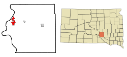
Brule County South Dakota Incorporated and Unincorporated areas Chamberlain Highlighted.svg
Location in Brule County and the state of South Dakota
Coordinates: 43°48′20″N99°19′42″W / 43.80556°N 99.32833°W / 43.80556; -99.32833
CountryUnited States
State South Dakota
County Brule
Founded1881 [1]
Area
[2]
  Total5.67 sq mi (14.70 km2)
  Land4.48 sq mi (11.60 km2)
  Water1.20 sq mi (3.10 km2)
Elevation
1,404 ft (428 m)
Population
 (2020) [3]
  Total2,473
  Density552.13/sq mi (213.16/km2)
Time zone UTC−6 (Central (CST))
  Summer (DST) UTC−5 (CDT)
ZIP codes
57325-57326
Area code 605
FIPS code 46-11220 [4]
GNIS feature ID1265153 [5]
Website www.chamberlainsd.org

Chamberlain is a city in Brule County, South Dakota, United States. It is located on the east bank of the Missouri River, at the dammed section of the Lake Francis Case, close to where it is crossed by Interstate 90.

Contents

The population of Chamberlain was 2,473 at the 2020 census. [6] It is the county seat of Brule County. [7]

Chamberlain is home to the South Dakota Hall of Fame, and the 50-foot tall Dignity statue is nearby.

History

Chamberlain was named after Selah Chamberlain, a railroad director of the Chicago, Milwaukee and St. Paul Railway, as it was established by European Americans in relation to construction of the railroad. [8] [9] The city is called "earth dwelling" in Lakota. [10]

Chamberlain, S.D LCCN2007662794.tif
Chamberlain, 1907

Geography

According to the United States Census Bureau, the city has a total area of 7.84 square miles (20.31 km2), of which 6.64 square miles (17.20 km2) is land and 1.20 square miles (3.11 km2) is water. [11]

Climate

Climate data for Chamberlain 5 S, South Dakota (1991−2020 normals, extremes 1980−present)
MonthJanFebMarAprMayJunJulAugSepOctNovDecYear
Record high °F (°C)68
(20)
75
(24)
88
(31)
93
(34)
100
(38)
111
(44)
113
(45)
112
(44)
105
(41)
98
(37)
87
(31)
73
(23)
113
(45)
Mean maximum °F (°C)53.1
(11.7)
59.8
(15.4)
74.2
(23.4)
82.9
(28.3)
90.2
(32.3)
95.0
(35.0)
102.1
(38.9)
99.7
(37.6)
95.4
(35.2)
86.2
(30.1)
71.6
(22.0)
56.4
(13.6)
103.5
(39.7)
Mean daily maximum °F (°C)29.0
(−1.7)
33.8
(1.0)
45.4
(7.4)
57.4
(14.1)
69.0
(20.6)
79.6
(26.4)
87.0
(30.6)
85.2
(29.6)
76.9
(24.9)
61.7
(16.5)
45.9
(7.7)
32.7
(0.4)
58.6
(14.8)
Daily mean °F (°C)19.0
(−7.2)
23.1
(−4.9)
33.9
(1.1)
45.1
(7.3)
56.9
(13.8)
67.7
(19.8)
74.2
(23.4)
72.2
(22.3)
63.4
(17.4)
49.0
(9.4)
34.6
(1.4)
23.0
(−5.0)
46.8
(8.2)
Mean daily minimum °F (°C)9.0
(−12.8)
12.3
(−10.9)
22.3
(−5.4)
32.9
(0.5)
44.8
(7.1)
55.9
(13.3)
61.5
(16.4)
59.3
(15.2)
49.9
(9.9)
36.2
(2.3)
23.3
(−4.8)
13.2
(−10.4)
35.0
(1.7)
Mean minimum °F (°C)−13.0
(−25.0)
−8.5
(−22.5)
1.8
(−16.8)
18.6
(−7.4)
31.6
(−0.2)
44.2
(6.8)
51.0
(10.6)
49.1
(9.5)
35.1
(1.7)
19.9
(−6.7)
5.3
(−14.8)
−7.6
(−22.0)
−17.7
(−27.6)
Record low °F (°C)−30
(−34)
−34
(−37)
−19
(−28)
1
(−17)
24
(−4)
32
(0)
46
(8)
39
(4)
24
(−4)
4
(−16)
−13
(−25)
−30
(−34)
−34
(−37)
Average precipitation inches (mm)0.54
(14)
0.60
(15)
1.08
(27)
2.65
(67)
3.51
(89)
4.27
(108)
2.82
(72)
3.02
(77)
2.28
(58)
1.97
(50)
0.81
(21)
0.53
(13)
24.08
(612)
Average snowfall inches (cm)7.3
(19)
8.0
(20)
7.2
(18)
6.8
(17)
0.0
(0.0)
0.0
(0.0)
0.0
(0.0)
0.0
(0.0)
0.0
(0.0)
1.4
(3.6)
5.1
(13)
7.5
(19)
43.3
(110)
Average precipitation days (≥ 0.01 in)5.85.96.29.511.211.48.88.37.37.45.46.093.2
Average snowy days (≥ 0.1 in)4.44.33.82.00.00.00.00.00.00.62.84.722.6
Source: NOAA [12] [13]

Demographics

Historical population
CensusPop.Note
1890 939
1900 874−6.9%
1910 1,27545.9%
1920 1,3032.2%
1930 1,3644.7%
1940 1,62619.2%
1950 1,91217.6%
1960 2,59835.9%
1970 2,6261.1%
1980 2,258−14.0%
1990 2,3473.9%
2000 2,338−0.4%
2010 2,3872.1%
2020 2,4733.6%
U.S. Decennial Census [3]

2010 census

As of the census [14] of 2010, there were 2,386 people, 1,040 households, and 588 families living in the city. The population density was 359.5 inhabitants per square mile (138.8/km2). There were 1,142 housing units at an average density of 172.0 per square mile (66.4/km2). The racial makeup of the city was 81.9% White, 0.3% African American, 14.8% Native American, 0.2% Asian, 0.1% from other races, and 2.8% from two or more races. Hispanic or Latino of any race were 1.5% of the population.

There were 1,040 households, of which 28.3% had children under the age of 18 living with them, 41.9% were married couples living together, 12.9% had a female householder with no husband present, 2.7% had a male householder with no wife present, and 43.4% were non-families. 36.9% of all households were made up of individuals, and 15% had someone living alone who was 65 years of age or older. The average household size was 2.17 and the average family size was 2.87.

The median age in the city was 41.8 years. 24.1% of residents were under the age of 18; 6.9% were between the ages of 18 and 24; 22.7% were from 25 to 44; 28.7% were from 45 to 64; and 17.6% were 65 years of age or older. The gender makeup of the city was 45.7% male and 54.3% female.

2000 census

As of the census [4] of 2000, there were 2,338 people, 942 households, and 550 families living in the city. The population density was 360.8 inhabitants per square mile (139.3/km2). There were 1,044 housing units at an average density of 161.1 per square mile (62.2/km2). The racial makeup of the city was 86.83% White, 0.60% African American, 10.18% Native American, 0.38% Asian, 0.04% Pacific Islander, 0.13% from other races, and 1.84% from two or more races. Hispanic or Latino of any race were 0.68% of the population.

There were 942 households, out of which 29.0% had children under the age of 18 living with them, 45.3% were married couples living together, 10.0% had a female householder with no husband present, and 41.6% were non-families. 36.2% of all households were made up of individuals, and 15.2% had someone living alone who was 65 years of age or older. The average household size was 2.27 and the average family size was 3.01.

In the city the population was spread out, with 26.9% under the age of 18, 6.8% from 18 to 24, 27.2% from 25 to 44, 21.5% from 45 to 64, and 17.5% who were 65 years of age or older. The median age was 38 years. For every 100 females, there were 86.0 males. For every 100 females age 18 and over, there were 82.6 males.

As of 2000 the median income for a household in the city was $34,487, and the median income for a family was $43,500. Males had a median income of $29,545 versus $22,009 for females. The per capita income for the city was $17,018. About 4.4% of families and 12.0% of the population were below the poverty line, including 3.9% of those under age 18 and 25.9% of those age 65 or over.

Economy

Education

It is located in the Chamberlain School District. [15]

St. Joseph's Indian School is located just outside the city.

Infrastructure

Transportation

Chamberlain is served by the Chamberlain Municipal Airport, as well as the following three highways:

See also

Related Research Articles

<span class="mw-page-title-main">Mellette County, South Dakota</span> County in South Dakota, United States

Mellette County is a county in the U.S. state of South Dakota. As of the 2020 census, the population was 1,918. Its county seat is White River. The county was created in 1909, and was organized in 1911. It was named for Arthur C. Mellette, the last Governor of the Dakota Territory and the first Governor of the state of South Dakota.

<span class="mw-page-title-main">Brule County, South Dakota</span> County in South Dakota, United States

Brule County is a county in the U.S. state of South Dakota. As of the 2020 census, the population was 5,247. Its county seat is Chamberlain.

<span class="mw-page-title-main">Martin, South Dakota</span> City in South Dakota, United States

Martin is a city and the county seat of Bennett County, South Dakota, United States. The population was 938 at the 2020 census.

<span class="mw-page-title-main">Pukwana, South Dakota</span> Town in South Dakota, United States

Pukwana is a town in Brule County, South Dakota, United States. The population was 233 at the 2020 census.

<span class="mw-page-title-main">McIntosh, South Dakota</span> City in South Dakota, United States

McIntosh is a city in and the county seat of Corson County, South Dakota, United States. The population was 173 at the 2010 census and 111 at the 2020 United States Census.

<span class="mw-page-title-main">McLaughlin, South Dakota</span> City in South Dakota, United States

McLaughlin is a city in northeastern Corson County, South Dakota, United States. The population was 663 at the 2010 census. It is the largest city on the Standing Rock Indian Reservation. Most Lakȟóta speakers refer to the town as Makáȟleča or Matȟó Akíčita.

<span class="mw-page-title-main">Timber Lake, South Dakota</span> City in South Dakota, United States

Timber Lake is a city in and the county seat of Dewey County, South Dakota, United States. The population was 509 at the 2020 census.

<span class="mw-page-title-main">Oelrichs, South Dakota</span> Town in South Dakota, United States

Oelrichs is a town in Fall River County, South Dakota, United States. The population was 117 at the 2020 census.

<span class="mw-page-title-main">Interior, South Dakota</span> Town in South Dakota, United States

Interior is a town in Jackson County, South Dakota, United States. The population was 65 at the 2020 census.

<span class="mw-page-title-main">Lower Brule, South Dakota</span> Census-designated place in South Dakota, United States

Lower Brule is a census-designated place (CDP) in Lyman County, South Dakota, United States. The population was 703 at the 2020 census. The community is located within the Lower Brule Indian Reservation, from which it takes its name.

<span class="mw-page-title-main">Reliance, South Dakota</span> Town in South Dakota, United States

Reliance is a town in Lyman County, South Dakota, United States. The population was 128 at the 2020 census.

<span class="mw-page-title-main">White River, South Dakota</span> City in South Dakota, United States

White River is a city in and the county seat of Mellette County. South Dakota, United States. The population was 533 at the 2020 census.

<span class="mw-page-title-main">Wood, South Dakota</span> Town in South Dakota, United States

Wood is a town in Mellette County, South Dakota, United States. The population was 41 at the 2020 census.

<span class="mw-page-title-main">Wall, South Dakota</span> Town in South Dakota, United States

Wall is a town in Pennington County, South Dakota, United States. The population was 699 at the 2020 census.

<span class="mw-page-title-main">Wasta, South Dakota</span> Town in South Dakota, United States

Wasta(Lakota: wašté) is a town in Pennington County, South Dakota, United States, situated along the Cheyenne River. It had a population of 65 at the 2020 census.

<span class="mw-page-title-main">Pine Ridge, South Dakota</span> CDP in South Dakota, United States

Pine Ridge is a census-designated place (CDP) and the most populous community in Oglala Lakota County, South Dakota, United States. The population was 3,138 at the 2020 census. It is the tribal headquarters of the Oglala Sioux Tribe on the Pine Ridge Indian Reservation.

<span class="mw-page-title-main">Mission, South Dakota</span> City in South Dakota, United States

Mission is a city on the Rosebud Indian Reservation in northern Todd County, South Dakota, United States. The population was 1,156 at the 2020 census.

<span class="mw-page-title-main">Two Strike, South Dakota</span> CDP in South Dakota, United States

Two Strike is a census-designated place (CDP) in Todd County, South Dakota, United States, named after Brulé, Lakota chief Two Strike who lived at that location for a period of time. The population was 282 at the 2020 census.

<span class="mw-page-title-main">Mobridge, South Dakota</span> City in South Dakota, United States

Mobridge also Kȟowákataŋ Otȟúŋwahe is a city in Walworth County, South Dakota, United States. The population was 3,261 according to the 2020 census.

<span class="mw-page-title-main">Box Elder, South Dakota</span> City in South Dakota, United States

Box Elder is a city in Pennington and Meade counties in the State of South Dakota. The population was 11,746 at the 2020 census, making it the 11th most populous city in South Dakota. Ellsworth Air Force Base lies on the northeast side of the city.

References

  1. "SD Towns" (PDF). South Dakota State Historical Society. Archived from the original (PDF) on February 10, 2010. Retrieved February 11, 2010.
  2. "ArcGIS REST Services Directory". United States Census Bureau. Retrieved October 15, 2022.
  3. 1 2 "Census Population API". United States Census Bureau. Retrieved October 15, 2022.
  4. 1 2 "U.S. Census website". United States Census Bureau . Retrieved January 31, 2008.
  5. "US Board on Geographic Names". United States Geological Survey. October 25, 2007. Retrieved January 31, 2008.
  6. "U.S. Census Bureau: Chamberlain city, South Dakota". www.census.gov. United States Census Bureau. Retrieved June 27, 2022.
  7. "Find a County". National Association of Counties. Retrieved June 7, 2011.
  8. "Profile for Chamberlain, South Dakota". ePodunk . Retrieved May 29, 2010.
  9. Gannett, Henry (1905). The Origin of Certain Place Names in the United States. Govt. Print. Off. pp.  74.
  10. Ullrich, Jan F. (2014). New Lakota Dictionary (2nd ed.). Bloomington, IN: Lakota Language Consortium. ISBN   978-0-9761082-9-0. Archived from the original on October 18, 2016. Retrieved February 13, 2014.
  11. "US Gazetteer files 2010". United States Census Bureau. Archived from the original on July 2, 2012. Retrieved June 21, 2012.
  12. "NowData − NOAA Online Weather Data". National Oceanic and Atmospheric Administration. Retrieved October 16, 2021.
  13. "Station: Chamberlain 5 S, SD". U.S. Climate Normals 2020: U.S. Monthly Climate Normals (1991−2020). National Oceanic and Atmospheric Administration. Retrieved October 16, 2021.
  14. "U.S. Census website". United States Census Bureau . Retrieved June 21, 2012.
  15. "2020 CENSUS - SCHOOL DISTRICT REFERENCE MAP: Brule County, SD" (PDF). U.S. Census Bureau . Retrieved February 25, 2022.