Buffalo, South Dakota | |
|---|---|
 Harding County Courthouse in Buffalo | |
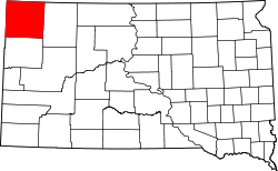
 Location in Harding County and the state of South Dakota | |
| Coordinates: 45°35′11″N103°32′36″W / 45.58639°N 103.54333°W | |
| Country | United States |
| State | South Dakota |
| County | Harding |
| Incorporated | 1949 [1] |
| Area | |
• Total | 0.55 sq mi (1.43 km2) |
| • Land | 0.55 sq mi (1.43 km2) |
| • Water | 0 sq mi (0.00 km2) |
| Elevation | 2,897 ft (883 m) |
| Population | |
• Total | 346 |
| • Density | 624.9/sq mi (241.29/km2) |
| Time zone | UTC-7 (Mountain (MST)) |
| • Summer (DST) | UTC-6 (MDT) |
| ZIP code | 57720 |
| Area code | 605 |
| FIPS code | 46-08140 [5] |
| GNIS feature ID | 1267302 [3] |
| Website | townofbuffalo |
Buffalo is a town in, and the county seat of, Harding County, South Dakota, United States. The population was 346 at the 2020 census. [6]