Dewey County, South Dakota

Last updated

Dewey County
FOREST CITY BRIDGE, DEWEY COUNTY, SD.jpg
Map of South Dakota highlighting Dewey County.svg
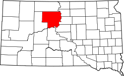
Location within the U.S. state of South Dakota
South Dakota in United States.svg
South Dakota's location within the U.S.
Coordinates: 45°10′N100°53′W / 45.16°N 100.88°W / 45.16; -100.88
CountryFlag of the United States.svg United States
StateFlag of South Dakota.svg  South Dakota
Founded1883 (created)
1910 (organized)
Named for William P. Dewey
Seat Timber Lake
Largest community North Eagle Butte
Area
  Total2,445 sq mi (6,330 km2)
  Land2,302 sq mi (5,960 km2)
  Water143 sq mi (370 km2)  5.8%
Population
 (2020)
  Total5,239
  Estimate 
(2023)
5,208 Decrease2.svg
  Density2.1/sq mi (0.83/km2)
Time zone UTC−7 (Mountain)
  Summer (DST) UTC−6 (MDT)
Congressional district At-large

Dewey County is a county in the U.S. state of South Dakota. As of the 2020 census, the population was 5,239. [1] Its county seat is Timber Lake. [2] The county was created in 1883 and organized in 1910. [3] It was named for William P. Dewey, [4] Territorial surveyor-general from 1873 to 1877.

Contents

Almost the entire county lies in the Cheyenne River Indian Reservation. The balance of the county, along its extreme northern county line, lies in the Standing Rock Indian Reservation. It is one of five South Dakota counties that are contained within Indian reservations.

Geography

The Moreau River flows east-northeasterly through the upper central parts of Dewey County, discharging into the Missouri River near the county's NE corner. Smaller drainages move runoff water northward from the central-eastern portions to the Missouri River, discharging near the community of Promise. A significant arm of the Missouri River forms the county's southeastern border. The county terrain consists of rolling hills, sloping southeastward and dropping off into the Missouri River basin. [5]

The county has a total area of 2,445 square miles (6,330 km2), of which 2,302 square miles (5,960 km2) is land and 143 square miles (370 km2) (5.8%) is water. [6]

The eastern portion of South Dakota's counties (48 of 66) observe Central Time; the western counties (18 of 66) observe Mountain Time. Dewey County is the easternmost of the SD counties to observe Mountain Time. [7]

Major highways

Adjacent counties

Protected Areas

Lakes

Demographics

Historical population
CensusPop.Note
1910 1,145
1920 4,802319.4%
1930 6,47634.9%
1940 5,709−11.8%
1950 4,916−13.9%
1960 5,2576.9%
1970 5,170−1.7%
1980 5,3663.8%
1990 5,5232.9%
2000 5,9728.1%
2010 5,301−11.2%
2020 5,239−1.2%
2023 (est.)5,208 [8] −0.6%
U.S. Decennial Census [9]
1790-1960 [10] 1900-1990 [11]
1990-2000 [12] 2010-2020 [1]

2020 census

As of the 2020 census, there were 5,239 people, 1,705 households, and 1,180 families residing in the county. [13] The population density was 2.3 inhabitants per square mile (0.89/km2). There were 1,923 housing units.

2010 census

As of the 2010 census, there were 5,301 people, 1,730 households, and 1,239 families in the county. The population density was 2.3 inhabitants per square mile (0.89/km2). There were 2,002 housing units at an average density of 0.9 units per square mile (0.35 units/km2). The racial makeup of the county was 74.9% American Indian, 21.0% white, 0.2% Asian, 0.1% black or African American, 0.2% from other races, and 3.6% from two or more races. Those of Hispanic or Latino origin made up 1.8% of the population. In terms of ancestry, 13.2% were German, 6.5% were Irish, and 0.6% were American.

Of the 1,730 households, 45.9% had children under the age of 18 living with them, 37.6% were married couples living together, 24.2% had a female householder with no husband present, 28.4% were non-families, and 24.6% of all households were made up of individuals. The average household size was 3.05 and the average family size was 3.60. The median age was 30.0 years.

The median income for a household in the county was $33,255 and the median income for a family was $40,500. Males had a median income of $33,942 versus $28,594 for females. The per capita income for the county was $15,632. About 20.5% of families and 30.5% of the population were below the poverty line, including 39.5% of those under age 18 and 13.5% of those age 65 or over.

Communities

Cities

Town

Census-designated places

Unincorporated communities

Unorganized territories

The county is divided into two areas of unorganized territory: North Dewey and South Dewey.

Politics

Dewey has since the 1990s been a strongly Democratic county in solidly Republican South Dakota. The last Republican to carry the county was Ronald Reagan in his 1984 landslide when he came within 3,819 votes of claiming all fifty states. Before this period, by contrast, Dewey was a Republican-leaning county even for South Dakota. Between its formation and 1984, Dewey had voted Democratic only in the three landslide Democratic wins of 1964, 1936 and 1932, plus for Woodrow Wilson in 1916 when his anti-war policies had strong appeal in the West.

United States presidential election results for Dewey County, South Dakota [17]
Year Republican Democratic Third party
No.%No.%No.%
2020 79040.18%1,13157.53%452.29%
2016 72342.33%88851.99%975.68%
2012 66334.99%1,20763.69%251.32%
2008 65932.64%1,32865.78%321.58%
2004 92135.92%1,60662.64%371.44%
2000 76145.27%88052.35%402.38%
1996 65733.20%1,11456.29%20810.51%
1992 64236.64%76643.72%34419.63%
1988 76542.76%1,00756.29%170.95%
1984 94154.49%77244.70%140.81%
1980 1,04559.14%60033.96%1226.90%
1976 82053.46%70646.02%80.52%
1972 1,00858.88%69940.83%50.29%
1968 94152.72%72140.39%1236.89%
1964 98143.79%1,25956.21%00.00%
1960 1,16852.80%1,04447.20%00.00%
1956 1,19756.76%91243.24%00.00%
1952 1,30166.34%66033.66%00.00%
1948 86453.80%72745.27%150.93%
1944 91364.12%51135.88%00.00%
1940 1,39656.36%1,08143.64%00.00%
1936 1,01244.25%1,21653.17%592.58%
1932 71030.51%1,59168.37%261.12%
1928 1,29356.39%99643.44%40.17%
1924 95653.05%22212.32%62434.63%
1920 88063.31%33524.10%17512.59%
1916 35247.00%37950.60%182.40%
1912 00.00%41142.20%56357.80%

See also

Related Research Articles

<span class="mw-page-title-main">Clay County, South Dakota</span> County in South Dakota, United States

Clay County is a county in the U.S. state of South Dakota. As of the 2020 census, the population was 14,967. The county seat is Vermillion, which is also home to the University of South Dakota. The county is named for Henry Clay, American statesman, US Senator from Kentucky, and United States Secretary of State in the 19th century.

<span class="mw-page-title-main">Ziebach County, South Dakota</span> County in South Dakota, United States

Ziebach County is a county in the U.S. state of South Dakota. As of the 2020 census, the population was 2,413. Its county seat is Dupree. It is the last county in the United States alphabetically.

<span class="mw-page-title-main">Yankton County, South Dakota</span> County in South Dakota, United States

Yankton County is a county in the U.S. state of South Dakota. As of the 2020 census, the population was 23,310, making it the 9th most populous county in South Dakota. Its county seat is Yankton. Yankton County comprises the Yankton, SD Micropolitan Statistical Area.

<span class="mw-page-title-main">Walworth County, South Dakota</span> County in South Dakota, United States

Walworth County is a county in the U.S. state of South Dakota. As of the 2020 census, the population was 5,315. Its county seat is Selby. The county was created in 1873 and organized in 1883. It is named for Walworth County, Wisconsin.

<span class="mw-page-title-main">Union County, South Dakota</span> County in South Dakota, United States

Union County is the southernmost county in the U.S. state of South Dakota. As of the 2020 census, the population was 16,811, making it the 13th most populous county in South Dakota. Its county seat has been Elk Point since April 30, 1865. Originally named Cole County, its name was changed to Union on January 7, 1864, because of Civil War sentiment.

<span class="mw-page-title-main">Todd County, South Dakota</span> County in South Dakota, United States

Todd County is a county in the U.S. state of South Dakota. As of the 2020 census, the population was 9,319. Todd County does not have its own county seat. Instead, Winner in neighboring Tripp County serves as its administrative center. Its largest city is Mission. The county was created in 1909, although it remains unorganized. The county was named for John Blair Smith Todd, a delegate from Dakota Territory to the United States House of Representatives and a Civil War general.

<span class="mw-page-title-main">Sully County, South Dakota</span> County in South Dakota, United States

Sully County is a county in the U.S. state of South Dakota. As of the 2020 census, the population was 1,446, making it the fifth-least populous county in South Dakota. Its county seat is Onida. The county was created in 1873 and organized in 1883. It is named after General Alfred Sully, who built Fort Sully.

<span class="mw-page-title-main">Stanley County, South Dakota</span> County in South Dakota, United States

Stanley County is a county in the U.S. state of South Dakota. As of the 2020 census, the population was 2,980. Its county seat is Fort Pierre. The county was created in 1873, and was organized in 1890. It is named for David S. Stanley, a commander at Fort Sully from 1866 to 1874, which was located nearby.

<span class="mw-page-title-main">Potter County, South Dakota</span> County in South Dakota, United States

Potter County is a county in the U.S. state of South Dakota. As of the 2020 census, the population was 2,472. Its county seat is Gettysburg. The county was created in 1873 and organized in 1883.

<span class="mw-page-title-main">Perkins County, South Dakota</span> County in South Dakota, United States

Perkins County is a county in the U.S. state of South Dakota. As of the 2020 census, the population was 2,835. Its county seat is Bison. The county was established in 1908 and organized in 1909. It was named for Sturgis, South Dakota, official Henry E. Perkins.

<span class="mw-page-title-main">Mellette County, South Dakota</span> County in South Dakota, United States

Mellette County is a county in the U.S. state of South Dakota. As of the 2020 census, the population was 1,918. Its county seat is White River. The county was created in 1909, and was organized in 1911. It was named for Arthur C. Mellette, the last Governor of the Dakota Territory and the first Governor of the state of South Dakota.

<span class="mw-page-title-main">Haakon County, South Dakota</span> County in South Dakota, United States

Haakon County is a county in the U.S. state of South Dakota. As of the 2020 census, the population was 1,872. Its county seat is Philip.

<span class="mw-page-title-main">Gregory County, South Dakota</span> County in South Dakota, United States

Gregory County is a county in the U.S. state of South Dakota. As of the 2020 census, the population was 3,994. Its county seat is Burke. The county was created in 1862 and organized in 1898. It was named for the politician J. Shaw Gregory.

<span class="mw-page-title-main">Davison County, South Dakota</span> County in South Dakota, United States

Davison County is a county in the U.S. state of South Dakota. As of the 2020 census, the population was 19,956, making it the 10th most populous county in South Dakota. Its county seat is Mitchell. The county was created in 1873 and organized in 1874. It was named for Henry C. Davison, the first settler in the county.

<span class="mw-page-title-main">Corson County, South Dakota</span> County in South Dakota, United States

Corson County is a county in the U.S. state of South Dakota. As of the 2020 census, the population was 3,902. Its county seat is McIntosh. The county was named for Dighton Corson, a native of Maine, who came to the Black Hills in 1876, and in 1877 began practicing law at Deadwood.

<span class="mw-page-title-main">Campbell County, South Dakota</span> County in South Dakota, United States

Campbell County is a county in the U.S. state of South Dakota. As of the 2020 census, the population was 1,377, making it the fourth-least populous county in South Dakota. Its county seat is Mound City. The county was created in 1873 and organized in 1884. It was named for Norman B. Campbell, a Dakota Territory legislator in 1873 and son of General Charles T. Campbell.

<span class="mw-page-title-main">Buffalo County, South Dakota</span> County in South Dakota, United States

Buffalo County is a county in the U.S. state of South Dakota. As of the 2020 census, the population was 1,948. Its county seat is Gann Valley which, at 10 people, is the least populous county seat in the United States. The county was created in 1864, and was organized in 1871 as part of the Dakota Territory.

<span class="mw-page-title-main">Bon Homme County, South Dakota</span> County in South Dakota, United States

Bon Homme County is a county in the U.S. state of South Dakota. As of the 2020 census, the population was 7,003. Its county seat is Tyndall.

<span class="mw-page-title-main">Aurora County, South Dakota</span> County in South Dakota, United States

Aurora County is a county in the U.S. state of South Dakota. As of the 2020 census, the population was 2,747. The county was created in 1879, and was organized in 1881.

<span class="mw-page-title-main">La Plant, South Dakota</span> Census-designated place in South Dakota, United States

La Plant is a census-designated place (CDP) in Dewey County, South Dakota, United States. The population was 167 at the 2020 census. It is within the Cheyenne River Indian Reservation.

References

  1. 1 2 "State & County QuickFacts". United States Census Bureau. Retrieved March 21, 2024.
  2. "Find a County". National Association of Counties. Archived from the original on May 31, 2011. Retrieved June 7, 2011.
  3. "Dakota Territory, South Dakota, and North Dakota: Individual County Chronologies". Dakota Territory Atlas of Historical County Boundaries. The Newberry Library. 2006. Archived from the original on April 2, 2018. Retrieved March 29, 2015.
  4. Gannett, Henry (1905). The Origin of Certain Place Names in the United States. Govt. Print. Off. p.  105.
  5. ""Find an Altitude" Google Maps (accessed February 2, 2019)". Archived from the original on May 21, 2019. Retrieved February 2, 2019.
  6. "2010 Census Gazetteer Files". United States Census Bureau. August 22, 2012. Retrieved March 24, 2015.
  7. Map of Time Zone Line through South Dakota (accessed January 30, 2019)]
  8. "County Population Totals and Components of Change: 2020-2023" . Retrieved March 17, 2024.
  9. "U.S. Decennial Census". United States Census Bureau. Retrieved March 24, 2015.
  10. "Historical Census Browser". University of Virginia Library. Retrieved March 24, 2015.
  11. Forstall, Richard L., ed. (March 27, 1995). "Population of Counties by Decennial Census: 1900 to 1990". United States Census Bureau. Retrieved March 24, 2015.
  12. "Census 2000 PHC-T-4. Ranking Tables for Counties: 1990 and 2000" (PDF). United States Census Bureau. April 2, 2001. Archived (PDF) from the original on October 9, 2022. Retrieved March 24, 2015.
  13. "US Census Bureau, Table P16: Household Type". United States Census Bureau. Retrieved March 21, 2024.
  14. Bear Creek SD Google Maps (accessed February 2, 2019)
  15. Parade SD Google Maps (accessed February 2, 2019)
  16. Promise SD Google Maps (accessed February 2, 2019)
  17. Leip, David. "Atlas of US Presidential Elections". uselectionatlas.org. Retrieved April 15, 2018.

45°10′N100°53′W / 45.16°N 100.88°W / 45.16; -100.88