Lantry, South Dakota | |
|---|---|
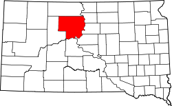
 Lantry Location within the state of South Dakota  Lantry Lantry (the United States) | |
| Coordinates: 45°01′06″N101°25′58″W / 45.01833°N 101.43278°W | |
| Country | United States |
| State | South Dakota |
| County | Dewey |
| Area | |
• Total | 0.42 sq mi (1.08 km2) |
| • Land | 0.42 sq mi (1.08 km2) |
| • Water | 0 sq mi (0.00 km2) |
| Elevation | 2,382 ft (726 m) |
| Population | |
• Total | 33 |
| • Density | 79.5/sq mi (30.68/km2) |
| Time zone | UTC-6 (Central (CST)) |
| • Summer (DST) | UTC-5 (CDT) |
| ZIP codes | 57636 |
| FIPS code | 46-35900 |
| GNIS feature ID | 2813015 [2] |
Lantry is an unincorporated community and a census-designated place (CDP) in Dewey County, South Dakota, United States. The population of the CDP was 33 at the 2020 census. [4]
Contents
According to the Federal Writers' Project, the origin of the name Lantry is obscure. [5]