La Plant, South Dakota

Last updated

La Plant, South Dakota
Dewey County South Dakota Incorporated and Unincorporated areas La Plant Highlighted.svg
Location in Dewey County and the state of South Dakota
Coordinates: 45°08′17″N100°39′53″W / 45.13806°N 100.66472°W / 45.13806; -100.66472
Country United States
State South Dakota
County Dewey
Area
[1]
  Total9.49 sq mi (24.57 km2)
  Land9.45 sq mi (24.48 km2)
  Water0.04 sq mi (0.10 km2)
Elevation
[2]
2,041 ft (622 m)
Population
 (2020) [3]
  Total167
  Density17.67/sq mi (6.82/km2)
Time zone UTC-7 (Mountain (MST))
  Summer (DST) UTC-6 (MDT)
ZIP code
57652
Area code 605
FIPS code 46-35940 [4]
GNIS feature ID2393074 [2]

La Plant is a census-designated place (CDP) in Dewey County, South Dakota, United States. The population was 167 at the 2020 census. [5] It is within the Cheyenne River Indian Reservation.

Contents

La Plant was laid out in 1910, and named in honor of a local cattleman. [6]

Geography

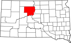
La Plant is located in east-central Dewey County and U.S. Route 212 passes through the community, leading west 32 miles (51 km) to Eagle Butte and east 39 miles (63 km) to Gettysburg. The Missouri River (Lake Oahe) is 20 miles (32 km) to the east, and Pierre, the state capital, is 76 miles (122 km) to the southeast.

According to the United States Census Bureau, the CDP has a total area of 9.5 square miles (24.6 km2), of which 9.5 square miles (24.5 km2) is land and 0.04 square miles (0.1 km2), or 0.40%, is water. [7]

Demographics

Historical population
CensusPop.Note
2020 167
U.S. Decennial Census [8]

As of the census [4] of 2000, there were 150 people, 34 households, and 29 families residing in the CDP. The population density was 16.6 people per square mile (6.4/km2). There were 42 housing units at an average density of 4.7/sq mi (1.8/km2). The racial makeup of the CDP was 100.00% Native American.

There were 34 households, out of which 58.8% had children under the age of 18 living with them, 41.2% were married couples living together, 35.3% had a female householder with no husband present, and 11.8% were non-families. 11.8% of all households were made up of individuals, and 5.9% had someone living alone who was 65 years of age or older. The average household size was 4.41 and the average family size was 4.73.

In the CDP, the population was spread out, with 45.3% under the age of 18, 13.3% from 18 to 24, 22.7% from 25 to 44, 14.7% from 45 to 64, and 4.0% who were 65 years of age or older. The median age was 19 years. For every 100 females, there were 105.5 males. For every 100 females age 18 and over, there were 95.2 males.

The median income for a household in the CDP was $18,194, and the median income for a family was $18,333. Males had a median income of $41,042 versus $7,250 for females. The per capita income for the CDP was $6,888. There were 62.5% of families and 61.6% of the population living below the poverty line, including 48.5% of those under 18 and 56.3% of those over 64.

Education

It is in Eagle Butte School District 20-1, [9] which jointly operates Cheyenne-Eagle Butte School with the Bureau of Indian Education (BIE). [10]

Related Research Articles

<span class="mw-page-title-main">Ziebach County, South Dakota</span> County in South Dakota, United States

Ziebach County is a county in the U.S. state of South Dakota. As of the 2020 census, the population was 2,413. Its county seat is Dupree. It is the last county in the United States alphabetically.

<span class="mw-page-title-main">Meade County, South Dakota</span> County in South Dakota, United States

Meade County is a county in the U.S. state of South Dakota. As of the 2020 census, the population was 29,852. Its county seat is Sturgis. The county was created in 1889 and named for Fort Meade, which was garrisoned as a United States military post in the area in 1878 and itself named for General George Meade.

<span class="mw-page-title-main">Dewey County, South Dakota</span> County in South Dakota, United States

Dewey County is a county in the U.S. state of South Dakota. As of the 2020 census, the population was 5,239. Its county seat is Timber Lake. The county was created in 1883 and organized in 1910. It was named for William P. Dewey, Territorial surveyor-general from 1873 to 1877.

<span class="mw-page-title-main">Corson County, South Dakota</span> County in South Dakota, United States

Corson County is a county in the U.S. state of South Dakota. As of the 2020 census, the population was 3,902. Its county seat is McIntosh. The county was named for Dighton Corson, a native of Maine, who came to the Black Hills in 1876, and in 1877 began practicing law at Deadwood.

<span class="mw-page-title-main">Butte, Alaska</span> CDP in Alaska, United States

Butte is a census-designated place (CDP) in Matanuska-Susitna Borough, Alaska, United States. It is part of the Anchorage, Alaska Metropolitan Statistical Area. At the 2020 census, the population was 3,589, up from 3,246 in 2010. Butte is located between the Matanuska River and the Knik River, approximately 5 miles (8 km) southeast of Palmer. It is accessible via the Old Glenn Highway.

<span class="mw-page-title-main">Storla, South Dakota</span> CDP in South Dakota, United States

Storla is a census-designated place (CDP) in Aurora County, South Dakota, United States. The population was 6 in the 2020 census.

<span class="mw-page-title-main">Little Eagle, South Dakota</span> CDP in South Dakota, United States

Little Eagle is a census-designated place (CDP) in Corson County, South Dakota, United States. The population was 319 at the 2010 census.

<span class="mw-page-title-main">Loomis, South Dakota</span> CDP in South Dakota, United States

Loomis is a census-designated place (CDP) in Davison County, South Dakota, United States. The population was 33 at the 2020 census. It is part of the Mitchell, South Dakota Micropolitan Statistical Area.

<span class="mw-page-title-main">Green Grass, South Dakota</span> CDP in South Dakota, United States

Green Grass is a census-designated place (CDP) in Dewey County, South Dakota, United States. The population was 21 at the 2020 census.

<span class="mw-page-title-main">North Eagle Butte, South Dakota</span> Census-designated place in South Dakota, United States

North Eagle Butte is a census-designated place (CDP) in Dewey County, South Dakota, United States, along the 45th parallel. The population was 1,879 at the 2020 census.

<span class="mw-page-title-main">Whitehorse, South Dakota</span> CDP in South Dakota, United States

Whitehorse is a census-designated place (CDP) in Dewey County, South Dakota, United States. The population was 106 at the 2020 census.

<span class="mw-page-title-main">St. Charles, South Dakota</span> CDP in South Dakota, United States

St. Charles or Saint Charles is a census-designated place (CDP) in Gregory County, South Dakota, United States. The population was 15 at the 2020 census.

<span class="mw-page-title-main">Kaylor, South Dakota</span> CDP in South Dakota, United States

Kaylor is a census-designated place (CDP) in Hutchinson County, South Dakota, United States. The population was 30 at the 2020 census.

<span class="mw-page-title-main">Wanblee, South Dakota</span> Census-designated place in South Dakota, United States

Wanblee is a census-designated place on the Pine Ridge Indian Reservation, located in Jackson County, South Dakota, United States. The population was 674 at the 2020 census, virtually all of whom are members of the Oglala band of Lakota Sioux. Wanbli is the Lakota word for eagle, and the town was named for its proximity to Wanbli hohpi paha. Wanblee is a few miles directly northeast of the North American continental pole of inaccessibility.

<span class="mw-page-title-main">Ashland Heights, South Dakota</span> CDP in South Dakota, United States

Ashland Heights is a census-designated place (CDP) and unincorporated community in Pennington County, South Dakota, United States. The population was 678 at the 2020 census.

<span class="mw-page-title-main">Colonial Pine Hills, South Dakota</span> CDP in South Dakota, United States

Colonial Pine Hills is a census-designated place (CDP) and unincorporated community in Pennington County, South Dakota, United States. The population was 1,903 at the 2020 census.

<span class="mw-page-title-main">Green Valley, South Dakota</span> CDP in South Dakota, United States

Green Valley is a census-designated place (CDP) and unincorporated community in Pennington County, South Dakota, United States. The population was 1,051 at the 2020 census.

<span class="mw-page-title-main">Oglala, South Dakota</span> CDP in South Dakota, United States

Oglala is a census-designated place (CDP) in West Oglala Lakota Unorganized Territory equivalent, Oglala Lakota County, South Dakota, United States. The population was 1,282 at the 2020 census. Its location is in the northwest of the Pine Ridge Indian Reservation.

<span class="mw-page-title-main">Antelope, South Dakota</span> CDP in South Dakota, United States

Antelope is a census-designated place (CDP) in Todd County, South Dakota, United States. The population was 830 at the 2020 census.

<span class="mw-page-title-main">Eagle Butte, South Dakota</span> City in South Dakota, United States

Eagle Butte is a city in Dewey and Ziebach counties in South Dakota, United States. The population was 1,258 at the 2020 census.

References

  1. "ArcGIS REST Services Directory". United States Census Bureau. Retrieved October 15, 2022.
  2. 1 2 U.S. Geological Survey Geographic Names Information System: La Plant, South Dakota
  3. "Census Population API". United States Census Bureau. Retrieved October 15, 2022.
  4. 1 2 "U.S. Census website". United States Census Bureau . Retrieved January 31, 2008.
  5. "U.S. Census Bureau: La Plant CDP, South Dakota". www.census.gov. United States Census Bureau. Retrieved February 13, 2022.
  6. Federal Writers' Project (1940). South Dakota place-names, v.1-3. University of South Dakota. p. 47.
  7. "Geographic Identifiers: 2010 Demographic Profile Data (G001): La Plant CDP, South Dakota". U.S. Census Bureau, American Factfinder. Archived from the original on February 13, 2020. Retrieved January 6, 2016.
  8. "Census of Population and Housing". Census.gov. Retrieved June 4, 2016.
  9. "2020 CENSUS - SCHOOL DISTRICT REFERENCE MAP: Dewey County, SD" (PDF). U.S. Census Bureau . Retrieved August 6, 2021.
  10. "About". Eagle Butte School District 20-1. Retrieved August 6, 2021.