Hughes County, South Dakota

Last updated

Hughes County
Hughes County Courthouse.JPG
Map of South Dakota highlighting Hughes County.svg
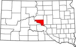
Location within the U.S. state of South Dakota
South Dakota in United States.svg
South Dakota's location within the U.S.
Coordinates: 44°23′N99°59′W / 44.39°N 99.99°W / 44.39; -99.99
CountryFlag of the United States.svg United States
StateFlag of South Dakota.svg  South Dakota
FoundedJanuary 8, 1873 (created)
November 26, 1880 (organized)
Named for Alexander Hughes
Seat Pierre
Largest cityPierre
Area
  Total801 sq mi (2,070 km2)
  Land742 sq mi (1,920 km2)
  Water59 sq mi (150 km2)  7.4%
Population
 (2020)
  Total17,765
  Estimate 
(2023)
17,624 Decrease2.svg
  Density22/sq mi (8.6/km2)
Time zone UTC−6 (Central)
  Summer (DST) UTC−5 (CDT)
Congressional district At-large
Website www.hughescounty.org

Hughes County is a county in the U.S. state of South Dakota. As of the 2020 census, the population was 17,765, making it the least populous capital county in the nation, and the 12th most populous county in South Dakota. [1] Its county seat is Pierre, [2] which is also the state capital. The county was created in 1873, and was organized in 1880. It was named for Alexander Hughes, a legislator. [3] On June 4, 1891, the county's area was increased by the addition of Farm Island, in the Missouri River downstream of Pierre. [4]

Contents

Hughes County is part of the Pierre, SD Micropolitan Statistical Area.

Geography

The Missouri River forms the southwestern boundary line of Hughes County. The county's terrain consists of rolling hills cut by gullies and drainages. The area is partially dedicated to agriculture, including the use of center pivot irrigation. [5]

The county terrain generally slopes to the southeast, although the hills along the west fall off into the river valley. The county's highest point is on the upper part of the east boundary line, at 1,952 ft (595 m) ASL. [6] The county has a total area of 801 square miles (2,070 km2), of which 742 square miles (1,920 km2) is land and 59 square miles (150 km2) (7.4%) is water. [7]

Major highways

Airport

Pierre Regional Airport (PIR) serves Hughes County and the surrounding communities.

Adjacent counties

Protected areas

Source: [5]

  • Arikara State Game Production Area
  • Buckeye State Game Production Area
  • Cowan State Game Production Area
  • DeGrey State Game Production Area
  • DeGrey State Lakeside Use Area
  • Dry Run State Game Production Area
  • East Shore State Lakeside Use Area
  • Farm Island State Recreation Area
  • Fort George State Game Production Area
  • Fort George State Lakeside Use Area
  • Gutenkauf State Game Production Area
  • Joe Creek Recreation Area
  • LaFramboise Island State Nature Area
  • North Bend State Lakeside Use Area
  • North Big Bend State Game Production Area
  • Oahe Mission Recreation Area
  • Peoria Flats State Game Production Area
  • Peoria Flats State Lakeside Use Area
  • Rousseau State Game Production Area
  • Rousseau State Lakeside Use Area
  • Sand Creek State Game Production Area
  • Spring Creek State Recreation Area
  • Tailrace Recreation Area
  • Valley state Game Production Area
  • West Bend State Recreation Area
  • West Big Bend State Game Production Area
  • West DeGrey State Game Production Area
  • Woodruff Lake State Game Production Area

Lakes

Source: [5]

Demographics

Historical population
CensusPop.Note
1880 268
1890 5,0441,782.1%
1900 3,684−27.0%
1910 6,27170.2%
1920 5,711−8.9%
1930 7,00922.7%
1940 6,624−5.5%
1950 8,11122.4%
1960 12,72556.9%
1970 11,632−8.6%
1980 14,22022.2%
1990 14,8174.2%
2000 16,48111.2%
2010 17,0223.3%
2020 17,7654.4%
2023 (est.)17,624 [8] −0.8%
U.S. Decennial Census [9]
1790-1960 [10] 1900-1990 [11]
1990-2000 [12] 2010-2020 [1]

2020 census

As of the 2020 census, there were 17,765 people, 7,240 households, and 4,506 families residing in the county. [13] The population density was 24.0 inhabitants per square mile (9.3/km2). There were 7,922 housing units.

2010 census

As of the 2010 census, there were 17,022 people, 7,066 households, and 4,435 families in the county. The population density was 23.0 inhabitants per square mile (8.9/km2). There were 7,623 housing units at an average density of 10.3 per square mile (4.0/km2). The racial makeup of the county was 85.7% white, 10.5% American Indian, 0.5% black or African American, 0.5% Asian, 0.5% from other races, and 2.3% from two or more races. Those of Hispanic or Latino origin made up 1.8% of the population. In terms of ancestry, 42.7% were German, 12.4% were Norwegian, 9.8% were Irish, 9.7% were English, and 3.8% were American.

Of the 7,066 households, 30.2% had children under the age of 18 living with them, 49.5% were married couples living together, 9.4% had a female householder with no husband present, 37.2% were non-families, and 32.3% of all households were made up of individuals. The average household size was 2.30 and the average family size was 2.90. The median age was 39.8 years.

The median income for a household in the county was $53,501 and the median income for a family was $70,881. Males had a median income of $42,701 versus $32,265 for females. The per capita income for the county was $28,236. About 7.1% of families and 9.3% of the population were below the poverty line, including 14.5% of those under age 18 and 6.0% of those age 65 or over.

Politics

Hughes is a strongly Republican county in Presidential and Congressional elections. The last Democrat to win a majority in the county was Franklin D. Roosevelt in 1936. In 2012, Republican Mitt Romney won 64% of the county's vote.

United States presidential election results for Hughes County, South Dakota [14]
Year Republican Democratic Third party
No.%No.%No.%
2020 5,52263.30%2,95333.85%2482.84%
2016 5,17463.29%2,45029.97%5516.74%
2012 5,21964.00%2,78634.16%1501.84%
2008 5,29862.56%3,03735.86%1331.57%
2004 6,01768.10%2,69730.53%1211.37%
2000 5,18868.86%2,21229.36%1341.78%
1996 4,46956.80%2,78835.43%6117.77%
1992 4,32553.26%2,57831.74%1,21815.00%
1988 4,54561.07%2,85338.34%440.59%
1984 4,98570.32%2,07229.23%320.45%
1980 4,65266.00%1,75124.84%6459.15%
1976 3,99761.15%2,50638.34%330.50%
1972 4,23167.35%2,03732.43%140.22%
1968 3,20461.46%1,66631.96%3436.58%
1964 2,73251.18%2,60648.82%00.00%
1960 3,32061.99%2,03638.01%00.00%
1956 2,92363.41%1,68736.59%00.00%
1952 2,93275.86%93324.14%00.00%
1948 1,73961.43%1,08038.15%120.42%
1944 1,67664.12%93835.88%00.00%
1940 1,98259.27%1,36240.73%00.00%
1936 1,54746.71%1,66250.18%1033.11%
1932 1,37442.02%1,85256.64%441.35%
1928 1,91261.56%1,17137.70%230.74%
1924 1,26053.21%32513.72%78333.07%
1920 1,31368.31%43322.53%1769.16%
1916 61151.13%53644.85%484.02%
1912 00.00%54450.51%53349.49%
1908 79566.64%34929.25%494.11%
1904 92972.18%33526.03%231.79%
1900 53765.65%27233.25%91.10%
1896 46258.19%32741.18%50.63%
1892 45962.88%10213.97%16923.15%

In the South Dakota Senate Hughes is part of the 24th Senate district, which is held by Republican Bob Gray. In the State House Hughes is part of district 24, which is held by Republicans Tad Perry and Mark Venner.

Communities

Cities

Town

Census-designated place

Unincorporated communities

Townships

Unorganized territories

Education

School districts include: [15]

See also

Related Research Articles

<span class="mw-page-title-main">Pierre, South Dakota</span> Capital city of South Dakota, United States

Pierre is the capital city of the U.S. state of South Dakota and the seat of Hughes County. The population was 14,091 at the 2020 census, making it the 2nd least populous US state capital after Montpelier, Vermont. It is South Dakota's 9th most populous city. Founded in 1880 on the Missouri River near the center of South Dakota, it was selected as the state capital when the territory was admitted as a state. Pierre is the principal city of the Pierre Micropolitan Statistical Area, which includes all of Hughes and Stanley counties.

<span class="mw-page-title-main">Walworth County, South Dakota</span> County in South Dakota, United States

Walworth County is a county in the U.S. state of South Dakota. As of the 2020 census, the population was 5,315. Its county seat is Selby. The county was created in 1873 and organized in 1883. It is named for Walworth County, Wisconsin.

<span class="mw-page-title-main">Sully County, South Dakota</span> County in South Dakota, United States

Sully County is a county in the U.S. state of South Dakota. As of the 2020 census, the population was 1,446, making it the fifth-least populous county in South Dakota. Its county seat is Onida. The county was created in 1873 and organized in 1883. It is named after General Alfred Sully, who built Fort Sully.

<span class="mw-page-title-main">Stanley County, South Dakota</span> County in South Dakota, United States

Stanley County is a county in the U.S. state of South Dakota. As of the 2020 census, the population was 2,980. Its county seat is Fort Pierre. The county was created in 1873, and was organized in 1890. It is named for David S. Stanley, a commander at Fort Sully from 1866 to 1874, which was located nearby.

<span class="mw-page-title-main">Potter County, South Dakota</span> County in South Dakota, United States

Potter County is a county in the U.S. state of South Dakota. As of the 2020 census, the population was 2,472. Its county seat is Gettysburg. The county was created in 1873 and organized in 1883.

<span class="mw-page-title-main">Meade County, South Dakota</span> County in South Dakota, United States

Meade County is a county in the U.S. state of South Dakota. As of the 2020 census, the population was 29,852, making it the 6th most populous county in South Dakota. Its county seat is Sturgis. The county was created in 1889 and named for Fort Meade, which was garrisoned as a United States military post in the area in 1878 and itself named for General George Meade.

<span class="mw-page-title-main">Marshall County, South Dakota</span> County in South Dakota, United States

Marshall County is a county in the U.S. state of South Dakota. As of the 2020 census, the population was 4,306. Its county seat is Britton. The county was created on May 2, 1885, and was named for Marshall Vincent, who homesteaded near Andover, South Dakota.

<span class="mw-page-title-main">Lyman County, South Dakota</span> County in South Dakota, United States

Lyman County is a county located in the U.S. state of South Dakota. As of the 2020 census, the population was 3,718. Its county seat is Kennebec.

<span class="mw-page-title-main">Gregory County, South Dakota</span> County in South Dakota, United States

Gregory County is a county in the U.S. state of South Dakota. As of the 2020 census, the population was 3,994. Its county seat is Burke. The county was created in 1862 and organized in 1898. It was named for the politician J. Shaw Gregory.

<span class="mw-page-title-main">Faulk County, South Dakota</span> County in South Dakota, United States

Faulk County is a county in the U.S. state of South Dakota. As of the 2020 census, the population was 2,125. Its county seat is Faulkton. The county was founded in 1873 and organized in 1883. It is named for Andrew Jackson Faulk, the third Governor of Dakota Territory.

<span class="mw-page-title-main">Fall River County, South Dakota</span> County in South Dakota, United States

Fall River County is a county in the U.S. state of South Dakota. As of the 2020 census, the population was 6,973. Its county seat is Hot Springs. The county was founded in 1883. It is named for Fall River which runs through it.

<span class="mw-page-title-main">Edmunds County, South Dakota</span> County in South Dakota, United States

Edmunds County is a county in the U.S. state of South Dakota. At the 2020 census, the population was 3,986. Its county seat is Ipswich. The county was established in 1873 and organized in 1883. It is named for Newton Edmunds, the second Governor of Dakota Territory.

<span class="mw-page-title-main">Dewey County, South Dakota</span> County in South Dakota, United States

Dewey County is a county in the U.S. state of South Dakota. As of the 2020 census, the population was 5,239. Its county seat is Timber Lake. The county was created in 1883 and organized in 1910. It was named for William P. Dewey, Territorial surveyor-general from 1873 to 1877.

<span class="mw-page-title-main">Codington County, South Dakota</span> County in South Dakota, United States

Codington County is a county in the U.S. state of South Dakota. As of the 2020 census, the population was 28,325, making it the 7th most populous county in South Dakota. Its county seat is Watertown. The county was created in 1877 and organized in 1878. It is named for Rev. George S. S. Codington, Dakota Territory legislator.

<span class="mw-page-title-main">Charles Mix County, South Dakota</span> County in South Dakota, United States

Charles Mix County is a county in the U.S. state of South Dakota. As of the 2020 census, the population was 9,373. Its county seat is Lake Andes. The county was created in 1862 and organized in 1879. It was named for Charles Eli Mix, an official of the Bureau of Indian Affairs influential in signing a peace treaty with the local Lakota Indian tribes. The easternmost approximately 60% of the county comprises the Yankton Indian Reservation.

<span class="mw-page-title-main">Campbell County, South Dakota</span> County in South Dakota, United States

Campbell County is a county in the U.S. state of South Dakota. As of the 2020 census, the population was 1,377, making it the fourth-least populous county in South Dakota. Its county seat is Mound City. The county was created in 1873 and organized in 1884. It was named for Norman B. Campbell, a Dakota Territory legislator in 1873 and son of General Charles T. Campbell.

<span class="mw-page-title-main">Brule County, South Dakota</span> County in South Dakota, United States

Brule County is a county in the U.S. state of South Dakota. As of the 2020 census, the population was 5,247. Its county seat is Chamberlain.

<span class="mw-page-title-main">Brown County, South Dakota</span> County in South Dakota, United States

Brown County is a county in the U.S. state of South Dakota. As of the 2020 census, the population was 38,301, making it the fourth most populous county in South Dakota. Its county seat is Aberdeen. The county is named for Alfred Brown, of Hutchinson County, South Dakota, a Dakota Territory legislator in 1879.

<span class="mw-page-title-main">Brookings County, South Dakota</span> County in South Dakota, United States

Brookings County is a county in the U.S. state of South Dakota. As of the 2020 census, the population was 34,375, making it the fifth most populous county in South Dakota. Its county seat is Brookings. The county was created in 1862 and organized in 1871.

<span class="mw-page-title-main">Bon Homme County, South Dakota</span> County in South Dakota, United States

Bon Homme County is a county in the U.S. state of South Dakota. As of the 2020 census, the population was 7,003. Its county seat is Tyndall.

References

  1. 1 2 "State & County QuickFacts". United States Census Bureau. Retrieved March 21, 2024.
  2. "Find a County". National Association of Counties. Archived from the original on May 31, 2011. Retrieved June 7, 2011.
  3. Gannett, Henry (1905). The Origin of Certain Place Names in the United States. Govt. Print. Off. p.  162.
  4. "Dakota Territory, South Dakota, and North Dakota: Individual County Chronologies". Dakota Territory Atlas of Historical County Boundaries. The Newberry Library. 2006. Archived from the original on April 2, 2018. Retrieved March 29, 2015.
  5. 1 2 3 Hughes County SD Google Maps (accessed February 3, 2019)
  6. ""Find an Altitude" Google Maps (accessed February 3, 2019)". Archived from the original on May 21, 2019. Retrieved February 4, 2019.
  7. "2010 Census Gazetteer Files". United States Census Bureau. August 22, 2012. Retrieved March 26, 2015.
  8. "County Population Totals and Components of Change: 2020-2023" . Retrieved March 17, 2024.
  9. "U.S. Decennial Census". United States Census Bureau. Retrieved March 26, 2015.
  10. "Historical Census Browser". University of Virginia Library. Retrieved March 26, 2015.
  11. Forstall, Richard L., ed. (March 27, 1995). "Population of Counties by Decennial Census: 1900 to 1990". United States Census Bureau. Retrieved March 26, 2015.
  12. "Census 2000 PHC-T-4. Ranking Tables for Counties: 1990 and 2000" (PDF). United States Census Bureau. April 2, 2001. Archived (PDF) from the original on October 9, 2022. Retrieved March 26, 2015.
  13. "US Census Bureau, Table P16: Household Type". United States Census Bureau. Retrieved March 21, 2024.
  14. Leip, David. "Atlas of US Presidential Elections". uselectionatlas.org. Retrieved April 15, 2018.
  15. "2020 CENSUS - SCHOOL DISTRICT REFERENCE MAP: Hughes County, SD" (PDF). United States Census Bureau . Retrieved March 13, 2024. - Text list

44°23′N99°59′W / 44.39°N 99.99°W / 44.39; -99.99