Mellette County, South Dakota

Last updated

Mellette County
White River, SD.jpg
White River from the West, the county seat
Map of South Dakota highlighting Mellette County.svg
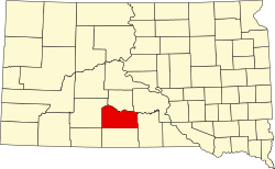
Location within the U.S. state of South Dakota
South Dakota in United States.svg
South Dakota's location within the U.S.
Coordinates: 43°35′N100°46′W / 43.58°N 100.76°W / 43.58; -100.76
CountryFlag of the United States.svg United States
StateFlag of South Dakota.svg  South Dakota
Founded1909 (created)
1911 (organized)
Named for Arthur C. Mellette
Seat White River
Largest cityWhite River
Area
  Total1,311 sq mi (3,400 km2)
  Land1,307 sq mi (3,390 km2)
  Water3.6 sq mi (9 km2)  0.3%
Population
 (2020)
  Total1,918
  Estimate 
(2022)
1,892 Decrease2.svg
  Density1.5/sq mi (0.56/km2)
Time zone UTC−6 (Central)
  Summer (DST) UTC−5 (CDT)
Congressional district At-large

Mellette County is a county in the U.S. state of South Dakota. As of the 2020 census, the population was 1,918. [1] Its county seat is White River. [2] The county was created in 1909, and was organized in 1911. [3] It was named for Arthur C. Mellette, the last Governor of the Dakota Territory and the first Governor of the state of South Dakota.

Contents

Historically territory of the Sioux/Lakota peoples, 33.35 percent of the county's land is trust land associated with the Rosebud Indian Reservation in the neighboring county to the south. According to the 2000 United States Census, 52.2% of the population is Native American, mostly the federally recognized Sicangu Oyate (Upper Brulé Sioux) and the Rosebud Sioux Tribe, a branch of the Lakota people.

Geography

The White River flows eastward along the north boundary line of Mellette County. The Little White River flows northward through central Mellette County, discharging into White River. The terrain consists of semi-arid rolling hills, the northern portion dotted with ponds and small lakes. The area is mostly devoted to agriculture. [4] The terrain slopes to the northeast; its highest point is the SW corner at 2,779 ft (847 m) ASL. [5] The county has a total area of 1,311 square miles (3,400 km2), of which 1,307 square miles (3,390 km2) is land and 3.6 square miles (9.3 km2) (0.3%) is water. [6]

The eastern portion of South Dakota's counties (48 of 66) observe Central Time; the western counties (18 of 66) observe Mountain Time. Mellette County is the westernmost of the SD counties to observe Central Time. [7]

Major highways

Adjacent counties

Demographics

Historical population
CensusPop.Note
1910 1,700
1920 3,850126.5%
1930 5,29337.5%
1940 4,107−22.4%
1950 3,046−25.8%
1960 2,664−12.5%
1970 2,420−9.2%
1980 2,249−7.1%
1990 2,137−5.0%
2000 2,083−2.5%
2010 2,048−1.7%
2020 1,918−6.3%
2023 (est.)1,851 [8] −3.5%
U.S. Decennial Census [9]
1790-1960 [10] 1900-1990 [11]
1990-2000 [12] 2010-2020 [1]

2020 census

As of the census of 2020, there were 1,918 people, 586 households in the county.

2010 census

As of the census of 2010, there were 2,048 people, 693 households, and 493 families in the county. The population density was 1.6 inhabitants per square mile (0.62/km2). There were 838 housing units at an average density of 0.6 units per square mile (0.23 units/km2). The racial makeup of the county was 54.1% American Indian, 39.7% white, 0.2% Asian, 0.1% black or African American, 0.2% from other races, and 5.6% from two or more races. Those of Hispanic or Latino origin made up 1.5% of the population. In terms of ancestry, 25.6% were German, 8.4% were Irish, 6.1% were English, and 0.6% were American.

Of the 693 households, 41.6% had children under the age of 18 living with them, 43.3% were married couples living together, 19.0% had a female householder with no husband present, 28.9% were non-families, and 24.7% of all households were made up of individuals. The average household size was 2.88 and the average family size was 3.38. The median age was 34.2 years.

The median income for a household in the county was $34,055 and the median income for a family was $35,781. Males had a median income of $31,625 versus $30,956 for females. The per capita income for the county was $16,971. About 23.4% of families and 27.0% of the population were below the poverty line, including 40.5% of those under age 18 and 6.3% of those age 65 or over.

Communities

City

Town

Census-designated places

Unincorporated communities

Townships

  • Bad Nation
  • Blackpipe
  • Butte
  • Cody
  • Fairview
  • Mosher
  • New Surprise Valley
  • Norris
  • Prospect
  • Red Fish
  • Ring Thunder
  • Riverside
  • Rocky Ford
  • Rosebud
  • Running Bird
  • Surprise Valley

Unorganized territories

Politics

Like most of South Dakota, Mellette County is solidly Republican. It has not been carried by a Democrat since Lyndon Johnson’s 1964 landslide, although Barack Obama came within six votes of doing so in the 2012 election.

United States presidential election results for Mellette County, South Dakota [13]
Year Republican Democratic Third party
No.%No.%No.%
2020 44958.39%29838.75%222.86%
2016 40258.86%23834.85%436.30%
2012 38149.54%37548.76%131.69%
2008 44552.79%37344.25%252.97%
2004 55359.40%36138.78%171.83%
2000 49567.53%22230.29%162.18%
1996 41752.26%30237.84%799.90%
1992 41749.58%27732.94%14717.48%
1988 46053.99%38545.19%70.82%
1984 61666.45%30332.69%80.86%
1980 62464.80%27928.97%606.23%
1976 50853.53%42945.21%121.26%
1972 63759.20%43340.24%60.56%
1968 61155.70%40737.10%797.20%
1964 52544.38%65855.62%00.00%
1960 77460.28%51039.72%00.00%
1956 64355.29%52044.71%00.00%
1952 78769.40%34730.60%00.00%
1948 48249.33%48249.33%131.33%
1944 54457.02%41042.98%00.00%
1940 99052.24%90547.76%00.00%
1936 71146.56%80852.91%80.52%
1932 65729.14%1,58370.20%150.67%
1928 94350.13%92749.28%110.58%
1924 64239.93%60437.56%36222.51%
1920 53363.53%26131.11%455.36%
1916 37945.55%43652.40%172.04%
1912 00.00%32053.96%27346.04%

See also

The Geography, Geology and Biology of Mellett, Washabaugh, Bennett and Todd Counties, South-Central South Dakota The Geography, Geology and Biology of Mellett, Washabaugh, Bennett and Todd Counties, South-Central South Dakota.pdf
The Geography, Geology and Biology of Mellett, Washabaugh, Bennett and Todd Counties, South-Central South Dakota

Related Research Articles

<span class="mw-page-title-main">Union County, South Dakota</span> County in South Dakota, United States

Union County is the southernmost county in the U.S. state of South Dakota. As of the 2020 census, the population was 16,811, making it the 13th most populous county in South Dakota. Its county seat has been Elk Point since April 30, 1865. Originally named Cole County, its name was changed to Union on January 7, 1864, because of Civil War sentiment.

<span class="mw-page-title-main">Tripp County, South Dakota</span> County in South Dakota, United States

Tripp County is a county in the U.S. state of South Dakota. As of the 2020 census, the population was 5,624. Its county seat is Winner. The county was created in 1873, and was organized in 1909. It is named for lawyer, judge, and diplomat Bartlett Tripp.

<span class="mw-page-title-main">Todd County, South Dakota</span> County in South Dakota, United States

Todd County is a county in the U.S. state of South Dakota. As of the 2020 census, the population was 9,319. Todd County does not have its own county seat. Instead, Winner in neighboring Tripp County serves as its administrative center. Its largest city is Mission. The county was created in 1909, although it remains unorganized. The county was named for John Blair Smith Todd, a delegate from Dakota Territory to the United States House of Representatives and a Civil War general.

<span class="mw-page-title-main">Spink County, South Dakota</span> County in South Dakota, United States

Spink County is a county in the U.S. state of South Dakota. As of the 2020 census, the population was 6,361. Its county seat is Redfield. The county was created in 1873, and was organized in 1879 within Dakota Territory.

<span class="mw-page-title-main">Roberts County, South Dakota</span> County in South Dakota, United States

Roberts County is a county in the U.S. state of South Dakota. As of the 2020 census, the population was 10,280. Its county seat is Sisseton. The county was named either for S. G. Roberts of Fargo, North Dakota, or for Solomon Robar, an early local French fur trader. It was created on March 8, 1883, and fully organized by August 6 of that year. Its boundary was altered once, in 1885.

<span class="mw-page-title-main">Minnehaha County, South Dakota</span> County in South Dakota, United States

Minnehaha County is a county on the eastern border of the state of South Dakota. As of the 2020 census, the population was 197,214, making it the state's most populous county. It contains over 20% of the state's population. Its county seat is Sioux Falls, South Dakota's most populous city. The county was created in 1862 and organized in 1868. Its name was derived from the Sioux word Mnihaha, meaning "rapid water," or "waterfall".

<span class="mw-page-title-main">Lyman County, South Dakota</span> County in South Dakota, United States

Lyman County is a county located in the U.S. state of South Dakota. As of the 2020 census, the population was 3,718. Its county seat is Kennebec.

<span class="mw-page-title-main">Lincoln County, South Dakota</span> County in South Dakota, United States

Lincoln County is a county in the U.S. state of South Dakota. As of the 2020 census, the population was 65,161, making it the third most populous county in South Dakota. Its county seat is Canton. The county was named for Abraham Lincoln, 16th President of the United States.

<span class="mw-page-title-main">Jones County, South Dakota</span> County in South Dakota, United States

Jones County is a county in the U.S. state of South Dakota. As of the 2020 census, the population was 917, making it the least populous county in South Dakota. Its county seat is Murdo. Created in 1916 and organized in 1917, it is the most recently established county in South Dakota. It was named after Granville Whittington Jones, an Arkansas-born clergyman/lawyer, who moved to Chamberlain, SD and became a noted Chautauqua speaker.

<span class="mw-page-title-main">Jackson County, South Dakota</span> County in South Dakota, United States

Jackson County is a county in the U.S. state of South Dakota. As of the 2020 census, the population was 2,806. Its county seat is Kadoka. The county was created in 1883, and was organized in 1915. Washabaugh County was merged into Jackson County in 1983.

<span class="mw-page-title-main">Haakon County, South Dakota</span> County in South Dakota, United States

Haakon County is a county in the U.S. state of South Dakota. As of the 2020 census, the population was 1,872. Its county seat is Philip.

<span class="mw-page-title-main">Corson County, South Dakota</span> County in South Dakota, United States

Corson County is a county in the U.S. state of South Dakota. As of the 2020 census, the population was 3,902. Its county seat is McIntosh. The county was named for Dighton Corson, a native of Maine, who came to the Black Hills in 1876, and in 1877 began practicing law at Deadwood.

<span class="mw-page-title-main">Bennett County, South Dakota</span> County in South Dakota, United States

Bennett County is a county in the U.S. state of South Dakota. As of the 2020 census, the population was 3,381. Its county seat is Martin. The county lies completely within the exterior boundary of the Pine Ridge Indian Reservation. To the east is the Rosebud Indian Reservation, occupied by Sicangu Oyate, also known the Upper Brulé Sioux Nation and the Rosebud Sioux Tribe (RST), a branch of the Lakota people.

<span class="mw-page-title-main">Sioux County, North Dakota</span> County in North Dakota, United States

Sioux County is a county located along the southern border of the U.S. state of North Dakota. As of the 2020 census, the population was 3,898. Its eastern border is the Missouri River and its county seat is Fort Yates.

<span class="mw-page-title-main">Grant County, North Dakota</span> County in North Dakota, United States

Grant County is a county in the U.S. state of North Dakota. As of the 2020 census, the population was 2,301. Its county seat is Carson.

<span class="mw-page-title-main">White River, South Dakota</span> City in South Dakota, United States

White River is a city in and the county seat of Mellette County. South Dakota, United States. The population was 533 at the 2020 census.

<span class="mw-page-title-main">Baltic, South Dakota</span> City in South Dakota, United States

Baltic is a city on the Big Sioux River in northern Minnehaha County, South Dakota, United States. The population was 1,246 at the 2020 census.

<span class="mw-page-title-main">Mellette, South Dakota</span> City in South Dakota, United States

Mellette is a city in Spink County, South Dakota, United States. The population was 199 at the 2020 census.

<span class="mw-page-title-main">Mission, South Dakota</span> City in South Dakota, United States

Mission is a city on the Rosebud Indian Reservation in northern Todd County, South Dakota, United States. The population was 1,156 at the 2020 census.

<span class="mw-page-title-main">Rosebud, South Dakota</span> CDP in South Dakota, United States

Rosebud also Sicanġu is a census-designated place (CDP) in Todd County, South Dakota, United States. The population was 1,455 at the 2020 census.

References

  1. 1 2 "State & County QuickFacts". United States Census Bureau. Retrieved November 1, 2023.
  2. "Find a County". National Association of Counties. Retrieved June 7, 2011.
  3. "Dakota Territory, South Dakota, and North Dakota: Individual County Chronologies". Dakota Territory Atlas of Historical County Boundaries. The Newberry Library. 2006. Archived from the original on April 2, 2018. Retrieved March 30, 2015.
  4. 1 2 Mellette County SD Google Maps (accessed February 7, 2019)
  5. ""Find an Altitude" Google Maps (accessed February 7, 2019)". Archived from the original on May 21, 2019. Retrieved February 7, 2019.
  6. "2010 Census Gazetteer Files". United States Census Bureau. August 22, 2012. Retrieved March 28, 2015.
  7. Map of Time Zone Line through South Dakota (accessed January 30, 2019)
  8. "County Population Totals and Components of Change: 2020-2023" . Retrieved March 17, 2024.
  9. "U.S. Decennial Census". United States Census Bureau. Retrieved March 28, 2015.
  10. "Historical Census Browser". University of Virginia Library. Retrieved March 28, 2015.
  11. Forstall, Richard L., ed. (March 27, 1995). "Population of Counties by Decennial Census: 1900 to 1990". United States Census Bureau. Retrieved March 28, 2015.
  12. "Census 2000 PHC-T-4. Ranking Tables for Counties: 1990 and 2000" (PDF). United States Census Bureau. April 2, 2001. Archived (PDF) from the original on October 9, 2022. Retrieved March 28, 2015.
  13. Leip, David. "Atlas of US Presidential Elections". uselectionatlas.org. Retrieved April 15, 2018.

Further reading