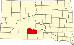
Horse Creek, South Dakota | |
---|---|
Coordinates: 43°32′17″N100°44′17″W / 43.53806°N 100.73806°W | |
Country | United States |
State | South Dakota |
County | Mellette |
Area | |
• Total | 0.95 sq mi (2.46 km2) |
• Land | 0.95 sq mi (2.46 km2) |
• Water | 0.00 sq mi (0.00 km2) |
Elevation | 2,005 ft (611 m) |
Population | |
• Total | 187 |
• Density | 196.84/sq mi (75.99/km2) |
Time zone | UTC-7 (Mountain (MST)) |
• Summer (DST) | UTC-6 (MDT) |
ZIP Code | 57579 (White River) |
Area code | 605 |
FIPS code | 46-30056 |
GNIS feature ID | 2813051 [2] |
Horse Creek is an unincorporated community and census-designated place (CDP) in Mellette County, South Dakota, United States. It was first listed as a CDP prior to the 2020 census. [2] The population of the CDP was 187 at the 2020 census. [4]
It is in the central part of the county, 2 miles (3 km) south of White River, the county seat. The Little White River flows from north to south through the CDP, with most of the community's development to the east of the river on high ground.
U.S. Route 83 runs along the eastern edge of the CDP, leading north through White River 25 miles (40 km) to Interstate 90 at Murdo and south 20 miles (32 km) to Mission. South Dakota Highway 44 leads east-southeast from the CDP 52 miles (84 km) to Winner. Highway 44 follows US 83 north to White River, then turns west and leads 77 miles (124 km) to Interior, near Badlands National Park.
Census | Pop. | Note | %± |
---|---|---|---|
2020 | 187 | — | |
U.S. Decennial Census [5] |
Pine Knot is an unincorporated community and census-designated place (CDP) in McCreary County, Kentucky, United States. The population was 1,380 at the 2020 census, down from 1,621 in 2010.
Lowesville is a census-designated place (CDP) in Lincoln County, North Carolina, United States. The population was 2,945 at the 2010 census, up from 1,440 in 2000.
Parker is a census-designated place (CDP) in Greenville County, South Carolina, United States. The population was 11,431 at the 2010 census, up from 10,760 in 2000. It is part of the Greenville–Mauldin–Easley Metropolitan Statistical Area.
Mountville is an unincorporated community and census-designated place (CDP) in Laurens County, South Carolina, United States. The population was 108 at the 2010 census, down from 130 at the 2000 census. It is part of the Greenville–Mauldin–Easley Metropolitan Statistical Area.
Red Bank is an unincorporated community and census-designated place (CDP) in Lexington County, South Carolina, United States. The population was 9,617 at the 2010 census, up from 8,811 at the 2000 census. It is part of the Columbia, South Carolina Metropolitan Statistical Area.
Wanblee is a census-designated place on the Pine Ridge Indian Reservation, located in Jackson County, South Dakota, United States. The population was 674 at the 2020 census, virtually all of whom are members of the Oglala band of Lakota Sioux. Wanbli is the Lakota word for eagle, and the town was named for its proximity to Wanbli hohpi paha. Wanblee is a few miles directly northeast of the North American continental pole of inaccessibility.
North Spearfish is a census-designated place (CDP) in Lawrence County, South Dakota, United States. The population was 2,366 at the 2020 census.
Vivian is an unincorporated community and census-designated place (CDP) in Lyman County, South Dakota, United States. The population was 98 at the 2020 census.
Lipscomb is an unincorporated community and census-designated place (CDP) in Lipscomb County, Texas, United States. It is the Lipscomb county seat. The population was 37 at the 2010 census.
East Earl is an unincorporated community and census-designated place (CDP) in East Earl Township, Lancaster County, Pennsylvania, United States. As of the 2010 census, it had a population of 1,144.
Saint Onge is an unincorporated community and census-designated place (CDP) in Lawrence County, South Dakota, United States. As of the 2020 census, the population was 170.
Wakefield is an unincorporated community and census-designated place (CDP) within Fulton Township, Lancaster County, Pennsylvania, United States. As of the 2010 census, the population was 609. It is the largest community within the "Peach Bottom" ZIP code, with the area post office on Pennsylvania Route 272, just north of town.
Dover Hill is an unincorporated community and census-designated place (CDP) in Center Township, Martin County, in the U.S. state of Indiana. As of the 2020 census, it had a population of 96.
Shindler is an unincorporated community and census-designated place (CDP) in Lincoln County, South Dakota, United States. The population was 607 at the 2020 census.
Running Water is a census-designated place (CDP) in Bon Homme County, South Dakota, United States. The population was 47 at the 2020 census.
Crocker is an unincorporated community and census-designated place (CDP) in Clark County, South Dakota, United States. The population was 19 at the 2020 census.
Lake Buckhorn is a census-designated place (CDP) in Mechanic Township, Holmes County, Ohio, United States. As of the 2020 census it had a population of 720. It is a private, members-only gated community. The community is built around 220-acre (89 ha) Lake Buckhorn, a reservoir impounded in 1967.
Lake Madison is an unincorporated community and census-designated place in Lake County, South Dakota, United States. Its population was 829 as of the 2020 census. The community is located on the shores of Lake Madison.
White Rock Colony is a census-designated place (CDP) and Hutterite colony in Roberts County, South Dakota, United States, partly within the Lake Traverse Indian Reservation. It was first listed as a CDP prior to the 2020 census. The population of the CDP was 0 at the 2020 census.
Bridger is an unincorporated community and census-designated place (CDP) in Ziebach County, South Dakota, United States, within the Cheyenne River Indian Reservation. The population was 48 at the 2020 census. It was first listed as a CDP prior to the 2020 census.