Mission, South Dakota

Last updated

Mission, South Dakota
Mission, SD.jpg
Todd County South Dakota Incorporated and Unincorporated areas Mission Highlighted.svg
Location in Todd County and the state of South Dakota
Coordinates: 43°18′23″N100°39′39″W / 43.30639°N 100.66083°W / 43.30639; -100.66083
Country United States
State South Dakota
County Todd
Founded1915 [1]
Area
[2]
  Total0.59 sq mi (1.52 km2)
  Land0.59 sq mi (1.52 km2)
  Water0.00 sq mi (0.00 km2)
Elevation
[3]
2,579 ft (786 m)
Population
 (2020) [4]
  Total1,156
  Density1,969.34/sq mi (760.42/km2)
Time zone UTC-6 (Central (CST))
  Summer (DST) UTC-5 (CDT)
ZIP code
57555
Area code 605
FIPS code 46-42940 [5]
GNIS feature ID1267478 [3]
Website www.mission-sd.com

Mission is a city on the Rosebud Indian Reservation in northern Todd County, South Dakota, United States. The population was 1,156 at the 2020 census. [6]

Contents

Mission is home of the Sinte Gleska University. It is the largest incorporated community in the county, but is smaller than the unincorporated community of Rosebud, the capital of the Rosebud Sioux Tribe.

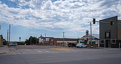
Mission is named for one of the many missions established by religious groups in the late 19th century to educate and assist the Sicangu Lakota (Rosebud Sioux) and other Native American people. The major economic center of the county, it is located at the junction of U.S. routes 18 and 83. The city contains part of the Oyate Trail, the headquarters of the Todd County School District, Cherry-Todd Rural Electric Cooperative, and various federal/tribal agencies.

Geography

According to the United States Census Bureau, the city has a total area of 0.59 square miles (1.53 km2), all land. [7]

Demographics

Historical population
CensusPop.Note
1940 452
1950 388−14.2%
1960 61157.5%
1970 73920.9%
1980 7481.2%
1990 730−2.4%
2000 90423.8%
2010 1,18230.8%
2020 1,156−2.2%
U.S. Decennial Census [8]
[4]

The closely linked communities of Antelope and White Horse, and other nearby settlements, including School District and Bureau of Indian Affairs housings and private communities, are located outside the city limits.[ citation needed ]

2010 census

As of the census [9] of 2010, there were 1,182 people, 398 households, and 298 families living in the city. The population density was 2,003.4 inhabitants per square mile (773.5/km2). There were 443 housing units at an average density of 750.8 per square mile (289.9/km2). The racial makeup of the city was 11.7% White, 0.3% African American, 85.4% Native American, 0.1% Asian, 0.2% from other races, and 2.5% from two or more races. Hispanic or Latino of any race were 2.1% of the population.

There were 398 households, of which 57.0% had children under the age of 18 living with them, 21.9% were married couples living together, 39.7% had a female householder with no husband present, 13.3% had a male householder with no wife present, and 25.1% were non-families. 21.4% of all households were made up of individuals, and 5.8% had someone living alone who was 65 years of age or older. The average household size was 2.97 and the average family size was 3.30.

The median age in the city was 23.2 years. 40.1% of residents were under the age of 18; 14.3% were between the ages of 18 and 24; 23.1% were from 25 to 44; 17.2% were from 45 to 64; and 5.2% were 65 years of age or older. The gender makeup of the city was 46.1% male and 53.9% female.

2000 census

As of the census [5] of 2000, there were 904 people, 302 households, and 214 families living in the city. The population density was 1,523.4 inhabitants per square mile (588.2/km2). There were 339 housing units at an average density of 571.3 per square mile (220.6/km2). The racial makeup of the city was 74.89% Native American, 22.01% White, 0.11% African American, and 2.99% from two or more races. Hispanic or Latino of any race were 1.33% of the population.

There were 302 households, out of which 46.7% had children under the age of 18 living with them, 33.4% were married couples living together, 27.5% had a female householder with no husband present, and 29.1% were non-families. 24.5% of all households were made up of individuals, and 7.0% had someone living alone who was 65 years of age or older. The average household size was 2.82 and the average family size was 3.34.

In the city, the population was spread out, with 40.2% under the age of 18, 9.8% from 18 to 24, 25.6% from 25 to 44, 17.7% from 45 to 64, and 6.7% who were 65 years of age or older. The median age was 25 years. For every 100 females, there were 87.2 males. For every 100 females age 18 and over, there were 82.8 males.

As of 2000 the median income for a household in the city was $23,631, and the median income for a family was $21,375. Males had a median income of $25,417 versus $22,778 for females. The per capita income for the city was $11,374. About 29.5% of families and 30.8% of the population were below the poverty line, including 39.0% of those under age 18 and 24.4% of those age 65 or over.

Notable person

See also

Related Research Articles

<span class="mw-page-title-main">Mellette County, South Dakota</span> County in South Dakota, United States

Mellette County is a county in the U.S. state of South Dakota. As of the 2020 census, the population was 1,918. Its county seat is White River. The county was created in 1909, and was organized in 1911. It was named for Arthur C. Mellette, the last Governor of the Dakota Territory and the first Governor of the state of South Dakota.

<span class="mw-page-title-main">Rembrandt, Iowa</span> City in Iowa, United States

Rembrandt is a city in Buena Vista County, Iowa, United States. The population was 209 at the time of the 2020 census.

<span class="mw-page-title-main">Spirit Lake, Iowa</span> City in Iowa, United States

Spirit Lake is a city in Dickinson County, Iowa, United States. The population was 5,439 at the 2020 census. It is the county seat of Dickinson County.

<span class="mw-page-title-main">Dakota City, Nebraska</span> City in Dakota County, Nebraska, United States

Dakota City is a city in Dakota County, Nebraska, United States. The population was 1,919 at the 2010 census. It is the county seat of Dakota County. Tyson Foods' largest beef production plant is located in Dakota City.

<span class="mw-page-title-main">South Sioux City, Nebraska</span> City in Dakota County, Nebraska, United States

South Sioux City is a city in Dakota County, Nebraska, United States. It is located immediately across the Missouri River from Sioux City, Iowa, and is part of the Sioux City, IA-NE-SD Metropolitan Statistical Area. As of the 2010 census, the city population was 13,353, making it the 14th largest city in Nebraska.

<span class="mw-page-title-main">Marty, South Dakota</span> CDP in South Dakota, United States

Marty is a census-designated place (CDP) in southern Charles Mix County, South Dakota, United States. The population was 677 at the 2020 census.

<span class="mw-page-title-main">Baltic, South Dakota</span> City in South Dakota, United States

Baltic is a city on the Big Sioux River in northern Minnehaha County, South Dakota, United States. The population was 1,246 at the 2020 census.

<span class="mw-page-title-main">Crooks, South Dakota</span> City in South Dakota, United States

Crooks is a city in Minnehaha County, South Dakota, United States and is a suburb of Sioux Falls. The population was 1,362 at the 2020 census. Crooks was named New Hope until 1904. The town's present name honors W. A. Crooks, a local politician.

<span class="mw-page-title-main">Dell Rapids, South Dakota</span> City in South Dakota, United States

Dell Rapids is a city in Minnehaha County, South Dakota, United States. The population was 3,996 at the 2020 census. It is known as "The Little City with the Big Attractions."

<span class="mw-page-title-main">Hartford, South Dakota</span> City in South Dakota, United States

Hartford is a suburban American city in Minnehaha County, South Dakota, a few miles northwest of Sioux Falls. Its population was 3,354 at the 2020 census.

<span class="mw-page-title-main">Egan, South Dakota</span> City in South Dakota, United States

Egan is a city in Moody County, South Dakota, United States. The population was 241 at the 2020 census.

<span class="mw-page-title-main">Flandreau, South Dakota</span> City in South Dakota, United States

FlandreauFLAN-droo is a city in and county seat of Moody County, South Dakota, United States. The population was 2,372 at the 2020 census. It was named in honor of Charles Eugene Flandrau, a judge in the territory and state of Minnesota. He is credited with saving the community of New Ulm, Minnesota, from destruction during conflict with the Sioux tribe in 1862.

<span class="mw-page-title-main">Porcupine, South Dakota</span> CDP in South Dakota, United States

Porcupine is a census-designated place (CDP) in Oglala Lakota County, South Dakota, United States. The population was 925 at the 2020 census.

<span class="mw-page-title-main">Wounded Knee, South Dakota</span> CDP in South Dakota, United States

Wounded Knee is a census-designated place (CDP) on the Pine Ridge Indian Reservation in Oglala Lakota County, South Dakota, United States. The population was 364 at the 2020 census.

<span class="mw-page-title-main">Rosebud, South Dakota</span> CDP in South Dakota, United States

Rosebud also Sicanġu is a census-designated place (CDP) in Todd County, South Dakota, United States. The population was 1,455 at the 2020 census.

<span class="mw-page-title-main">St. Francis, South Dakota</span> Town in South Dakota, United States

St. Francis also Sápauŋ thí is a town on the Rosebud Indian Reservation in Todd County, South Dakota, United States. The population was 469 at the 2020 census.

<span class="mw-page-title-main">Colome, South Dakota</span> City in South Dakota, United States

Colome is a city in Tripp County, South Dakota, United States. The population was 331 as of the 2020 census.

<span class="mw-page-title-main">Elk Point, South Dakota</span> City in South Dakota, United States

Elk Point is a city in and county seat of Union County, South Dakota, United States. The population was 2,149 as of the 2020 census.

<span class="mw-page-title-main">North Sioux City, South Dakota</span> City in South Dakota, United States

North Sioux City is a city in Union County, South Dakota, United States. The population was 3,042 at the 2020 census. It is part of the Sioux City, IA-NE-SD Metropolitan Statistical Area.

<span class="mw-page-title-main">Irene, South Dakota</span> City in South Dakota, United States

Irene is a city in Clay, Turner, and Yankton counties in South Dakota, United States. The population was 422 at the 2020 census. The portion of Irene that is located in Turner County is a part of the Sioux Falls, South Dakota metropolitan area, the portion located in Yankton County is part of the Yankton Micropolitan Statistical Area, and the portion located in Clay County is part of both the Vermillion Micropolitan Statistical Area and the Sioux City-Vermillion Combined Statistical Area. Irene is also host to the Irene Rodeo, held every summer.

References

  1. "SD Towns" (PDF). South Dakota State Historical Society. Archived from the original (PDF) on February 10, 2010. Retrieved February 14, 2010.
  2. "ArcGIS REST Services Directory". United States Census Bureau. Retrieved October 15, 2022.
  3. 1 2 U.S. Geological Survey Geographic Names Information System: Mission, South Dakota
  4. 1 2 "Census Population API". United States Census Bureau. Retrieved October 15, 2022.
  5. 1 2 "U.S. Census website". United States Census Bureau . Retrieved January 31, 2008.
  6. "U.S. Census Bureau: Mission city, South Dakota". www.census.gov. United States Census Bureau. Retrieved December 18, 2021.
  7. "US Gazetteer files 2010". United States Census Bureau. Archived from the original on February 20, 2011. Retrieved June 21, 2012.
  8. "Census of Population and Housing". United States Census Bureau . Retrieved June 7, 2016.
  9. "U.S. Census website". United States Census Bureau . Retrieved June 21, 2012.