Yankton County, South Dakota

Last updated

Yankton County
Scottish Rite Masonic Center (Yankton SD) from E 1.JPG
Scottish Rite Masonic Center in Yankton.
Map of South Dakota highlighting Yankton County.svg
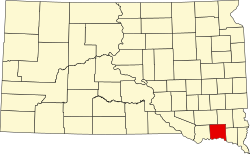
Location within the U.S. state of South Dakota
South Dakota in United States.svg
South Dakota's location within the U.S.
Coordinates: 43°01′N97°23′W / 43.01°N 97.39°W / 43.01; -97.39
CountryFlag of the United States.svg United States
StateFlag of South Dakota.svg  South Dakota
FoundedApril 10, 1862
Named after Yankton Sioux
Seat Yankton
Largest cityYankton
Area
  Total
532 sq mi (1,380 km2)
  Land521 sq mi (1,350 km2)
  Water11 sq mi (30 km2)  2.1%
Population
 (2020)
  Total
23,310
  Estimate 
(2024)
23,509 Increase2.svg
  Density44/sq mi (17/km2)
Time zone UTC−6 (Central)
  Summer (DST) UTC−5 (CDT)
Congressional district At-large
Website www.co.yankton.sd.us
Missouri River in winter downstream from Yankton, with Nebraska below and South Dakota above. This stretch of the river is part of the 59-mile reach of the Missouri National Recreational River. Missouri River in winter downstream from Yankton, South Dakota.jpg
Missouri River in winter downstream from Yankton, with Nebraska below and South Dakota above. This stretch of the river is part of the 59-mile reach of the Missouri National Recreational River.

Yankton County is a county in the U.S. state of South Dakota. As of the 2020 census, the population was 23,310, making it the 9th most populous county in South Dakota. [1] Its county seat is Yankton. [2] Yankton County comprises the Yankton, SD Micropolitan Statistical Area.

Contents

Geography

Gavins Point Dam, impounding Lewis and Clark Lake on the Missouri River in the southwestern part of Yankton County. Lewis & Clark Lake and Dam NE.jpg
Gavins Point Dam, impounding Lewis and Clark Lake on the Missouri River in the southwestern part of Yankton County.
View of Lewis and Clark Lake from Lewis & Clark Recreation Area along the South Dakota shore, west of Yankton. LewisandClarkSRA.jpg
View of Lewis and Clark Lake from Lewis & Clark Recreation Area along the South Dakota shore, west of Yankton.

Yankton County lies on the south side of South Dakota. Its south boundary line abuts the north boundary line of the state of Nebraska (across the Missouri River). The Missouri flows eastward along the county's south border. The James River flows south-southeastward through the west central portion of the county, discharging into the Missouri near the midpoint of the county's south line. The county terrain consists of rolling hills, carved by creeks and drainages, hosting several lakes and ponds. The area is devoted to agriculture. [3] The terrain slopes to the south and the east. Its highest point is 1,473 ft (449 m) ASL, on the eastern portion of its north boundary line. [4] The county has a total area of 532 square miles (1,380 km2), of which 521 square miles (1,350 km2) is land and 11 square miles (28 km2) (2.1%) is water. [5]

Lewis & Clark Lake, a popular regional tourist and recreational destination is found in the southwestern part of the county. [6]

Major highways

Airports

Adjacent counties

Protected areas [3]

Lakes and reservoirs

Demographics

Historical population
CensusPop.Note
1870 2,097
1880 8,390300.1%
1890 10,41424.1%
1900 12,64921.5%
1910 13,1353.8%
1920 15,23316.0%
1930 16,5898.9%
1940 16,7250.8%
1950 16,8040.5%
1960 17,5514.4%
1970 19,0398.5%
1980 18,952−0.5%
1990 19,2521.6%
2000 21,65212.5%
2010 22,4383.6%
2020 23,3103.9%
2024 (est.)23,509 [7] 0.9%
U.S. Decennial Census [8]
1790–1960 [9] 1900–1990 [10]
1990–2000 [11] 2010–2020 [1]

2020 census

As of the 2020 census, there were 23,310 people, 9,435 households, and 5,693 families in the county. [12] The population density was 44.7 inhabitants per square mile (17.3/km2). There were 10,372 housing units.

2010 census

As of the 2010 census, there were 22,438 people, 8,770 households, and 5,476 families in the county. The population density was 43.1 inhabitants per square mile (16.6/km2). There were 9,652 housing units at an average density of 18.5 per square mile (7.1/km2). The racial makeup of the county was 92.8% white, 2.5% American Indian, 1.5% black or African American, 0.5% Asian, 1.1% from other races, and 1.4% from two or more races. Those of Hispanic or Latino origin made up 2.7% of the population. In terms of ancestry.

Of the 8,770 households, 29.2% had children under the age of 18 living with them, 50.1% were married couples living together, 8.8% had a female householder with no husband present, 37.6% were non-families, and 32.0% of all households were made up of individuals. The average household size was 2.30 and the average family size was 2.90. The median age was 41.3 years.

The median income for a household in the county was $47,124 and the median income for a family was $62,070. Males had a median income of $37,637 versus $29,488 for females. The per capita income for the county was $24,776. About 5.0% of families and 11.2% of the population were below the poverty line, including 10.7% of those under age 18 and 13.5% of those age 65 or over.

Communities

Cities

Towns

Census-designated place

Townships

  • Gayville
  • Jamesville
  • Marindahl
  • Mayfield
  • Mission Hill
  • Turkey Valley
  • Utica
  • Volin
  • Walshtown

Unorganized territories

Politics and government

Yankton County is Governed by the County Commission, a five-member legislative body elected at-large. [13] The current commissioners are:

The county is located in South Dakota Legislative District 18. As of 2024, Yankton County is represented in the South Dakota Senate by Senator Jean Hunhoff-(R), and in the South Dakota House of Representatives by State Representatives Mike Stevens-(R) and Ryan Cwach-(D). [14] The county is located in South Dakota's At-Large Congressional District, currently held by Republican Dusty Johnson.

In national elections, Yankton County voters have been reliably Republican for several decades. In no national election since 1964 has the county selected the Democratic Party candidate.

United States presidential election results for Yankton County, South Dakota [15]
Year Republican Democratic Third party(ies)
No.%No.%No.%
2024 6,65061.39%3,88335.85%2992.76%
2020 6,58160.38%4,01636.84%3032.78%
2016 5,65958.81%3,30134.30%6636.89%
2012 5,49555.09%4,22642.37%2532.54%
2008 5,03949.72%4,83847.74%2572.54%
2004 6,00357.55%4,23740.62%1911.83%
2000 4,90456.11%3,59641.14%2402.75%
1996 3,88544.02%3,77542.77%1,16613.21%
1992 3,43036.60%3,40436.32%2,53827.08%
1988 4,18652.05%3,77746.96%800.99%
1984 5,16163.36%2,93236.00%520.64%
1980 5,35561.22%2,69830.84%6947.93%
1976 4,02949.82%3,98749.30%710.88%
1972 4,36653.08%3,83546.63%240.29%
1968 3,97756.08%2,73338.54%3825.39%
1964 3,20846.13%3,74753.87%00.00%
1960 4,06557.04%3,06142.96%00.00%
1956 4,06357.63%2,98742.37%00.00%
1952 4,80268.39%2,22031.61%00.00%
1948 2,90449.28%2,93249.75%570.97%
1944 3,31358.41%2,35941.59%00.00%
1940 4,17957.70%3,06442.30%00.00%
1936 2,70236.33%4,34958.47%3875.20%
1932 1,69325.16%4,93073.25%1071.59%
1928 2,97150.88%2,84148.66%270.46%
1924 1,50439.78%69318.33%1,58441.89%
1920 2,55561.80%1,14727.75%43210.45%
1916 1,42948.66%1,43848.96%702.38%
1912 00.00%1,28944.02%1,63955.98%
1908 1,64456.81%1,11838.63%1324.56%
1904 1,96869.03%78827.64%953.33%
1900 1,63955.75%1,26843.13%331.12%
1896 1,42351.39%1,33048.03%160.58%
1892 1,16653.98%22810.56%76635.46%

The Yankton County Sheriff's Office provides law enforcement in the county and operates the 120-bed county jail. As of 2021 the current Sheriff is Preston Crissey. [16]

Recreation and tourism

Lewis and Clark Lake is located in southwestern Yankton County, four miles (6.4 km) west of Yankton. The Lewis & Clark Lake area is a popular regional tourist and recreation destination with parks, trails, campgrounds, boat ramps, and marinas. Gavins Point Dam, which creates Lewis & Clark Lake, is a popular fishing destination on the Missouri River. [17] The South Dakota Department of Game, Fish, and Parks operates the Lewis & Clark State Recreation Area on the northern shore of the lake.

Below Gavins Point Dam, the Missouri National Recreational River is home to one of the few non-channelized portions of the "Big Muddy", and is popular with birdwatchers, hunters, canoers, and kayakers. [18]

See also

References

  1. 1 2 "State & County QuickFacts". United States Census Bureau. Retrieved March 20, 2024.
  2. "Find a County". National Association of Counties. Archived from the original on May 9, 2015. Retrieved June 7, 2011.
  3. 1 2 Yankton County SD Google Maps (accessed February 9, 2019)
  4. ""Find an Altitude" Google Maps (accessed February 9, 2019)". Archived from the original on May 21, 2019. Retrieved February 10, 2019.
  5. "2010 Census Gazetteer Files". United States Census Bureau. August 22, 2012. Archived from the original on December 8, 2015. Retrieved March 28, 2015.
  6. "Missouri River Dams". Archived from the original on December 16, 2018. Retrieved December 16, 2018.
  7. "County Population Totals and Components of Change: 2020-2024" . Retrieved March 15, 2025.
  8. "U.S. Decennial Census". United States Census Bureau. Retrieved July 20, 2014.
  9. "Historical Census Browser". University of Virginia Library. 2007. Archived from the original on December 12, 2009. Retrieved July 20, 2014.
  10. Forstall, Richard L. (March 27, 1995). "Population of Counties by Decennial Census: 1900 to 1990". United States Census Bureau. Archived from the original on February 19, 1999. Retrieved July 20, 2014.
  11. "Census 2000 PHC-T-4. Ranking Tables for Counties: 1990 and 2000" (PDF). United States Census Bureau. Archived (PDF) from the original on March 27, 2010. Retrieved July 20, 2014.
  12. "US Census Bureau, Table P16: Household Type". United States Census Bureau. Retrieved March 20, 2024.
  13. "Yankton County Commission" . Retrieved February 19, 2024.
  14. "SD Legislature". Archived from the original on January 10, 2019. Retrieved January 10, 2019.
  15. Leip, David. "Atlas of US Presidential Elections". uselectionatlas.org. Archived from the original on March 23, 2018. Retrieved April 15, 2018.
  16. "Yankton County Sheriff" . Retrieved February 19, 2024.
  17. "Omaha District > Missions > Dam and Lake Projects > Missouri River Dams > Gavins Point". www.nwo.usace.army.mil. Archived from the original on April 22, 2018. Retrieved April 15, 2018.
  18. "National Park Service/MNRR". Archived from the original on August 6, 2018. Retrieved August 6, 2018.

43°01′N97°23′W / 43.01°N 97.39°W / 43.01; -97.39