North Spearfish, South Dakota

Last updated

North Spearfish, South Dakota
Lawrence County South Dakota Incorporated and Unincorporated areas North Spearfish Highlighted.svg
Location in Lawrence County and the state of South Dakota
Coordinates: 44°30′29″N103°53′7″W / 44.50806°N 103.88528°W / 44.50806; -103.88528
CountryUnited States
State South Dakota
County Lawrence
Area
[1]
  Total4.28 sq mi (11.10 km2)
  Land4.28 sq mi (11.10 km2)
  Water0.00 sq mi (0.00 km2)
Elevation
[2]
3,645 ft (1,111 m)
Population
 (2020) [3]
  Total2,366
  Density552.29/sq mi (213.22/km2)
Time zone UTC−7 (Mountain (MST))
  Summer (DST) UTC−6 (MDT)
Area code 605
FIPS code 46-45715 [4]
GNIS feature ID2393154 [2]

North Spearfish is a census-designated place (CDP) in Lawrence County, South Dakota, United States. The population was 2,366 at the 2020 census. [5]

Contents

Geography

North Spearfish is located in northern Lawrence County at 44°30′29″N103°53′7″W / 44.50806°N 103.88528°W / 44.50806; -103.88528 (44.507983, -103.885173), [6] on the northwest side of the city of Spearfish, the largest community in the county. Interstate 90 runs along the northern edge of the CDP, with access from Exit 8 (McGuigan Road). I-90 leads southeast 50 miles (80 km) to Rapid City and west 90 miles (140 km) to Gillette, Wyoming. U.S. Route 85 departs from I-90 at the northeast corner of North Spearfish, leading north 10 miles (16 km) to Belle Fourche.

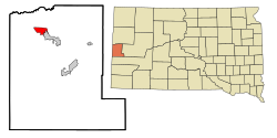
According to the United States Census Bureau, the North Spearfish CDP has a total area of 3.1 square miles (8.0 km2), all land. [7] The community drains northward via Higgins Gulch to Spearfish Creek, a north-flowing tributary of the Redwater River, which in turn is a northeast-flowing tributary of the Belle Fourche River, which runs east to the Missouri River.

Demographics

Historical population
CensusPop.Note
1990 2,274
2000 2,3061.4%
2010 2,221−3.7%
2020 2,3666.5%
U.S. Decennial Census [3]

At the 2000 census there were 2,306 people, 857 households, and 611 families living in the CDP. The population density was 556.2 inhabitants per square mile (214.8/km2). There were 914 housing units at an average density of 220.5 per square mile (85.1/km2). The racial makeup of the CDP was 96.96% White, 0.09% African American, 1.65% Native American, 0.17% Asian, 0.04% Pacific Islander, 0.09% from other races, and 1.00% from two or more races. Hispanic or Latino of any race were 1.17%. [4] 37.2% were of German, 17.3% Norwegian and 7.5% English ancestry according to Census 2000.

Of the 857 households 37.9% had children under the age of 18 living with them, 58.9% were married couples living together, 8.3% had a female householder with no husband present, and 28.7% were non-families. 20.4% of households were one person and 4.6% were one person aged 65 or older. The average household size was 2.61 and the average family size was 3.04.

The age distribution was 26.8% under the age of 18, 11.7% from 18 to 24, 26.2% from 25 to 44, 24.1% from 45 to 64, and 11.3% 65 or older. The median age was 35 years. For every 100 females, there were 97.9 males. For every 100 females age 18 and over, there were 97.3 males.

The median household income was $35,750 and the median family income was $40,455. Males had a median income of $29,559 versus $19,970 for females. The per capita income for the CDP was $16,865. About 7.7% of families and 10.7% of the population were below the poverty line, including 7.3% of those under age 18 and 4.8% of those age 65 or over.

Related Research Articles

<span class="mw-page-title-main">Lawrence County, South Dakota</span> County in South Dakota, United States

Lawrence County is a county in the U.S. state of South Dakota. As of the 2020 census, the population was 25,768. Its county seat is Deadwood.

<span class="mw-page-title-main">Butte County, South Dakota</span> County in South Dakota, United States

Butte County is a county in the U.S. state of South Dakota. As of the 2020 United States Census, the population was 10,243. Its county seat is Belle Fourche. The county was established in the Dakota Territory on March 2, 1883, and given the descriptive name based on the French word for a hill.

<span class="mw-page-title-main">Lisbon, Florida</span> Census-designated place in Florida

Lisbon is an unincorporated community and census-designated place (CDP) in Lake County, Florida, United States. The population was 260 at the 2000 census. It is part of the Orlando–Kissimmee Metropolitan Statistical Area.

<span class="mw-page-title-main">Andrews, Levy County, Florida</span> Census-designated place in Florida, United States

Andrews is a census-designated place (CDP) in Levy County, Florida, United States. The population was 798 at the 2010 census.

<span class="mw-page-title-main">Rio Chiquito, New Mexico</span> CDP in New Mexico, United States

Rio Chiquito is a census-designated place in Santa Fe County, New Mexico, United States. It is part of the Santa Fe, New Mexico Metropolitan Statistical Area. The population was 103 at the 2000 census.

<span class="mw-page-title-main">Fort Totten, North Dakota</span> CDP in North Dakota, United States

Fort Totten is a census-designated place (CDP) in Benson County, North Dakota, United States. The population was 1,243 at the 2010 census. Fort Totten is located within the Spirit Lake Reservation and is the site of tribal headquarters. The reservation has a total population estimated at 6,000. Although not formally incorporated as a city, Fort Totten has the largest population of any community in Benson County.

<span class="mw-page-title-main">Four Bears Village, North Dakota</span> CDP in North Dakota, United States

Four Bears Village is a census-designated place (CDP) in McKenzie County, North Dakota, United States. The population was 500 at the 2020 census.

<span class="mw-page-title-main">Donnybrook, North Dakota</span> City in North Dakota, United States

Donnybrook is a city in Ward County, North Dakota, United States. The population was 75 at the 2020 census. It is part of the Minot Micropolitan Statistical Area.

<span class="mw-page-title-main">Belle Fourche, South Dakota</span> City in South Dakota, United States

Belle Fourche is a city in and the county seat of Butte County, South Dakota, United States. Its population was 5,617 at the 2020 census. It is near the geographic center of the United States, which moved some 550 miles northwest from the geographic center of the contiguous United States in Lebanon, Kansas with the admission of Alaska and Hawaii in the mid-20th century.

<span class="mw-page-title-main">North Eagle Butte, South Dakota</span> Census-designated place in South Dakota, United States

North Eagle Butte is a census-designated place (CDP) in Dewey County, South Dakota, United States, along the 45th parallel. The population was 1,879 at the 2020 census.

<span class="mw-page-title-main">Spearfish, South Dakota</span> City in South Dakota, United States

Spearfish is a city in Lawrence County, South Dakota. The population was 12,193 at the time of the 2020 census, making it the 10th most populous city in South Dakota.

<span class="mw-page-title-main">Vivian, South Dakota</span> Census-designated place in South Dakota, United States

Vivian is an unincorporated community and census-designated place (CDP) in Lyman County, South Dakota, United States. The population was 98 at the 2020 census.

<span class="mw-page-title-main">Blackhawk, South Dakota</span> CDP in South Dakota, United States

Black Hawk is an unincorporated census-designated place (CDP) in Meade County, South Dakota, United States. The population was 3,026 at the 2020 census. Black Hawk has been assigned the ZIP code of 57718. Located along Interstate 90, Black Hawk is part of the Rapid City metropolitan area.

<span class="mw-page-title-main">Ashland Heights, South Dakota</span> CDP in South Dakota, United States

Ashland Heights is a census-designated place (CDP) and unincorporated community in Pennington County, South Dakota, United States. The population was 678 at the 2020 census.

<span class="mw-page-title-main">Colonial Pine Hills, South Dakota</span> CDP in South Dakota, United States

Colonial Pine Hills is a census-designated place (CDP) and unincorporated community in Pennington County, South Dakota, United States. The population was 1,903 at the 2020 census.

<span class="mw-page-title-main">Green Valley, South Dakota</span> CDP in South Dakota, United States

Green Valley is a census-designated place (CDP) and unincorporated community in Pennington County, South Dakota, United States. The population was 1,051 at the 2020 census.

<span class="mw-page-title-main">Rapid Valley, South Dakota</span> CDP in South Dakota, United States

Rapid Valley is a census-designated place (CDP) and unincorporated community in Pennington County, South Dakota, United States, and a suburb of Rapid City. The population was 8,098 at the 2020 census. Rapid Valley has been a retreat for people living in Rapid City due to its low crime, cheap land, and views of the Black Hills. Rapid Valley is home to many industrial and financial businesses, and is the headquarters for many corporations specializing in transport and engineering.

<span class="mw-page-title-main">Oglala, South Dakota</span> CDP in South Dakota, United States

Oglala is a census-designated place (CDP) in West Oglala Lakota Unorganized Territory equivalent, Oglala Lakota County, South Dakota, United States. The population was 1,282 at the 2020 census. Its location is in the northwest of the Pine Ridge Indian Reservation.

<span class="mw-page-title-main">North Sultan, Washington</span> CDP in Washington, United States

North Sultan is a census-designated place (CDP) in Snohomish County, Washington, United States. The population was 264 at the 2010 census.

<span class="mw-page-title-main">Beetown, Wisconsin</span> Town in Wisconsin, United States

The Town of Beetown is located in Grant County, Wisconsin, United States. The population was 734 at the 2000 census. The unincorporated communities of Beetown, Diamond Grove, Five Points, Flora Fountain, Hurricane, and North Andover are located in the town. The former community of Pleasant Ridge was also located in the town.

References

  1. "ArcGIS REST Services Directory". United States Census Bureau. Retrieved October 15, 2022.
  2. 1 2 U.S. Geological Survey Geographic Names Information System: North Spearfish, South Dakota
  3. 1 2 "Census Population API". United States Census Bureau. Retrieved October 15, 2022.
  4. 1 2 "U.S. Census website". United States Census Bureau . Retrieved January 31, 2008.
  5. "U.S. Census Bureau: North Spearfish CDP, South Dakota". www.census.gov. United States Census Bureau. Retrieved May 5, 2022.
  6. "US Gazetteer files: 2010, 2000, and 1990". United States Census Bureau. February 12, 2011. Retrieved April 23, 2011.
  7. "2019 U.S. Gazetteer Files". United States Census Bureau. Retrieved December 31, 2020.