Central City, South Dakota

Last updated

Central City, South Dakota
Lawrence County South Dakota Incorporated and Unincorporated areas Central City Highlighted.svg
Location in Lawrence County and the state of South Dakota
Coordinates: 44°22′07″N103°46′14″W / 44.36861°N 103.77056°W / 44.36861; -103.77056
Country United States
State South Dakota
County Lawrence
Founded1877 [1]
Area
[2]
  Total
0.15 sq mi (0.38 km2)
  Land0.15 sq mi (0.38 km2)
  Water0.00 sq mi (0.00 km2)
Elevation
[3]
4,931 ft (1,503 m)
Population
 (2020) [4]
  Total
93
  Density628.38/sq mi (243.01/km2)
Time zone UTC-7 (Mountain (MST))
  Summer (DST) UTC-6 (MDT)
ZIP code
57754
Area code 605
FIPS code 46-11140 [5]
GNIS feature ID1267317 [3]

Central City is a city in Lawrence County, South Dakota, United States. The population was 93 at the 2020 census. [6]

Contents

History

Central City was founded in 1877. [1] It was named after Central City, Colorado, by a settler from that community.[ citation needed ] It began as a mining town during the Black Hills Gold Rush days. There was once a quarrel over mining boundaries that resulted in a deliberate explosion of the nearby Comstock Mine and the death of one man. A miners' sit-down strike occurred and a cavalry unit from Fort Meade led by Seth Bullock was called in to end it. [7]

Geography

According to the United States Census Bureau, the city has a total area of 0.15 square miles (0.39 km2), all land. [8]

Climate

Climate data for Central City, South Dakota
MonthJanFebMarAprMayJunJulAugSepOctNovDecYear
Record high °F (°C)69
(21)
66
(19)
74
(23)
84
(29)
88
(31)
96
(36)
99
(37)
98
(37)
96
(36)
84
(29)
74
(23)
65
(18)
99
(37)
Mean daily maximum °F (°C)36
(2)
37
(3)
43
(6)
52
(11)
61
(16)
71
(22)
79
(26)
78
(26)
68
(20)
55
(13)
43
(6)
35
(2)
55
(13)
Mean daily minimum °F (°C)17
(−8)
18
(−8)
23
(−5)
31
(−1)
40
(4)
49
(9)
56
(13)
55
(13)
45
(7)
34
(1)
24
(−4)
16
(−9)
34
(1)
Record low °F (°C)−27
(−33)
−32
(−36)
−17
(−27)
−5
(−21)
9
(−13)
24
(−4)
36
(2)
33
(1)
15
(−9)
−5
(−21)
−16
(−27)
−33
(−36)
−33
(−36)
Average precipitation inches (mm)1.34
(34)
1.65
(42)
2.58
(66)
3.55
(90)
4.64
(118)
3.57
(91)
2.76
(70)
2.09
(53)
1.99
(51)
3.04
(77)
1.83
(46)
1.51
(38)
30.55
(776)
Source: The Weather Channel (Historical Monthly Averages) [9]

Demographics

Historical population
CensusPop.Note
1880 1,008
1890 519−48.5%
1900 448−13.7%
1910 296−33.9%
1920 199−32.8%
1930 198−0.5%
1940 30252.5%
1950 218−27.8%
1960 24713.3%
1970 188−23.9%
1980 177−5.9%
1990 1854.5%
2000 149−19.5%
2010 134−10.1%
2020 93−30.6%
U.S. Decennial Census [10] [4]

2010 census

As of the census [11] of 2010, there were 134 people, 66 households, and 37 families living in the city. The population density was 893.3 inhabitants per square mile (344.9/km2). There were 78 housing units at an average density of 520.0 per square mile (200.8/km2). The racial makeup of the city was 94.0% White, 1.5% Native American, 0.7% from other races, and 3.7% from two or more races. Hispanic or Latino of any race were 0.7% of the population.

There were 66 households, of which 18.2% had children under the age of 18 living with them, 34.8% were married couples living together, 12.1% had a female householder with no husband present, 9.1% had a male householder with no wife present, and 43.9% were non-families. 33.3% of all households were made up of individuals, and 9.1% had someone living alone who was 65 years of age or older. The average household size was 2.03 and the average family size was 2.41.

The median age in the city was 48.7 years. 11.9% of residents were under the age of 18; 5.9% were between the ages of 18 and 24; 23.2% were from 25 to 44; 45.6% were from 45 to 64; and 13.4% were 65 years of age or older. The gender makeup of the city was 47.8% male and 52.2% female.

2000 census

As of the census [5] of 2000, there were 149 people, 67 households, and 39 families living in the city. The population density was 1,033.0 inhabitants per square mile (398.8/km2). There were 76 housing units at an average density of 526.9 per square mile (203.4/km2). The racial makeup of the city was 99.33% White and 0.67% Asian.

There were 67 households, out of which 19.4% had children under the age of 18 living with them, 53.7% were married couples living together, 4.5% had a female householder with no husband present, and 40.3% were non-families. 32.8% of all households were made up of individuals, and 7.5% had someone living alone who was 65 years of age or older. The average household size was 2.22 and the average family size was 2.80.

In the city, the population was spread out, with 19.5% under the age of 18, 5.4% from 18 to 24, 33.6% from 25 to 44, 33.6% from 45 to 64, and 8.1% who were 65 years of age or older. The median age was 43 years. For every 100 females, there were 112.9 males. For every 100 females age 18 and over, there were 118.2 males.

The median income for a household in the city was $21,250, and the median income for a family was $31,250. Males had a median income of $23,750 versus $18,438 for females. The per capita income for the city was $12,870. There were 10.5% of families and 15.9% of the population living below the poverty line, including 17.4% of under eighteens and 21.4% of those over 64.

Education

It is in Lead-Deadwood School District 40-1. [12]

Related Research Articles

<span class="mw-page-title-main">Columbia, South Dakota</span> City in South Dakota, United States

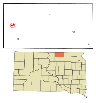
Columbia is an incorporated small town on the James River in Brown County, South Dakota, United States. The population was 160 at the 2020 census. There is a large granary co-op at Columbia, also a post office, a bank, a bar, a church, a town park, and a community center, in addition to the city hall; and many homes.

<span class="mw-page-title-main">Chamberlain, South Dakota</span> City in South Dakota, United States

Chamberlain is a city in Brule County, South Dakota, United States. It is located on the east bank of the Missouri River, at the dammed section of the Lake Francis Case, close to where it is crossed by Interstate 90.

<span class="mw-page-title-main">Newell, South Dakota</span> City in South Dakota, United States

Newell is a city in Butte County, South Dakota, United States. The population was 584 at the 2020 census.

<span class="mw-page-title-main">Wagner, South Dakota</span> City in South Dakota, United States

Wagner is a city in Charles Mix County, South Dakota, United States. The population was 1,490 at the 2020 census. The city is served by Wagner Municipal Airport as well as YST Transit buses.

<span class="mw-page-title-main">Garden City, South Dakota</span> Town in South Dakota, United States

Garden City is a town in Clark County, South Dakota, United States. The population was 33 at the 2020 census.

<span class="mw-page-title-main">Webster, South Dakota</span> City in South Dakota, United States

Webster is a city in and the county seat of Day County, South Dakota, United States. The population was 1,728 at the 2020 census.

<span class="mw-page-title-main">Bowdle, South Dakota</span> City in South Dakota, United States

Bowdle is a city in Edmunds County, South Dakota, United States. The population was 470 at the 2020 census.

<span class="mw-page-title-main">Hosmer, South Dakota</span> City in South Dakota, United States

Hosmer is a city in northwestern Edmunds County, South Dakota, United States. The population was 164 at the 2020 census.

<span class="mw-page-title-main">Ipswich, South Dakota</span> City in South Dakota, United States

Ipswich is a city in and county seat of Edmunds County, South Dakota, United States. The population was 928 at the 2020 census.

<span class="mw-page-title-main">Roscoe, South Dakota</span> City in South Dakota, United States

Roscoe is a city in central Edmunds County, South Dakota, United States. The population was 269 at the 2020 census.

<span class="mw-page-title-main">Gregory, South Dakota</span> City in South Dakota, United States

Gregory is a city in western Gregory County, South Dakota, United States. The population was 1,221 at the 2020 census.

<span class="mw-page-title-main">Parkston, South Dakota</span> City in South Dakota, United States

Parkston is a city in Hutchinson County, South Dakota, United States. The population was 1,567 at the 2020 census.

<span class="mw-page-title-main">Murdo, South Dakota</span> City in South Dakota, United States

Murdo is a city in and the county seat of Jones County, South Dakota, United States. The population was 475 at the 2020 census.

<span class="mw-page-title-main">Whitewood, South Dakota</span> City in South Dakota, United States

Whitewood is a city in Lawrence County, South Dakota, United States. The population was 879 at the 2020 census.

<span class="mw-page-title-main">Lennox, South Dakota</span> City in South Dakota, United States

Lennox is a city in Lincoln County, South Dakota, United States, located 20 miles (32 km) southwest of Sioux Falls. The population was 2,423 at the 2020 census.

<span class="mw-page-title-main">Tea, South Dakota</span> City in South Dakota, United States

Tea is a city in Lincoln County, South Dakota, United States and is a suburb of Sioux Falls. The population was 5,598 at the 2020 census, and was estimated to be 7,381 in 2023.

<span class="mw-page-title-main">Eureka, South Dakota</span> City in South Dakota, United States

Eureka is a city in western McPherson County, South Dakota, United States, near the North Dakota state line. The population was 813 at the 2020 census.

<span class="mw-page-title-main">Letcher, South Dakota</span> Town in South Dakota, United States

Letcher is a town in Sanborn County, South Dakota, United States. The population was 159 at the 2020 census.

<span class="mw-page-title-main">Winner, South Dakota</span> City in South Dakota, United States

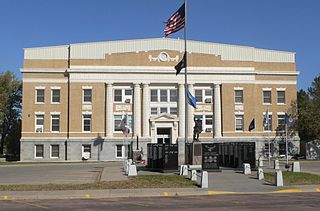
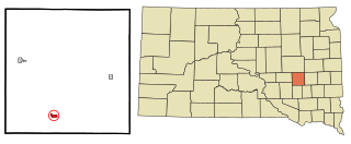
Winner is a city in central Tripp County, South Dakota, United States. The population was 2,921 at the 2020 census. It is the county seat of Tripp County. Winner also serves as the administrative center of neighboring Todd County, which does not have its own county seat. The nearest airport is Winner Regional Airport.

<span class="mw-page-title-main">Elk Point, South Dakota</span> City in South Dakota, United States

Elk Point is a city in and the county seat of Union County, South Dakota, United States. The population was 2,149 as of the 2020 census.

References

  1. 1 2 "SD Towns" (PDF). South Dakota State Historical Society. Archived from the original (PDF) on February 10, 2010. Retrieved February 11, 2010.
  2. "ArcGIS REST Services Directory". United States Census Bureau. Retrieved October 15, 2022.
  3. 1 2 U.S. Geological Survey Geographic Names Information System: Central City, South Dakota
  4. 1 2 "Census Population API". United States Census Bureau. Retrieved October 15, 2022.
  5. 1 2 "U.S. Census website". United States Census Bureau . Retrieved January 31, 2008.
  6. "U.S. Census Bureau: Central City city, South Dakota". www.census.gov. United States Census Bureau. Retrieved May 5, 2022.
  7. Parker, Watson, and Hugh K. Lambert. Black Hills Ghost Towns. First ed. Vol. 1. Chicago, IL: The Swallow Press Incorporated, 1974. 69. 1 vols. Print.
  8. "US Gazetteer files 2010". United States Census Bureau. Archived from the original on January 25, 2012. Retrieved June 21, 2012.
  9. "Climate Statistics for Central City, SD" . Retrieved September 30, 2013.
  10. "Census of Population and Housing". Census.gov. Retrieved June 4, 2015.
  11. "U.S. Census website". United States Census Bureau . Retrieved June 21, 2012.
  12. "2020 CENSUS - SCHOOL DISTRICT REFERENCE MAP: Lawrence County, SD" (PDF). U.S. Census Bureau . Retrieved September 27, 2024. - Text list

Commons-logo.svg Media related to Central City, South Dakota at Wikimedia Commons