Milford, Nebraska | |
---|---|
Coordinates: 40°46′20″N97°03′12″W / 40.77222°N 97.05333°W | |
Country | United States |
State | Nebraska |
County | Seward |
Area | |
• Total | 0.82 sq mi (2.13 km2) |
• Land | 0.81 sq mi (2.11 km2) |
• Water | 0.01 sq mi (0.02 km2) |
Elevation | 1,467 ft (447 m) |
Population | |
• Total | 2,155 |
• Density | 2,650.68/sq mi (1,023.55/km2) |
Time zone | UTC-6 (Central (CST)) |
• Summer (DST) | UTC-5 (CDT) |
ZIP code | 68405 |
Area code | 402 |
FIPS code | 31-32060 |
GNIS feature ID | 2395326 [2] |
Website | http://www.milfordne.gov/ |
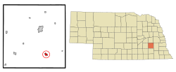
Milford is a city in Seward County, Nebraska, United States. It is part of the Lincoln, Nebraska Metropolitan Statistical Area. The population was 2,155 at the 2020 census. [3]
Milford was platted in 1866. [4] It took its name from a mill at a ford on the Blue River. [5]
According to the United States Census Bureau, the city has a total area of 0.79 square miles (2.05 km2), of which 0.78 square miles (2.02 km2) is land and 0.01 square miles (0.03 km2) is water. [6]
Census | Pop. | Note | %± |
---|---|---|---|
1880 | 402 | — | |
1890 | 555 | 38.1% | |
1900 | 542 | −2.3% | |
1910 | 716 | 32.1% | |
1920 | 792 | 10.6% | |
1930 | 832 | 5.1% | |
1940 | 759 | −8.8% | |
1950 | 951 | 25.3% | |
1960 | 1,462 | 53.7% | |
1970 | 1,846 | 26.3% | |
1980 | 2,108 | 14.2% | |
1990 | 1,886 | −10.5% | |
2000 | 2,070 | 9.8% | |
2010 | 2,090 | 1.0% | |
2020 | 2,155 | 3.1% | |
U.S. Decennial Census [7] 2012 Estimate [8] |
As of the census of 2020, [3] there were 2,155 people, 829 housing units, and 910 families living in the city. The population density was 2,727.8 inhabitants per square mile (1,053.2/km2). There were 829 housing units at an average density of 1,049.4 units per square mile (405.2 units/km2). The racial makeup of the city was 91.79% White, 0.46% African American, 0.6% Native American, 0.56% Asian, 0.05% Pacific Islander, 1.39% from other races, and 5.15% from two or more races. [9] Hispanic or Latino of any race were 2.97% of the population.
As of the census of 2010 [10] of 2010, there were 2,090 people, 770 households, and 494 families living in the city. The population density was 2,679.5 inhabitants per square mile (1,034.6/km2). There were 843 housing units at an average density of 1,080.8 units per square mile (417.3 units/km2). The racial makeup of the city was 97.4% White, 0.3% African American, 0.4% Native American, 0.2% Asian, 0.7% from other races, and 1.0% from two or more races. Hispanic or Latino of any race were 1.6% of the population.
There were 770 households, of which 30.6% had children under the age of 18 living with them, 55.6% were married couples living together, 4.8% had a female householder with no husband present, 3.8% had a male householder with no wife present, and 35.8% were non-families. 29.0% of all households were made up of individuals, and 13.5% had someone living alone who was 65 years of age or older. The average household size was 2.39 and the average family size was 2.97.
The median age in the city was 31.7 years. 22.2% of residents were under the age of 18; 21.1% were between the ages of 18 and 24; 20% were from 25 to 44; 21.5% were from 45 to 64; and 15.4% were 65 years of age or older. The gender makeup of the city was 55.8% male and 44.2% female.
As of the census of 2000, there were 2,070 people, 722 households, and 464 families living in the city. The population density was 2,901.9 inhabitants per square mile (1,120.4/km2). There were 770 housing units at an average density of 1,079.5 units per square mile (416.8 units/km2). The racial makeup of the city was 97.83% White, 0.24% African American, 0.29% Native American, 0.05% Asian, 0.05% Pacific Islander, 0.68% from other races, and 0.87% from two or more races. Hispanic or Latino of any race were 1.50% of the population.
There were 722 households, out of which 30.2% had children under the age of 18 living with them, 56.1% were married couples living together, 5.7% had a female householder with no husband present, and 35.7% were non-families. 26.7% of all households were made up of individuals, and 10.9% had someone living alone who was 65 years of age or older. The average household size was 2.44 and the average family size was 2.99.
In the city, the population was spread out, with 21.7% under the age of 18, 24.9% from 18 to 24, 21.9% from 25 to 44, 16.5% from 45 to 64, and 15.0% who were 65 years of age or older. The median age was 28 years. For every 100 females, there were 132.1 males. For every 100 females age 18 and over, there were 140.5 males.
As of 2000 the median income for a household in the city was $37,039, and the median income for a family was $51,012. Males had a median income of $30,170 compared to $22,026 for females. The per capita income for the city was $16,217. About 4.6% of families and 10.6% of the population were below the poverty line, including 6.7% of those under age 18 and 11.2% of those age 65 or over.
Milford uses a city council consisting of six members plus the mayor. As of March 2020, the current mayor of Milford is James Stone. [11]
Milford is the location of a campus of Southeast Community College. Originally established in Milford in 1941 as the Nebraska State Trade School, it became part of the new Southeast Technical Community College system in 1973. As of 2016, about 750 students were enrolled on the campus. [12]
Currently, Milford is one of only 11 [13] cities in Nebraska to have an official flag. This flag was adopted on March 5, 2019, but had been worked on since July 2018. It was designed as an Eagle Scout Service Project by Boy Scout Nolan Eickhoff and was adopted at a city council meeting. [14]
Milford is a city in Geary County, Kansas, United States. As of the 2020 census, the population of the city was 408.
Murray is a village in Cass County, Nebraska, United States. The population was 480 at the 2020 census.
Sutton is a city in Clay County, Nebraska, United States. The population was 1,447 at the 2020 census. It is part of the Hastings, Nebraska Micropolitan Statistical Area.
Boys Town is a village in Douglas County, Nebraska, United States. The population was 410 at the 2020 census. Boys Town is an enclave and a suburb of Omaha.
Waterloo is a village in Douglas County, Nebraska, United States. The population was 935 at the 2020 census.
Beaver City is a city in Furnas County, on the southern border of Nebraska, United States. The population was 609 at the 2010 census. It is the county seat of Furnas County.
Crofton is a city in Knox County, Nebraska, United States. The population was 726 at the 2010 census.
Nelson is a village and the county seat of Nuckolls County, Nebraska, United States. The population was 488 at the 2010 census. The city was named for C. Nelson Wheeler, the original owner of the town site.
Syracuse is a city in Otoe County, Nebraska, United States. The population was 1,941 at the 2020 census.
Bellevue is a suburban city in Sarpy County, Nebraska, United States. It is part of the Omaha–Council Bluffs metropolitan area, and had a population of 64,176 as of the 2020 census, making it the 3rd most populous city in Nebraska, behind Omaha and Lincoln, and the second largest city in the U.S. named "Bellevue," behind Bellevue, Washington.
Beaver Crossing is a village in Seward County, Nebraska, United States. The population was 403 at the 2010 census.
Bee is a village in Seward County, Nebraska, United States. It is part of the Lincoln, Nebraska Metropolitan Statistical Area. The population was 191 at the 2010 census.
Cordova is a village in Seward County, Nebraska, United States. It is part of the Lincoln, Nebraska Metropolitan Statistical Area. The population was 137 at the 2010 census.
Garland, formerly known as Germantown, is a village in Seward County, Nebraska, United States. It is part of the Lincoln, Nebraska Metropolitan Statistical Area. The population was 216 at the 2010 census.
Pleasant Dale is a village in Seward County, Nebraska, United States. It is part of the Lincoln, Nebraska Metropolitan Statistical Area. The population was 205 at the 2010 census.
Seward is a city and county seat of Seward County, Nebraska, United States. The population was 7,643 at the 2020 census. Seward is part of the Lincoln, Nebraska Metropolitan Statistical Area.
Staplehurst is a village in Seward County, Nebraska, United States. It is part of the Lincoln, Nebraska Metropolitan Statistical Area. The population was 242 at the 2010 census.
Utica is a village in Seward County, Nebraska, United States. It is part of the Lincoln, Nebraska Metropolitan Statistical Area. The population was 861 at the 2010 census.
Milford Center is a village in Union County, Ohio, United States. The population was 807 at the 2020 census.
Milford is a town in Penobscot County, Maine, United States. It is located across the Penobscot River from the city of Old Town. The population of Milford was 3,069 at the 2020 census. The town's slogan is the "Best little town by a dam site," referring to the Milford Dam abutting Milford on the Penobscot River, south of the Penobscot Indian Island Reservation.
Media related to Milford, Nebraska at Wikimedia Commons