Enders, Nebraska

Last updated
Enders, Nebraska
Enders, Nebraska (2).JPG
Enders, seen from the south across Enders Reservoir
USA Nebraska location map.svg
Red pog.svg
Enders
Location within the state of Nebraska
Coordinates: 40°27′19″N101°32′2″W / 40.45528°N 101.53389°W / 40.45528; -101.53389 Coordinates: 40°27′19″N101°32′2″W / 40.45528°N 101.53389°W / 40.45528; -101.53389
Country United States
State Nebraska
County Chase
Area
[1]
  Total0.13 sq mi (0.34 km2)
  Land0.13 sq mi (0.34 km2)
  Water0.00 sq mi (0.00 km2)
Elevation
3,150 ft (960 m)
Population
 (2020)
  Total37
  Density282.44/sq mi (108.93/km2)
Time zone UTC-7 (Mountain (MST))
  Summer (DST) UTC-6 (MDT)
ZIP codes
69027
FIPS code 31-15885
GNIS feature ID829124

Enders is an unincorporated community and census-designated place in Chase County, Nebraska, United States. As of the 2010 census it had a population of 42. [2] Although Enders is unincorporated, it has a post office, with the ZIP code of 69027. [3]

Contents

Geography

Enders lies along U.S. Route 6 and Nebraska Highway 61, [4] 9 miles (14 km) southeast of the city of Imperial, the county seat of Chase County. [5] Its elevation is 3,150 feet (960 m) above sea level. [6]

Enders is located on the north shore of Enders Reservoir. Enders Dam was built on Frenchman Creek in 1947-1951 as part of the Missouri Basin Program [7] of the Bureau of Reclamation. Enders Reservoir State Recreation Area is a popular location for fishing, hunting and other outdoor recreation activities. [8]

Demographics

Historical population
CensusPop.
2020 37
U.S. Decennial Census [9]

History

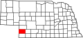
Enders was established on the present site in 1890. The original location of Enders was 2 miles (3 km) to the east-southeast of the present site. The village was relocated to the railroad line which was to be built to Imperial. Enders Post Office was established Aug. 26, 1890, with William A. Reid as postmaster. After being closed in 1893, the post office was reestablished in 1907 with George W. Brown as postmaster. The village was named for Peter Enders, a local pioneer rancher. [10]

Enders was one of the first communities in western Nebraska to be served with electrical power. An irrigation and power dam was located south of the village on Frenchman Creek. [11] The dam and generator were operated by Ralph Grosbach. The location of the power dam was flooded when Enders Dam was finished in 1951.[ citation needed ]

Related Research Articles

<span class="mw-page-title-main">Chase County, Nebraska</span> County in Nebraska, United States

Chase County is a county in the U.S. state of Nebraska. As of the 2010 United States Census, the population was 3,966. Its county seat is Imperial.

<span class="mw-page-title-main">Champion, Nebraska</span> Census-designated place in Nebraska, United States

Champion is an unincorporated community and census-designated place in central Chase County, Nebraska, United States. As of the 2010 census, it had a population of 103. It has a post office with the ZIP code 69023.

Fruitland is an unincorporated community in western Duchesne County, Utah, United States, on the Uintah and Ouray Indian Reservation.

<span class="mw-page-title-main">Mountain Home, Utah</span> Unincorporated community in the state of Utah, United States

Mountain Home is an unincorporated community in central Duchesne County, Utah, United States, adjacent to the Uintah and Ouray Indian Reservation.

<span class="mw-page-title-main">Inavale, Nebraska</span> Census-designated place in Nebraska, United States

Inavale is an unincorporated community and census-designated place in western Webster County, Nebraska, United States. It lies along U.S. Route 136, west of the city of Red Cloud, the county seat of Webster County. Its elevation is 1,736 feet (529 m).

<span class="mw-page-title-main">Inland, Nebraska</span> Census-designated place in Nebraska, United States

Inland is an unincorporated community and census-designated place in northwestern Clay County, Nebraska, United States. As of the 2010 census it had a population of 62. Although Inland is unincorporated, it has a post office, with the ZIP code of 68954.

<span class="mw-page-title-main">Keystone, Nebraska</span> Census-designated place in Nebraska, United States

Keystone is an unincorporated community and census-designated place in central Keith County, Nebraska, United States. As of the 2010 census its population was 59.

<span class="mw-page-title-main">Lemoyne, Nebraska</span> Census-designated place in Nebraska, United States

Lemoyne is an unincorporated community and census-designated place in northwestern Keith County, Nebraska, United States. As of the 2010 census it had a population of 82.

<span class="mw-page-title-main">Martell, Nebraska</span> Unincorporated community in Nebraska, United States

Martell is an unincorporated community in southwestern Lancaster County, Nebraska, United States. It lies along local roads southwest of the city of Lincoln, the county seat of Lancaster County and Nebraska's state capital. Its elevation is 1,332 feet (406 m). Although Martell is unincorporated, it has a post office, with the ZIP code of 68404.

<span class="mw-page-title-main">Mills, Nebraska</span> Unincorporated community in Nebraska, United States

Mills is an unincorporated community in northeastern Keya Paha County, Nebraska, United States. It lies along local roads northeast of the village of Springview, the county seat of Keya Paha County. Its elevation is 1,919 feet (585 m). Although Mills is unincorporated, it has a post office, with the ZIP code of 68753; the ZCTA for ZIP code 68753 had a population of 106 at the 2000 census.

<span class="mw-page-title-main">St. Libory, Nebraska</span> Census-designated place in Nebraska, United States

St. Libory is an unincorporated community and census-designated place (CDP) in southeastern Howard County, Nebraska, United States. As of the 2010 census it had a population of 264.

Vancourt is an unincorporated community in eastern Tom Green County, Texas, United States. It lies along U.S. Route 87 east of the city of San Angelo, the county seat of Tom Green County. Its elevation is 1,867 feet (569 m). Although Vancourt is unincorporated, it has a post office, with the ZIP code of 76955; the ZCTA for ZIP Code 76955 had a population of 108 at the 2000 census.

Mereta is an unincorporated community in eastern Tom Green County, Texas, United States. It lies along local roads east of the city of San Angelo, the county seat of Tom Green County. Its elevation is 1,755 feet (535 m). Although Mereta is unincorporated, it has a post office, with the ZIP code of 76940; the ZCTA for ZIP Code 76940 had a population of 138 at the 2000 census.

<span class="mw-page-title-main">Cee Vee, Texas</span> Unincorporated community in Texas, United States

Cee Vee is an unincorporated community in northwestern Cottle County, Texas, United States. It lies along FM 1440 northwest of the town of Paducah, the county seat of Cottle County. Its elevation is 1,880 feet (573 m), and it is located at 34°13′23″N100°26′44″W. Although Cee Vee is unincorporated, it has a post office, with the ZIP code of 79223; the ZCTA for ZIP Code 79223 had a population of 35 at the 2000 census.

Nathalie is an unincorporated community and census-designated place (CDP) in Halifax County, Virginia, United States, in the south-central region of the state. The population as of the 2010 census was 183.

<span class="mw-page-title-main">Frenchman Creek (Republican River tributary)</span> River

Frenchman Creek is a spring-fed waterway that begins in Phillips County, Colorado, crosses Chase and Hayes counties in Nebraska and ends at its juncture with the Republican River in Hitchcock County, Nebraska. The length of the waterway is approximately 166 miles (267 km).

Red Willow Dam is a dam in Frontier County, Nebraska, about ten miles northwest of McCook.

<span class="mw-page-title-main">Enders Dam</span> Dam in Chase County, Nebraska

Enders Dam is a dam in Chase County, Nebraska, near the southwestern corner of the state.

<span class="mw-page-title-main">Medicine Creek Dam</span>

Medicine Creek Dam is a dam in Frontier County, Nebraska.

References

  1. "ArcGIS REST Services Directory". United States Census Bureau. Retrieved September 18, 2022.
  2. "Geographic Identifiers: 2010 Demographic Profile Data (G001): Enders CDP, Nebraska". U.S. Census Bureau, American actfinder. Archived from the original on February 12, 2020. Retrieved October 15, 2014.
  3. Zip Code Lookup
  4. Nebraska Highway Logbook
  5. Rand McNally. The Road Atlas '08. Chicago: Rand McNally, 2008, p. 62.
  6. U.S. Geological Survey Geographic Names Information System: Enders, Nebraska, Geographic Names Information System, 1979-03-09. Accessed 2008-04-26.
  7. Pick-Sloan Missouri Basin Project Archived 2009-01-18 at the Wayback Machine
  8. Nebraska Game and Parks Commission Archived 2009-05-11 at the Wayback Machine
  9. "Census of Population and Housing". Census.gov. Retrieved June 4, 2016.
  10. Chase County Historical Society
  11. U.S. Geological Survey Geographic Names Information System: Enders, Nebraska