
Buffalo County is a county located in the U.S. state of Nebraska in the Midwestern United States. As of the 2020 United States Census, the population was 50,084, making it Nebraska's fifth-most populous county. Its county seat is Kearney. The county was created in 1855 and was organized in 1870. It was named after the once-prevalent buffalo herds of the Great Plains.

Lisco is a census-designated place (CDP) in Garden County, Nebraska, United States. The population was 64 at the 2010 census.

Chalco is a census-designated place (CDP) in northern Sarpy County, Nebraska, United States, and an adjacent suburb of Omaha, with La Vista located to the southeast. The population was 11,064 at the 2020 census.

Buffalo is a census-designated place (CDP) in Union County, South Carolina, United States. The population was 1,266 at the 2010 United States Census.

Odessa is a census-designated place (CDP) in Odessa Township, Buffalo County, Nebraska, United States. It is part of the Kearney, Nebraska Micropolitan Statistical Area. The population of the CDP was 130 at the 2010 census.
Columbia is an unincorporated community and census-designated place (CDP) located within Knowlton Township in Warren County, in the U.S. state of New Jersey. While the community has existed for over a century, the CDP was created as part of the 2010 United States Census. As of the 2010 Census, the CDP's population was 229. The area is served as United States Postal Service ZIP Code 07832.
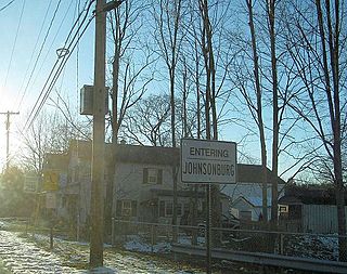
Johnsonburg is an unincorporated community and census-designated place (CDP) located within Frelinghuysen Township in Warren County, in the U.S. state of New Jersey, that was created as part of the 2010 United States Census. As of the 2020 Census, the CDP's population was 381, up from 101 in the 2010 Census.
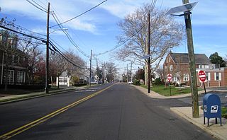
Yardville is an unincorporated community and census-designated place (CDP) located within Hamilton Township, in Mercer County, in the U.S. state of New Jersey. As of the 2010 United States Census, the CDP's population was 2,945. Before the 2010 Census, the area was part of the Yardville-Groveville CDP.
Walton is an unincorporated community and census-designated place in Lancaster County, Nebraska, United States. Walton had a population of 306 as of the 2010 census. The headquarters of the Cornhusker Council of the Boy Scouts of America are located in Walton.

Buffalo is a census-designated place (CDP) in Liberty Township, White County, in the U.S. state of Indiana. The population was 692 at the 2010 census.

Kistler is an unincorporated community and census-designated place (CDP) in Logan County, West Virginia, United States. As of the 2010 census, its population was 528.
Robinette is an unincorporated community and census-designated place (CDP) in Logan County, West Virginia, United States, along Buffalo Creek. Its population was 663 as of the 2010 census. Prior to 2010, Robinette was part of the Amherstdale-Robinette CDP.

Amherstdale is a census-designated place (CDP) in Logan County, West Virginia, United States, situated along Buffalo Creek. The CDP includes the unincorporated communities of Amherstdale, Becco, Fanco, and Braeholm. The CDP population was 350 as of the 2010 census.
Overland is a census-designated place (CDP) in Hamilton County, Nebraska, United States. The population was 153 at the 2010 census.
Broadway is an unincorporated community and census-designated place (CDP) located within Franklin Township, in Warren County, in the U.S. state of New Jersey, that was created as part of the 2010 United States Census. As of the 2010 Census, the CDP's population was 244.
Titanic is a census-designated place (CDP) in Adair County, Oklahoma, United States. The population was 356 at the 2010 census. It was presumably named after the famous ocean liner RMS Titanic.
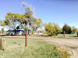
Glenwood is a census-designated place (CDP) in Buffalo County, Nebraska, United States. It conforms to the unincorporated area known as Glenwood Park. It is part of the Kearney, Nebraska Micropolitan Statistical Area. The population was 466 at the 2010 census.

Holmesville is a census-designated place (CDP) in Gage County, Nebraska, United States. As of the 2010 census it had a population of 51.
Sarben is an unincorporated community and census-designated place in Keith County, Nebraska, United States. As of the 2010 census it had a population of 31.
King Lake is an unincorporated community and census-designated place in Douglas County, Nebraska, United States. The population was 280 at the 2010 census. Of the population, 218 people are male and 62 are female. The area is 1.02 square miles (2.6 km2). The population density is 125.09 people/sq. mi. The land area is 0.99 square miles (2.6 km2). The water area is 0.03 square miles (0.078 km2).


