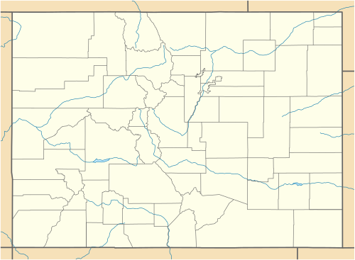
The U.S. State of Colorado has 210 census-designated places. [1] The United States Census Bureau defines certain unincorporated communities as census-designated places (CDPs) for enumeration in each decennial census. The Census Bureau defined 187 CDPs in Colorado for the 2010 Census and 210 CDPs for the 2020 Census. [1]
At the 2020 United States Census, 714,417 of the 5,773,714 Colorado residents (12.37%) lived in one of these 210 census-designated places. Another 4,299,942 residents (74.47%) lived in one of the 272 municipalities of the state, while the remaining 759,355 residents (13.15%) lived in the many rural and mountainous regions of the state. [2]
Colorado CDPs range in population from the Highlands Ranch CDP with a 2020 population of 103,444 to the Fulford CDP which lost both of its residents before the 2020 Census. The Black Forest CDP is the most extensive CDP with 101 square miles (261 km2) of land area, while the Blue Sky CDP is the least extensive with 23 acres (0.093 km2) of land area. The Orchard Mesa CDP was the most densely populated CDP with a 2020 population density of 41,840 residents per square mile (16,155/km2), while the Cathedral CDP was the lease densely populated of the populated CDPs with 0.70 resident per square mile (0.27/km2).
Five Colorado CDPs extend into more than one county: the Brook Forest CDP, the Coal Creek CDP, the Columbine CDP, the Strasburg CDP, and the Watkins CDP.
The Town of Keystone incorporated on March 28, 2023.
County seat |
The following table contains the 2020 population of each of the five census-designated places that currently extend into more than one Colorado county.
Census-designated place | 2020 Census [2] | |||
---|---|---|---|---|
Total | County | by county | % | |
Brook Forest CDP | 622 | Jefferson | 334 | 53.7% |
Clear Creek | 288 | 46.3% | ||
Coal Creek CDP [lower-alpha 2] | 2,494 | Jefferson | 1,537 | 61.6% |
Boulder | 665 | 26.7% | ||
Gilpin | 292 | 11.7% | ||
Columbine CDP | 25,229 | Jefferson | 23,247 | 92.1% |
Arapahoe | 1,982 | 7.9% | ||
Strasburg CDP | 3,307 | Adams | 2,036 | 61.6% |
Arapahoe | 1,271 | 38.4% | ||
Watkins CDP | 682 | Arapahoe | 594 | 87.1% |
Adams | 88 | 12.9% |
The Population history of Colorado census-designated places includes the population of the 210 census-designated places in Colorado since 2000 United States Census.
Denver is the central city of a conurbation region in the U.S. state of Colorado. The conurbation includes one continuous region consisting of the six central counties of Adams, Arapahoe, Broomfield, Denver, Douglas, and Jefferson. The Denver region is part of the Front Range Urban Corridor.
Coal Creek, commonly known as Coal Creek Canyon, is a census-designated place (CDP) located in and governed by Jefferson, Boulder, and Gilpin counties in Colorado, United States, but primarily Jefferson County. The population of the Coal Creek CDP was 2,494 at the United States Census 2020. The Golden post office serves the area.
Divide is an unincorporated town, a post office, and a census-designated place (CDP) located in and governed by Teller County, Colorado, United States. The CDP is a part of the Colorado Springs, CO Metropolitan Statistical Area. The Divide post office has the ZIP Code 80814. At the United States Census 2020, the population of the Divide CDP was 143.
The North Central Colorado Urban Area comprises the four contiguous metropolitan statistical areas in the north central region of the State of Colorado: the Denver–Aurora Metropolitan Statistical Area, the Boulder Metropolitan Statistical Area, the Fort Collins-Loveland Metropolitan Statistical Area, and the Greeley Metropolitan Statistical Area. With the exception of southeastern Elbert County, southeastern Park County, and tiny portions of southern Douglas County, the entire North Central Colorado Urban Area is drained by the South Platte River and its tributaries. The North Central Colorado Urban Area is the central, and the most populous, of the three primary subregions of the Front Range Urban Corridor.
The South Central Colorado Urban Area comprises the Colorado Springs Metropolitan Statistical Area, the Pueblo Metropolitan Statistical Area, and the Cañon City Micropolitan Statistical Area in the central and south central region of the State of Colorado. With the exception of northern Teller County and small portions of northern El Paso County, the entire South Central Colorado Urban Area is drained by the Arkansas River and its tributaries. The South Central Colorado Urban Area is the southernmost of the three primary subregions of the Front Range Urban Corridor.
Glendale is an unincorporated community and a census-designated place (CDP) located in and governed by Boulder County, Colorado, United States. The CDP is a part of the Boulder, CO Metropolitan Statistical Area. The population of the Glendale CDP was 64 at the United States Census 2020. The Jamestown post office serves the area.
This is a population history of the 272 active incorporated municipalities of the US State of Colorado since the 2000 United States census as estimated by the United States Census Bureau.
This is a population history of the 64 counties of the US State of Colorado since the 2000 United States census as enumerated or estimated by the United States Census Bureau.
This is a population history of the 210 census-designated places in the US state of Colorado since the 2000 United States census. The United States Census Bureau defines certain unincorporated communities as census-designated places (CDPs) for enumeration in each decennial census. The Census Bureau defined 85 CDPs in Colorado for the 2000 Census, 187 CDPs for the 2010 Census, and 210 CDPs for the 2020 Census.