Blende, Colorado

Last updated

Blende, Colorado
Blende, Colorado.JPG
Looking east along Santa Fe Drive in Blende.
Pueblo County Colorado Incorporated and Unincorporated areas Blende Highlighted 0807245.svg
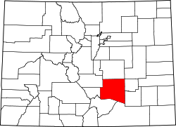
Location of the Blende CDP in Pueblo County, Colorado.
USA Colorado location map.svg
Red pog.svg
Blende
Location of the Blende CDP in the State of Colorado.
Coordinates: 38°14′57″N104°34′12″W / 38.24917°N 104.57000°W / 38.24917; -104.57000 (Blende CDP, Colorado) [1]
Country Flag of the United States.svg  United States
State Flag of Colorado.svg  Colorado
County Pueblo County
Government
[1]
  Type unincorporated community
Area
[2]
  Total0.839 sq mi (2.172 km2)
  Land0.839 sq mi (2.172 km2)
  Water0.0002 sq mi (0.0004 km2)
Elevation
[1]
4,741 ft (1,445 m)
Population
 (2020) [3]
  Total788
  Density940/sq mi (360/km2)
Time zone UTC-7 (MST)
  Summer (DST) UTC-6 (MDT)
ZIP Code [4]
Pueblo 81006
Area code 719
GNIS feature ID 2583212 [1]

Blende is a Census-designated place (CDP) in and governed by Pueblo County, Colorado, United States. The CDP is a part of the Pueblo, CO Metropolitan Statistical Area. The population of the Blende CDP was 788 at the United States Census 2020. [3] The Pueblo post office (Zip Code 81006) serves the area. [4]

Contents

Geography

The Blende CDP has an area of 537 acres (2.172 km2), including 0.01 acre (0.0004 km2) of water. [2]

Demographics

Blende CDP, Colorado
YearPop.±%
2010 878    
2020 788−10.3%
Source: United States Census Bureau

The United States Census Bureau initially defined the Blende CDP for the United States Census 2010.

See also

Related Research Articles

<span class="mw-page-title-main">Coal Creek, Jefferson County, Colorado</span> Census-designated place in Boulder, Gilpin, and Jefferson counties in Colorado, United States

Coal Creek, commonly known as Coal Creek Canyon, is a census-designated place (CDP) located in and governed by Jefferson, Boulder, and Gilpin counties in Colorado, United States, but primarily Jefferson County. The population of the Coal Creek CDP was 2,494 at the United States Census 2020. The Golden post office serves the area.

<span class="mw-page-title-main">The Pinery, Colorado</span> Census Designated Place in Colorado, United States

The Pinery is an unincorporated community and a census-designated place (CDP) located in and governed by Douglas County, Colorado, United States. The CDP is a part of the Denver–Aurora–Lakewood, CO Metropolitan Statistical Area. The population of The Pinery CDP was 11,311 at the United States Census 2020. Douglas County governs the unincorporated community. The Parker post office serves the area.

<span class="mw-page-title-main">Genesee, Colorado</span> Census Designated Place in Colorado, United States

Genesee is an unincorporated community and a census-designated place (CDP) located in and governed by Jefferson County, Colorado, United States. The CDP is a part of the Denver–Aurora–Lakewood, CO Metropolitan Statistical Area. The population of the Genesee CDP was 3,610 at the United States Census 2020. The Golden post office serves the area.

<span class="mw-page-title-main">Avondale, Colorado</span> Census-designated place in Pueblo County, Colorado, United States

Avondale is a census-designated place (CDP) and post office in and governed by Pueblo County, Colorado, United States. The CDP is a part of the Pueblo, CO Metropolitan Statistical Area. The Avondale post office has the ZIP Code 81022. At the United States Census 2020, the population of the Avondale CDP was 594, while the population of the 81022 ZIP Code Tabulation Area was 1,624 including adjacent areas.

<span class="mw-page-title-main">Beulah Valley, Colorado</span> Census-designated placed in Pueblo County, Colorado, United States

Beulah Valley is a census-designated place (CDP) in and governed by Pueblo County, Colorado, United States. The CDP is a part of the Pueblo, CO Metropolitan Statistical Area. The population of the Beulah Valley CDP was 518 at the United States Census 2020. The Beulah post office (Zip Code 81023) serves the area.

<span class="mw-page-title-main">Colorado City, Colorado</span> Census-designated place in Pueblo County, Colorado, United States

Colorado City is a census-designated place (CDP) and post office in and governed by Pueblo County, Colorado, United States. The CDP is a part of the Pueblo, CO Metropolitan Statistical Area. The Colorado City post office has the ZIP Code 81019. At the United States Census 2020, the population of the Colorado City CDP was 2,237. The Colorado City Metropolitan District provides services.

<span class="mw-page-title-main">Salt Creek, Colorado</span> Census Designated Place in Colorado, United States

Salt Creek is an unincorporated community and a census-designated place (CDP) located in and governed by Pueblo County, Colorado, United States. The CDP is a part of the Pueblo, CO Metropolitan Statistical Area. The population of the Salt Creek CDP was 507 at the United States Census 2020. The Pueblo post office (Zip Code 81006) serves the area. The community takes its name from Salt Creek, a stream that flows on the community's west side.

<span class="mw-page-title-main">Dotsero, Colorado</span> Census Designated Place in Colorado, United States

Dotsero is an unincorporated community and a census-designated place (CDP) located in and governed by Eagle County, Colorado, United States. The CDP is a part of the Edwards, CO Micropolitan Statistical Area. The population of the Dotsero CDP was 1,172 at the United States Census 2020. The Gypsum post office serves the area.

<span class="mw-page-title-main">Brick Center, Colorado</span> Census Designated Place in Colorado, United States

Brick Center is an unincorporated community and a census-designated place (CDP) located in and governed by Arapahoe County, Colorado, United States. The CDP is a part of the Denver–Aurora–Lakewood, CO Metropolitan Statistical Area. The population of the Brick Center CDP was 105 at the United States Census 2020. The Bennett post office serves the area.

<span class="mw-page-title-main">Peoria, Colorado</span> Census Designated Place in Colorado, United States

Peoria is an unincorporated community and a census-designated place (CDP) located in and governed by Arapahoe County, Colorado, United States. The CDP is a part of the Denver–Aurora–Lakewood, CO Metropolitan Statistical Area. The population of the Peoria CDP was 153 at the United States Census 2020. The Byers post office serves the area.

<span class="mw-page-title-main">Lazy Acres, Colorado</span> Census Designated Place in Colorado, United States

Lazy Acres is an unincorporated community and a census-designated place (CDP) located in and governed by Boulder County, Colorado, United States. The CDP is a part of the Boulder, CO Metropolitan Statistical Area. The population of the Lazy Acres CDP was 957 at the United States Census 2020. The Boulder post office serves the area.

<span class="mw-page-title-main">Leyner, Colorado</span> Census Designated Place in Colorado, United States

Leyner is an unincorporated community and a census-designated place (CDP) located in and governed by Boulder County, Colorado, United States. The CDP is a part of the Boulder, CO Metropolitan Statistical Area. The population of the Leyner CDP was 40 at the United States Census 2020. The Lafayette post office serves the area.

<span class="mw-page-title-main">Chacra, Colorado</span> Census-designated places in Garfield County, Colorado, United States

Chacra is a census-designated place (CDP) in and governed by Garfield County, Colorado, United States. The CDP is a part of the Glenwood Springs, CO Micropolitan Statistical Area. The population of the Chacra CDP was 331 at the United States Census 2020. The Glenwood Springs post office serves the area.

<span class="mw-page-title-main">Vineland, Colorado</span> Census-designated place in Pueblo County, Colorado, United States

Vineland is a census-designated place (CDP) in and governed by Pueblo County, Colorado, United States. The CDP is a part of the Pueblo, CO Metropolitan Statistical Area. The population of the Vineland CDP was 269 at the United States Census 2020. The Pueblo post office (Zip Code 81006) serves the area.

<span class="mw-page-title-main">Portland, Ouray County, Colorado</span> Census-designated place in Ouray County, Colorado, United States

Portland is a census-designated place (CDP) located in and governed by Ouray County, Colorado, United States. The CDP is a part of the Montrose, CO Micropolitan Statistical Area. The population of the Portland CDP was 136 at the United States Census 2020. The Ridgway post office (Zip Code 81432) serves the area.

<span class="mw-page-title-main">Shaw Heights, Colorado</span> Census Designated Place in Colorado, United States

Shaw Heights is an unincorporated community and a census-designated place (CDP) located in and governed by Adams County, Colorado, United States. The CDP is part of the Denver–Aurora–Lakewood, CO Metropolitan Statistical Area. The population of the Shaw Heights CDP was 5,185 at the United States Census 2020. The Westminster post office serves the area.

<span class="mw-page-title-main">North La Junta, Colorado</span> Census-designated place in Colorado, United States

North La Junta is a census-designated place (CDP) in and governed by Otero County, Colorado, United States. The population of the North La Junta CDP was 482 at the United States Census 2020. The La Junta post office (Zip Code 81050) serves the area.

<span class="mw-page-title-main">El Moro, Colorado</span> Census Designated Place in Colorado, United States

El Moro is an unincorporated community and a census-designated place (CDP) located in and governed by Las Animas County, Colorado, United States. The population of the El Moro CDP was 216 at the United States Census 2020. The Trinidad post office serves the area.

Stepping Stone is an unincorporated community and a census-designated place (CDP) located in and governed by Douglas County, Colorado, United States. The population was 2,780 at the 2020 census. The CDP is a part of the Denver–Aurora–Lakewood, CO Metropolitan Statistical Area. The unincorporated community lies in ZIP code 80134.

Park Center is a census-designated place (CDP) in and governed by Fremont County, Colorado, United States. The CDP is a part of the Cañon City, CO Micropolitan Statistical Area. The population of the Park Center CDP was 2,953 at the United States Census 2020. The Cañon City post office serves the area.

References

  1. 1 2 3 4 U.S. Geological Survey Geographic Names Information System: Blende, Colorado
  2. 1 2 "State of Colorado Census Designated Places - BAS20 - Data as of January 1, 2020". United States Census Bureau . Retrieved December 26, 2020.
  3. 1 2 United States Census Bureau. "Blende CDP, Colorado" . Retrieved April 13, 2023.
  4. 1 2 "Look Up a ZIP Code". United States Postal Service . Retrieved December 26, 2020.