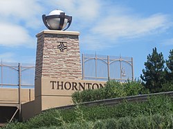
Thornton, Colorado | |
---|---|
Location of Thornton in the United States | |
Coordinates: 39°54′11″N104°57′16″W / 39.90306°N 104.95444°W | |
Country | United States |
State | Colorado |
Counties [2] | Adams County Weld County |
City [1] | Thornton |
Incorporated | June 12, 1956 [3] |
Named for | Daniel I.J. Thornton |
Government | |
• Type | Home rule municipality [1] |
• Mayor | Janifer "Jan" Kulmann (Since 2019) |
• City Manager | Kevin Woods (Since 2017) |
Area | |
• Total | 37.947 sq mi (98.282 km2) |
• Land | 35.924 sq mi (93.043 km2) |
• Water | 2.023 sq mi (5.239 km2) |
Elevation | 5,351 ft (1,631 m) |
Population | |
• Total | 141,867 |
• Rank | 6th in Colorado 191st in the United States |
• Density | 3,949/sq mi (1,525/km2) |
• Metro | 2,963,821 (19th) |
• CSA | 3,623,560 (17th) |
• Front Range | 5,055,344 |
Time zone | UTC−07:00 (MST) |
• Summer (DST) | UTC−06:00 (MDT) |
ZIP codes [6] | Denver 80221, 80229, 80233, 80241, 80260 Brighton 80602 |
Area code(s) | Both 303 and 720 |
FIPS code | 08-77290 |
GNIS feature ID | 0181265 |
Highways | |
Website | City of Thornton |
Sixth most populous Colorado city |
Thornton is a home rule municipality located in Adams and Weld counties, Colorado, United States. [1] The city population was 141,867, all in Adams County, at the 2020 United States Census, an increase of +19.44% since the 2010 United States census. [4] Thornton is the sixth-most-populous city in Colorado and the 191st-most-populous city in the United States. Thornton is 10 miles (16 km) north of the Colorado State Capitol in Denver and is a part of the Denver–Aurora–Lakewood, CO Metropolitan Statistical Area.
Thornton consisted solely of farmland until 1953, when Sam Hoffman purchased a lot off Washington Street about seven miles (11 km) north of Denver. The town he laid out was the first fully planned community in Adams County, and the first to offer full municipal services from a single tax levy, including recreation services and free trash pickup. Thornton was named in honor of then-incumbent Colorado Governor Dan Thornton. [7]
The Thornton Community Association (TCA) was formed in 1954 to help guide the new community's development. By the end of 1955, Thornton had 5,500 residents in over 1,200 homes. The TCA was instrumental in Thornton's 1956 incorporation as a city. Oyer G. Leary was elected the first mayor. [8]
Thornton is located at 39°54′11″N104°57′16″W / 39.90306°N 104.95444°W (39.903043, -104.954406). [9]
At the 2020 United States Census, the town had a total area of 24,286 acres (98.282 km2) including 1,295 acres (5.239 km2) of water. [4]
Census | Pop. | Note | %± |
---|---|---|---|
1960 | 11,353 | — | |
1970 | 13,326 | 17.4% | |
1980 | 42,054 | 215.6% | |
1990 | 55,031 | 30.9% | |
2000 | 82,384 | 49.7% | |
2010 | 118,772 | 44.2% | |
2020 | 141,867 | 19.4% | |
U.S. Decennial Census |
Race / Ethnicity (NH = Non-Hispanic) | Pop 2000 [10] | Pop 2010 [11] | Pop 2020 [12] | % 2000 | % 2010 | % 2020 |
---|---|---|---|---|---|---|
White alone (NH) | 59,635 | 71,147 | 72,316 | 72.39% | 59.90% | 50.97% |
Black or African American alone (NH) | 1,106 | 1,903 | 2,660 | 1.34% | 1.60% | 1.87% |
Native American or Alaska Native alone (NH) | 560 | 566 | 748 | 0.68% | 0.48% | 0.53% |
Asian alone (NH) | 2,013 | 5,058 | 8,250 | 2.44% | 4.26% | 5.82% |
Pacific Islander alone (NH) | 64 | 97 | 130 | 0.08% | 0.08% | 0.09% |
Some Other Race alone (NH) | 78 | 184 | 658 | 0.09% | 0.15% | 0.46% |
Mixed Race or Multi-Racial (NH) | 1,345 | 2,215 | 5,713 | 1.63% | 1.86% | 4.03% |
Hispanic or Latino (any race) | 17,583 | 37,602 | 51,392 | 21.34% | 31.66% | 36.23% |
Total | 82,384 | 118,772 | 141,867 | 100.00% | 100.00% | 100.00% |
As of the 2010 census, there were 118,772 people, 41,359 households, and 30,254 families living in the city. The population density was 3,409.1 inhabitants per square mile (1,316.3/km2). There were 43,230 housing units at an average density of 1,240.8 per square mile (479.1/km2). The racial makeup of the city was 77.4% White, 4.4% Asian, 1.8% African American, 1.1% American Indian, 0.1% Pacific Islander, 11.4% from other races, and 3.8% from two or more races. Hispanics and Latinos of any race were 31.7% of the population. [13]
There were 41,359 households, out of which 43.9% had children under the age of 18 living with them, 54.7% were married couples living together, 6.2% had a male householder with no wife present, 12.2% had a female householder with no husband present, and 26.9% were non-families. 20.1% of all households were made up of individuals, and 4.2% had someone living alone who was 65 years of age or older. The average household size was 2.86, and the average family size was 3.32. [13]
The distribution of the population by age was 29.5% under the age of 18, 9.1% from 18 to 24, 32.6% from 25 to 44, 22.3% from 45 to 64, and 6.5% who were 65 years of age or older. The median age was 32.0 years. The gender makeup of the city was 49.5% male and 50.5% female. [13]
The median income for a household in the city was $65,578, and the median income for a family was $74,233. Males had a median income of $49,154 versus $39,596 for females. The city's per capita income was $26,100. About 7.8% of families and 9.9% of the population were below the poverty line, including 14.1% of those under age 18 and 7.4% of those age 65 or over. [13]
Thornton has 81 city parks and nearly 2,000 acres (8.1 km2) of parks and open space. [14] There are over 80 miles (130 km) of trails throughout the city. Recreational facilities include the Margaret Carpenter Recreation Center [15] and the Thornton Community Center. [16] Golf courses include the Thorncreek Golf Course [17] and Todd Creek Golf. [18]
Six highways run through the city of Thornton:
The Regional Transportation District provides bus and commuter rail service to Thornton. Commuter rail service to the city began on September 21, 2020, on the N Line. There are three commuter rail stations within the city, Original Thornton/88th station, Thornton Crossroads/104th station, and Eastlake/124th station, which currently serves as the northern terminus of the N Line.
Thornton is served primarily by four school districts: Adams County School District 12, Adams County School District 14 Mapleton Public Schools, and Brighton School District 27J. These include: Eight high schools (Thornton High School and Horizon High School {Both Adams 12}, Riverdale Ridge High School {Brighton 27J}, and five of Mapleton's small-by-design high schools), eleven middle schools (Five in Adams 12, one in Brighton 27J, five in Mapleton) and twenty elementary schools (Twelve in Adams 12, two in Brighton 27J, and six in Mapleton).
There are also several charter schools in or near Thornton, including Stargate School, Colorado Virtual Academy, New America School, and Westgate Community Charter School.
Lord of Life Lutheran School is a Christian Pre-K–8 school of the Wisconsin Evangelical Lutheran Synod in Thornton. [19]
Thornton has several libraries and is served by the Rangeview Library District, also known as Anythink Libraries. [20]
Thornton has several shopping areas, such as Larkridge Mall, Thornton Town Center, and Thorncreek Crossing Shopping Center. Larkridge is home to national anchor tenants, big box retailers and restaurants, and has a pedestrian village. DaveCo Liquor Store is the largest liquor store in the world. [21]
Notable individuals who were born in or have lived in Thornton include:
Adams County is a county located in the U.S. state of Colorado. As of the 2020 census, the population was 519,572. The county seat is Brighton, and the largest city is Thornton. The county is named for Alva Adams, an early Governor of the State of Colorado in 1887–1889. Adams County is part of the Denver–Aurora–Lakewood, CO Metropolitan Statistical Area.
Denver is the central city of a conurbation region in the U.S. state of Colorado. The conurbation includes one continuous region consisting of the six central counties of Adams, Arapahoe, Broomfield, Denver, Douglas, and Jefferson. The Denver region is part of the Front Range Urban Corridor and its metropolitan planning organization is the Denver Regional Council of Governments.
Weld County is a county located in the U.S. state of Colorado. As of the 2020 census, the population was 328,981. The county seat is Greeley.
Gilpin County is a county located in the U.S. state of Colorado, smallest in land area behind only the City and County of Broomfield. As of the 2020 census, the population was 5,808. The county seat is Central City. The county was formed in 1861, while Colorado was still a territory, and was named after Colonel William Gilpin, the first territorial governor.
Arvada is a home rule municipality on the border between Jefferson and Adams counties, Colorado, United States. The city population was 124,402 at the 2020 United States Census, with 121,510 residing in Jefferson County and 2,892 in Adams County. Arvada is the seventh most populous city in Colorado. The city is a part of the Denver–Aurora–Lakewood, CO Metropolitan Statistical Area and the Front Range Urban Corridor. The Olde Town Arvada historic district is 7 miles (11 km) northwest of the Colorado State Capitol in Denver.
Aurora is a home rule municipality located in Arapahoe, Adams, and Douglas counties, Colorado, United States. The city's population was 386,261 at the 2020 United States Census with 336,035 residing in Arapahoe County, 47,720 residing in Adams County, and 2,506 residing in Douglas County. Aurora is the third-most-populous city in the State of Colorado and the 52nd-most-populous city in the United States. Aurora is a principal city of the Denver–Aurora–Lakewood Metropolitan Statistical Area (MSA) and a major city of the Front Range Urban Corridor.
Brighton is a home rule municipality city located in Adams and Weld counties, Colorado, United States. Brighton is the county seat of Adams County and a part of the Denver–Aurora–Lakewood, CO Metropolitan Statistical Area and the Front Range Urban Corridor. The city population was 40,083 at the 2020 United States Census with 39,718 residing in Adams County and 365 residing in Weld County.
Broomfield is a consolidated city and county located in the U.S. state of Colorado. It has a consolidated government which operates under Article XX, Sections 10–13 of the Constitution of the State of Colorado. Broomfield's population was 74,112 at the 2020 United States Census, making it the 15th most populous municipality and the 12th most populous county in Colorado. Broomfield is a part of the Denver–Aurora–Lakewood, CO Metropolitan Statistical Area and the Front Range urban corridor.
The City of Commerce City is a home rule municipality located in Adams County, Colorado, United States. The city population was 62,418 at the 2020 United States Census, a 35.95% increase since the 2010 United States census. Commerce City is the 18th most populous municipality in Colorado. Commerce City is located north of Denver and is a part of the Denver–Aurora–Lakewood, CO Metropolitan Statistical Area and the Front Range Urban Corridor. Dick's Sporting Goods Park, a premier soccer stadium facility in Commerce City, hosts the Colorado Rapids of Major League Soccer.
Derby is an unincorporated community and a census-designated place (CDP) located in and governed by Adams County, Colorado, United States. The CDP is a part of the Denver–Aurora–Lakewood, CO Metropolitan Statistical Area. The population of the Derby CDP was 8,407 at the United States Census 2020. The Commerce City post office serves the area.
Todd Creek is an unincorporated community and a census-designated place (CDP) located in and governed by Adams County, Colorado, United States. The CDP is a part of the Denver–Aurora–Lakewood, CO Metropolitan Statistical Area. The population of the Todd Creek CDP was 5,028 at the United States Census 2020. The Todd Creek Village Metropolitan District and the Todd Creek Village Park and Recreation District provide services to the community, which lies in ZIP Code 80602.
The City of Westminster is a home rule municipality located in Adams and Jefferson counties, Colorado, United States. The city population was 116,317 at the 2020 United States Census with 71,240 residing in Adams County and 45,077 residing in Jefferson County. Westminster is the eighth most populous city in Colorado. The city is a part of the Denver–Aurora–Lakewood, CO Metropolitan Statistical Area and the Front Range Urban Corridor. The Westminster Municipal Center is located 9 miles (14 km) north-northwest of the Colorado State Capitol in Denver.
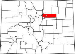
The City of Cherry Hills Village is a home rule municipality located in Arapahoe County, Colorado, United States. The city population was 6,442 at the 2020 United States Census. Cherry Hills Village is a part of the Denver–Aurora–Lakewood, CO Metropolitan Statistical Area and the Front Range Urban Corridor.
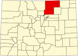
Centennial is a home rule municipality located in Arapahoe County, Colorado, United States. The city population was 108,418 at the 2020 United States Census, making Centennial the 11th most populous municipality in Colorado. Centennial is a part of the Denver–Aurora–Lakewood, CO Metropolitan Statistical Area and the Front Range Urban Corridor.
The United States Office of Management and Budget has defined the 12-county Denver–Aurora, CO Combined Statistical Area comprising the Denver–Aurora–Lakewood, CO Metropolitan Statistical Area, the Boulder, CO Metropolitan Statistical Area, and the Greeley, CO Metropolitan Statistical Area. The United States Census Bureau estimates that the population was 3,214,218 as of July 1, 2012, an increase of +3.99% since the 2010 United States Census, and ranking as the 16th most populous metropolitan combined statistical area and the 17th most populous primary statistical area of the United States. The population estimate for 2020 was 3,652,385.
Henderson, formerly known as Henderson Island, is an unincorporated community and a U.S. Post Office in Adams County, Colorado, United States. Henderson has the ZIP Code 80640. Portions of the Henderson area have been annexed by Commerce City, Brighton, and Thornton.
Lakewood is the home rule municipality that is the most populous municipality in Jefferson County, Colorado, United States. The city population was 155,984 at the 2020 U.S. Census, making Lakewood the fifth most populous city in Colorado and the 167th most populous city in the United States. Lakewood is a suburb of Denver and is a principal city of the Denver–Aurora–Lakewood, CO Metropolitan Statistical Area and a major city of the Front Range Urban Corridor.
27J Schools is a school district headquartered in Brighton, Colorado. The district was established in 1959 when several existing school districts were consolidated. Dr. Chris Fiedler is currently the superintendent.
Colorado's 8th congressional district is a new district in the United States House of Representatives that was apportioned after the 2020 United States census. The first congressional seat to be added to Colorado's congressional delegation since 2001, the 8th district was drawn before the 2022 elections. The district was drawn by the Colorado Independent Redistricting Commission and approved in an 11–1 vote on September 28, 2021, before being approved unanimously by the Colorado Supreme Court on November 1, 2021.