St. Vrain, Colorado

Last updated

St. Vrain
Ftstvrainmarker.jpg
Historical marker at the site of Fort Saint Vrain
USA Colorado location map.svg
Red pog.svg
St. Vrain
Usa edcp location map.svg
Red pog.svg
St. Vrain
Coordinates: 40°16′37″N104°51′10″W / 40.2770°N 104.8527°W / 40.2770; -104.8527
CountryUnited States
State Colorado
County Weld
Nearest town Platteville
Elevation4,764 ft (1,452 m)

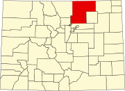
St. Vrain is a ghost town located in Weld County, Colorado, United States. The town was located adjacent to the frontier trading post of Fort Saint Vrain northeast of the confluence of Saint Vrain Creek and the South Platte River. [1] [2]

Contents

Etymology

The town of St. Vrain was named for nearby Fort Saint Vrain, which in turn took its name from Ceran de Hault de Lassus de Saint-Vrain, its founder. The historic Saint Vrain was known as Veranus of Cavaillon, a sixth-century French Christian bishop.

History

Fort Saint Vrain was built in 1837 in the unorganized territory. After the fort closed, the area remained an important meeting point and place of refuge. On May 30, 1854, the area became part of the new Territory of Nebraska.

Gold was discovered upstream along the South Platte River in July 1858, [3] and the area prospered from the prospector traffic along the South Platte River Trail. A post office was established at St. Vrain on January 18, 1859, and later that year, the St. Vrain Claims Club platted the Town of St. Vrain to avoid claim jumping. The extralegal Territory of Jefferson was organized on October 24, 1859, and on November 28, 1859, the Jefferson Territory created 12 counties including St. Vrain's County and designated St. Vrain as the county seat. The Jefferson Territory was superseded by the Territory of Colorado on February 28, 1861, and on November 1, 1861, the Colorado Territory designated St. Vrain as the county seat of the new Weld County.

Gradually, more accessible towns along the trail overtook St. Vrain. In 1868, the Weld County seat was moved to Latham (in present-day Greeley.) In 1875, the St. Vrain post office was moved to Platteville. In 1951, a farmer plowed up most of the area of the town and little evidence of its existence remains.

See also

Notes

Related Research Articles

<span class="mw-page-title-main">Adams County, Colorado</span> County in Colorado, United States

Adams County is a county located in the U.S. state of Colorado. As of the 2020 census, the population was 519,572. The county seat is Brighton. The county is named for Alva Adams, an early Governor of the State of Colorado in 1887–1889. Adams County is part of the Denver–Aurora–Lakewood, CO Metropolitan Statistical Area.

<span class="mw-page-title-main">Weld County, Colorado</span> County in Colorado, United States

Weld County is a county located in the U.S. state of Colorado. As of the 2020 census, the population was 328,981. The county seat is Greeley.

Jefferson County was a county of the extralegal United States Territory of Jefferson that existed from November 28, 1859, until February 28, 1861. Its territory covered a broad swath surrounding the region of the Pike's Peak Gold Rush, and was a functioning democratically elected government until the organization of the Territory of Colorado in 1861. At that time, the successor Jefferson County was permanently created, taking its name from its predecessor and incorporating the heart of its territory.

<span class="mw-page-title-main">Fort Saint Vrain</span> Trading post and fort in Colorado, United States

Fort Saint Vrain was an 1837 fur trading post built by the Bent, St. Vrain Company, and located at the confluence of Saint Vrain Creek and the South Platte River, about 20 miles (32 km) east of the Rocky Mountains in the unorganized territory of the United States, in present-day Weld County, Colorado. A historical marker notes the place where Old Fort St. Vrain once stood, today at the end of Weld County Road 40, located about seven miles north of Fort Vasquez, Colorado. Among those who helped to establish the fort was Ceran St. Vrain, after whom it was named.

Arapahoe County was a county of the extralegal United States Territory of Jefferson that existed from November 28, 1859, until February 28, 1861. The county name was also spelled Arapaho County, Arapahoe County, Arrapahoe County, and Arappahoe County. The county seat was Denver City.

El Paso County was a county of the extralegal United States Territory of Jefferson that existed from November 28, 1859, until February 28, 1861. The county seat was Colorado City.

Fountain County was a county of the extralegal United States Territory of Jefferson that existed from November 28, 1859, until February 28, 1861.

Heele County was a county of the extralegal United States Territory of Jefferson that existed from November 28, 1859, until February 28, 1861. It may also have been known as Steele County.

Jackson County was a county of the extralegal United States Territory of Jefferson that existed from November 28, 1859, until February 28, 1861.

Saratoga County was a county of the extralegal United States Territory of Jefferson that existed from November 28, 1859, until February 28, 1861.

<span class="mw-page-title-main">Index of Colorado-related articles</span>

This is an alphabetical list of articles related to the U.S. State of Colorado.

Fort Jackson was a fur trading post near the present-day town of Ione in Weld County, Colorado that operated from 1837 to 1838. It was one of the four trading posts along the South Platte River area. Nearby posts and competitors were Fort Vasquez, Fort Lupton, and Fort Saint Vrain.

St. Vrain's County was a county of the extralegal United States Territory of Jefferson that existed from November 28, 1859, until February 28, 1861.

References

  1. Pinner, R.S. (2023). "St. Vrain's Fort" . Retrieved March 9, 2023.
  2. "History of Weld County, Colorado: Fort St. Vrain's Memory Kept Alive". Weld County, Colorado. 2021. Retrieved March 9, 2023.
  3. Brown, Robert (1985). The Great Pikes Peak Gold Rush. Caldwell, Idaho: Caxton Press. ISBN   0-87004-412-5.