Prospect Valley, Colorado

Last updated
Prospect Valley, Colorado
Prospect Valley, Colorado.JPG
Prospect Valley, looking west along State Highway 52.
Prospect Valley, Colorado
Interactive map of Prospect Valley, Colorado
Coordinates: 40°04′25″N104°24′54″W / 40.07361°N 104.41500°W / 40.07361; -104.41500
Country Flag of the United States (23px).png  United States
State Flag of Colorado.svg Colorado
County Weld [1]
Elevation
[1]
4,846 ft (1,477 m)
Time zone UTC-7 (MST)
  Summer (DST) UTC-6 (MDT)
ZIP code [2]
80643 (Keenesburg)
GNIS feature ID 180877

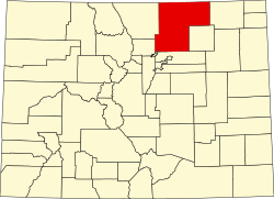
Prospect Valley is a populated place in Weld County, Colorado, United States. The Post Office at Keenesburg serves the Prospect Valley postal address. [2] SH 52 runs east and west through the community.
Geography

Prospect Valley is located at 40°4′25″N104°24′54″W / 40.07361°N 104.41500°W / 40.07361; -104.41500 (40.0735938, -104.4149556), [3] along State Highway 52, 11 miles east of Keenesburg.

References

  1. 1 2 "US Board on Geographic Names". United States Geological Survey. 2007-10-25. Retrieved 2008-01-31.
  2. 1 2 "ZIP Code Lookup" (JavaScript/HTML). United States Postal Service. January 2, 2007. Retrieved January 2, 2007.
  3. "US Gazetteer files: 2010, 2000, and 1990". United States Census Bureau. 2011-02-12. Retrieved 2011-04-23.