Garden City, Colorado

Last updated
Garden City, Colorado
Town of Garden City [1]
Garden City, Colorado.JPG
The Garden City Town Hall.
Weld County Colorado Incorporated and Unincorporated areas Garden City Highlighted 0829185.svg
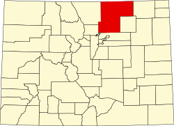
Location of the Town of Garden City in Weld County, Colorado.
Usa edcp location map.svg
Red pog.svg
Garden City
Location of the Town of Garden City in the United States.
Coordinates: 40°23′41″N104°41′19″W / 40.39472°N 104.68861°W / 40.39472; -104.68861 Coordinates: 40°23′41″N104°41′19″W / 40.39472°N 104.68861°W / 40.39472; -104.68861
Country Flag of the United States.svg  United States
State Flag of Colorado.svg  Colorado
County Weld County [1]
Founded1935
Incorporated (town) Initial filingSeptember 14, 1936 [2]
Incorporated (town) Uncontested FilingAugust 2, 1938 [3]
Government
  Type Statutory Town
  MayorLonelle Archuleta
  Mayor Pro TemClarence Krieger
  Trustees
  • Terry Greenwood
  • Fil Archuleta
  • Kelly Stewart
  • Dan Ruhala
  • Abby Clabough
Area
[5]
  Total0.113 sq mi (0.292 km2)
  Land0.113 sq mi (0.292 km2)
  Water0.000 sq mi (0.000 km2)
Elevation
[6]
4,695 ft (1,431 m)
Population
 (2020) [5] [7]
  Total254
  Density2,300/sq mi (870/km2)
   Front Range
5,055,344
Time zone UTC−07:00 (MST)
  Summer (DST) UTC−06:00 (MDT)
ZIP code [8]
80631
Area code 970
FIPS code 08-29185
GNIS feature ID0180637
Website townofgardencity.com

The Town of Garden City is a Statutory Town located in Weld County, Colorado, United States. [1] The town population was 254 at the 2020 United States Census. [5] Garden City is a part of the Greeley, CO Metropolitan Statistical Area and the Front Range Urban Corridor. It is surrounded by the cities of Greeley and Evans, Colorado.

Contents

Geography

Garden City is located at 40°23′41″N104°41′19″W / 40.39472°N 104.68861°W / 40.39472; -104.68861 (40.394766, -104.688634). [9]

At the 2020 United States Census, the town had a total area of 72 acres (0.292 km2), all of it land. [5]

Demographics

Historical population
CensusPop.Note
1940 87
1950 10419.5%
1960 12924.0%
1970 14210.1%
1980 85−40.1%
1990 199134.1%
2000 35779.4%
2010 234−34.5%
2020 2548.5%
U.S. Decennial Census

History

Garden City was founded on August 2, 1938, as a base for saloons and liquor stores serving residents of nearby Greeley, Colorado, which was then a Dry City. Shortly after the repeal of Prohibition in the United States, in June 1935, Greeley voters, by a majority of 356 votes, voted in the local option election to make Greeley "dry" and prohibit the sale, manufacture, transportation, or possession of liquor in the city limits of Greeley. The morning following the election, two Greeley liquor stores were closed by the Chief of Police. The Greeley Tribune published several articles about a Wet Town incorporating Greeley's southern edge.

This area was home to a 10-acre area known at the time as Ray's Cottage Camp, owned by Mrs. A.F. Ray. The law for incorporating a town at the time required a petition to be filled with Weld County of 30 or more residents who were also landowners. Mrs. Ray sold cabins and lots in her Cottage Camp for as little as $100.00 so that Garden City could meet the petition criteria.

According to Tribune articles written at the time, the incorporation of Garden City was challenged and found to be invalid twice but Garden City did finally become incorporated on the third attempt in 1938. According to the incorporation document on file in the Clerk's Office, the incorporation date was August 2, 1938. [3]

Education

Garden City is within Weld County School District Six. As of 2008 residents are zoned to Jackson Elementary School, [10] Brentwood Middle School, [11] and Greeley Central High School. [12] All of the schools assigned to Garden City are in Greeley.

See also

Related Research Articles

<span class="mw-page-title-main">Weld County, Colorado</span> County in Colorado, United States

Weld County is a county located in the U.S. state of Colorado. As of the 2020 census, the population was 328,981. The county seat is Greeley.

<span class="mw-page-title-main">Northglenn, Colorado</span> City in Colorado, United States

The City of Northglenn is a home rule municipality located in Adams and Weld counties, Colorado, United States. Northglenn is a part of the Denver–Aurora–Lakewood, CO Metropolitan Statistical Area. As of the 2010 census the city's population was 35,789. It was built as a master planned community in 1959 by Jordon Perlmutter.

<span class="mw-page-title-main">Aristocrat Ranchettes, Colorado</span> Census Designated Place in Colorado, United States

Aristocrat Ranchettes is an unincorporated community and a census-designated place (CDP) located in and governed by Weld County, Colorado, United States. The population of the Aristocrat Ranchettes CDP was 1,715 at the United States Census 2020. The Fort Lupton post office (Zip Code 80621) serves the area. The CDP is a part of the Greeley, CO Metropolitan Statistical Area.

<span class="mw-page-title-main">Ault, Colorado</span> Town in Colorado, United States

Ault is a statutory town located in Weld County, Colorado, United States. The town population was 1,887 at the 2020 United States Census, a +24.23% increase since the 2010 United States Census. Ault is a part of the Greeley, CO Metropolitan Statistical Area and the Front Range Urban Corridor.

<span class="mw-page-title-main">Dacono, Colorado</span> City in Colorado, United States

Dacono is a home rule municipality located in southwestern Weld County, Colorado, United States. The city population was 6,297 at the 2020 United States Census, an increase of +51.66% since the 2010 United States Census. Dacono is a part of the Greeley, CO Metropolitan Statistical Area and the Front Range Urban Corridor.

<span class="mw-page-title-main">Eaton, Colorado</span> Town in Colorado, United States

The Town of Eaton is a Statutory Town located in Weld County, Colorado, United States. The town population was 5,802 at the 2020 United States Census, a +32.92% increase since the 2010 United States Census. Eaton is a part of the Greeley, CO Metropolitan Statistical Area and the Front Range Urban Corridor.

<span class="mw-page-title-main">Evans, Colorado</span> City in Colorado, United States

The City of Evans is a home rule municipality located in Weld County, Colorado, United States. The city population was 22,165 at the 2020 United States Census, a 19.57% increase since the 2010 United States Census. Evans is a part of the Greeley, CO Metropolitan Statistical Area and the Front Range Urban Corridor.

<span class="mw-page-title-main">Firestone, Colorado</span> Town in Colorado, United States

The Town of Firestone is a Statutory Town in southwestern Weld County, Colorado, United States. The town population was 16,381 at the 2020 United States Census, a 61.44% increase since the 2010 United States Census. Firestone is a part of the Greeley, CO Metropolitan Statistical Area and the Front Range Urban Corridor.

<span class="mw-page-title-main">Fort Lupton, Colorado</span> City in Colorado, United States

The City of Fort Lupton is a Statutory City located in southern Weld County, Colorado, United States. The town population was 7,955 at the 2020 United States Census. Fort Lupton is a part of the Greeley, Colorado Metropolitan Statistical Area and the Front Range Urban Corridor.

<span class="mw-page-title-main">Frederick, Colorado</span> Town in Colorado, United States

The Town of Frederick is a Statutory Town located in Weld County, Colorado, United States. The town population was 14,513 at the 2020 United States Census, a +67.22% increase since the 2010 United States Census. Frederick is a part of the Greeley, CO Metropolitan Statistical Area and the Front Range Urban Corridor.

<span class="mw-page-title-main">Grover, Colorado</span> Town in Colorado, United States

The Town of Grover is a Statutory Town located in Weld County, Colorado, United States. The town population was 157 at the 2020 United States Census, a 14.60% increase since the 2010 United States Census. Grover is a part of the Greeley, CO Metropolitan Statistical Area and the Front Range Urban Corridor.

<span class="mw-page-title-main">Keenesburg, Colorado</span> Town in Colorado, United States

The Town of Keenesburg is a Statutory Town in Weld County, Colorado, United States. The population was 1,250 at the 2020 United States Census.

<span class="mw-page-title-main">Kersey, Colorado</span> Town in Weld County, Colorado, United States

The Town of Kersey is a Statutory Town in Weld County, Colorado, United States. The population was 1,495 at the 2020 United States Census.

<span class="mw-page-title-main">LaSalle, Colorado</span> Town in Colorado, United States

The Town of LaSalle is a Statutory Town in Weld County, Colorado, United States. The town population was 2,359 at the 2020 United States Census.

<span class="mw-page-title-main">Lochbuie, Colorado</span> Town in Colorado, United States

The Town of Lochbuie is a statutory town located in Weld and Adams counties in the U.S. state of Colorado. The town population was 8,088 at the 2020 United States Census.

<span class="mw-page-title-main">Milliken, Colorado</span> Town in Colorado, United States

Milliken is a statutory town in Weld County, Colorado, United States. The town population was 8,386 at the 2020 United States Census.

<span class="mw-page-title-main">Nunn, Colorado</span> Town in Colorado, United States

Nunn is a Statutory Town in Weld County, Colorado, United States. The population was 504 at the 2020 census.

<span class="mw-page-title-main">Pierce, Colorado</span> Town in Colorado, United States

Pierce is a Statutory Town in Weld County, Colorado, United States. The population was 1,097 at the 2020 census. The town is a rural agricultural community located on the Colorado Eastern Plains along U.S. Highway 85 north of Greeley.

<span class="mw-page-title-main">Severance, Colorado</span> Town in Colorado, United States

Severance is a Statutory Town in Weld County, Colorado, United States. The population was 7683 at the 2020 census. The town is located on the Colorado Eastern Plains, northwest of Greeley, a crossroads of county roads.

<span class="mw-page-title-main">Denver–Aurora combined statistical area</span> Place in Colorado, United States

The United States Office of Management and Budget has defined the 12-county Denver–Aurora, CO Combined Statistical Area comprising the Denver–Aurora–Lakewood, CO Metropolitan Statistical Area, the Boulder, CO Metropolitan Statistical Area, and the Greeley, CO Metropolitan Statistical Area. The United States Census Bureau estimates that the population was 3,214,218 as of July 1, 2012, an increase of +3.99% since the 2010 United States Census, and ranking as the 16th most populous metropolitan combined statistical area and the 17th most populous primary statistical area of the United States. The population estimate for 2020 was 3,652,385.

References

  1. 1 2 3 4 5 "Active Colorado Municipalities". Colorado Department of Local Affairs . Retrieved October 18, 2021.
  2. "Colorado Municipal Incorporations". State of Colorado, Department of Personnel & Administration, Colorado State Archives. 2004-12-01. Retrieved 2007-09-02.
  3. 1 2 "Garden City History". Town of Garden City. Retrieved 8 December 2014.}
  4. "Garden City Board of Trustees". Town of Garden City. Retrieved 8 December 2014.}
  5. 1 2 3 4 "Decennial Census P.L. 94-171 Redistricting Data". United States Census Bureau, United States Department of Commerce. August 12, 2021. Retrieved September 28, 2021.
  6. "US Board on Geographic Names". United States Geological Survey. 2007-10-25. Retrieved 2008-01-31.
  7. United States Census Bureau. "Garden City town, Colorado" . Retrieved April 19, 2023.
  8. "ZIP Code Lookup". United States Postal Service. Archived from the original (JavaScript/HTML) on November 4, 2010. Retrieved September 22, 2007.
  9. "US Gazetteer files: 2010, 2000, and 1990". United States Census Bureau. 2011-02-12. Retrieved 2011-04-23.
  10. "District 6 Elementary School Boundaries Archived July 26, 2011, at the Wayback Machine ." Weld County School District Six . Retrieved on December 10, 2008.
  11. "District 6 Middle School Boundaries Archived July 26, 2011, at the Wayback Machine ." Weld County School District Six . Retrieved on December 10, 2008.
  12. "District 6 High School Boundaries Archived July 26, 2011, at the Wayback Machine ." Weld County School District Six . Retrieved on December 10, 2008.