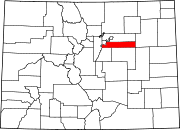
Sheridan, Colorado

Last updated • 3 min readFrom Wikipedia, The Free Encyclopedia

Sheridan, Colorado
City of Sheridan [1]
Sheridan, Colorado.JPG
The Sheridan City Hall.
Arapahoe County Colorado Incorporated and Unincorporated areas Sheridan Highlighted 0869645.svg
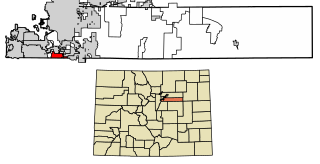
Location of the City of Sheridan in Arapahoe County, Colorado.
Usa edcp location map.svg
Red pog.svg
Sheridan
Location of the City of Sheridan in the United States.
Coordinates: 39°38′56″N105°1′4″W / 39.64889°N 105.01778°W / 39.64889; -105.01778
Country Flag of the United States.svg  United States
State Flag of Colorado.svg  Colorado
County Arapahoe County [2]
City Sheridan [1]
Incorporated April 1890 [3] [4]
Named for Philip Sheridan
Government
  Type Home rule municipality [1]
  MayorTara Beiter-Fluhr [5]
Area
[6]
  Total2.29 sq mi (5.93 km2)
  Land2.22 sq mi (5.76 km2)
  Water0.07 sq mi (0.17 km2)
Elevation
[7]
5,325 ft (1,623 m)
Population
 (2020) [8]
  Total6,105
  Density2,700/sq mi (1,000/km2)
Time zone UTC-7 (MST)
  Summer (DST) UTC-6 (MDT)
ZIP code [9]
80110
Area code(s) Both 303 and 720
FIPS code 08-69645
GNIS feature ID 0204714
Website www.ci.sheridan.co.us

The City of Sheridan is a home rule municipality located in Arapahoe County, Colorado, United States. Sheridan is a part of the Denver–Aurora–Lakewood, CO Metropolitan Statistical Area. The population was 6,105 at the 2020 census. [8]

Contents

History

Sheridan was originally part of the Indian Territory and has always been a small community. The first white settler of what would become Sheridan was John McBroom in the spring of 1859. [10] He homesteaded 160 acres (0.65 km2). The town was initially named Petersburg. McBroom built his first log cabin near Bear Creek which he later abandoned in 1866 when he married Emma J. Bennett. He prospered as a farmer and found a viable market in Denver for his goods. He was joined by his brother, Isaac McBroom, in June 1860, who also homesteaded a little over 160 acres (0.65 km2). The laying out of the town of Sheridan is credited to Isaac. He was also responsible for the name change from Petersburg to Sheridan. Isaac McBroom's cabin can be toured at the Littleton Historical Museum.

Another prominent figure in Sheridan's early history was Peter Magnes. Originally from Sweden, Magnes was a farmer who immigrated to the United States at the age of 26. In 1859, his first daughter was born on the banks of Cherry Creek. He also purchased 160 acres (0.65 km2) of land and built a small log cabin. In 1865 Magnes laid out the town of Petersburg and encouraged Swedish families to immigrate to his town. The town had a railroad, hotel, blacksmith, church, newspaper, post office and, of course, taverns. [11] The state of Colorado was formed in 1876, putting Sheridan within its new boundaries.

Citizens began moving toward incorporation of Sheridan in January 1890. There was some dispute among the petitioners about boundaries, and the final results were filed in February 1890. On April 14, 1890, the town of Sheridan was incorporated. [3]

Sheridan gets its name from U.S. Army General Philip H. Sheridan. [12] General Sheridan established Fort Logan, which was originally known as the "Camp close to Denver". It was on the site known as the Johnson Tract, south of the city, with a water supply, the proximity of the railroad, "available space for a parade ground, artesian well possibilities, the beautiful view and the distance from Denver and its saloons." [3] Because of the military post Sheridan continued to flourish. However, eventually the post was shut down, and it is now a mental health facility that borders Sheridan.

Sheridan has remained a community that continues to influence the surrounding areas, most recently with current redevelopment projects.

Geography

Sheridan is located at 39°38′56″N105°1′4″W / 39.64889°N 105.01778°W / 39.64889; -105.01778 (39.648920, -105.017681). [13]

According to the United States Census Bureau, the city has a total area of 2.3 square miles (5.9 km2), of which 2.2 square miles (5.7 km2) is land and 0.077 square miles (0.2 km2), or 2.91%, is water. [14]

Demographics

Historical population
CensusPop.Note
1900 442
1910 49812.7%
1920 455−8.6%
1930 58729.0%
1940 71221.3%
1950 1,715140.9%
1960 3,559107.5%
1970 4,78734.5%
1980 5,37712.3%
1990 4,976−7.5%
2000 5,60012.5%
2010 5,6641.1%
2020 6,1057.8%
U.S. Decennial Census

Education

The Sheridan School District operates area public schools. [15]

Transportation

Highways

Three highways run through the city of Sheridan:

Mass transit

The Oxford/City of Sheridan light rail station OxfordRTD.JPG
The Oxford/City of Sheridan light rail station

The Regional Transportation District provides bus and light rail service to Sheridan. Light rail service to the city began on July 14, 2000, on the C and D Lines, however C Line operation ended on January 10, 2021. Oxford-City of Sheridan station serves as the sole light rail station within the city. While the station platform is located within the city, the only entrance to the station is in Englewood.

Sheridan was the setting for the short-lived western TV series Legend. When the writers originally chose the name, they were not aware that the town of "Sheridan, Colorado" existed. [16] The show takes place in 1876, some time before Sheridan was incorporated.

See also

Related Research Articles

<span class="mw-page-title-main">Adams County, Colorado</span> County in Colorado, United States

Adams County is a county located in the U.S. state of Colorado. As of the 2020 census, the population was 519,572. The county seat is Brighton, and the largest city is Thornton. The county is named for Alva Adams, an early Governor of the State of Colorado in 1887–1889. Adams County is part of the Denver–Aurora–Lakewood, CO Metropolitan Statistical Area.
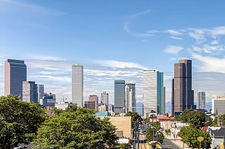
<span class="mw-page-title-main">Denver metropolitan area</span> Metropolitan Statistical Area in Colorado, United States

Denver is the central city of a conurbation region in the U.S. state of Colorado. The conurbation includes one continuous region consisting of the six central counties of Adams, Arapahoe, Broomfield, Denver, Douglas, and Jefferson. The Denver region is part of the Front Range Urban Corridor and its metropolitan planning organization is the Denver Regional Council of Governments.

<span class="mw-page-title-main">Jefferson County, Colorado</span> County in Colorado, United States

Jefferson County is a county located in the U.S. state of Colorado. As of the 2020 census, the population was 582,910, making it the fourth-most populous county in Colorado. The county seat is Golden, and the most populous city is Lakewood.

<span class="mw-page-title-main">Arapahoe County, Colorado</span> County in Colorado, United States

Arapahoe County is a county located in the U.S. state of Colorado. As of the 2020 census, its population was 655,070, making it the third-most populous county in Colorado. The county seat is Littleton, and the most populous city is Aurora. The county was named for the Arapaho Native American tribe, who once lived in the region.

<span class="mw-page-title-main">Bow Mar, Colorado</span> Town in Colorado, United States

Bow Mar is a Statutory Town located in Arapahoe and Jefferson counties, Colorado, United States. The town population was 853 at the 2020 United States Census with 587 residing in Arapahoe County and 266 residing in Jefferson County. Bow Mar is part of the Front Range Urban Corridor. The current mayor of Bow Mar is Bryan Sperry.

<span class="mw-page-title-main">Columbine, Colorado</span> Census-designated place in Jefferson and Arapahoe counties in Colorado, United States

Columbine is a census-designated place (CDP) in and governed by Jefferson and Arapahoe counties in Colorado, United States. The CDP is a part of the Denver metropolitan area. Located primarily in Jefferson County, Columbine lies immediately south of Denver. The population of the Columbine CDP was 25,229 at the 2020 census. The community lies in ZIP code 80123.

<span class="mw-page-title-main">Columbine Valley, Colorado</span> Town in Colorado, United States

The Town of Columbine Valley is a Statutory Town located in western Arapahoe County, Colorado, United States. The town population was 1,502 at the 2020 United States Census, a +19.59% increase since the 2010 United States Census. Columbine Valley is a part of the Denver-Aurora-Lakewood, CO Metropolitan Statistical Area and the Front Range Urban Corridor.
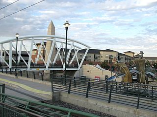
<span class="mw-page-title-main">Englewood, Colorado</span> City in Colorado, United States

The City of Englewood is a home rule municipality located in Arapahoe County, Colorado, United States. The town population was 33,659 at the 2020 United States Census. Englewood is a part of the Denver–Aurora–Lakewood, CO Metropolitan Statistical Area and the Front Range Urban Corridor. Englewood is located immediately south of Denver in the South Platte River Valley.

<span class="mw-page-title-main">Colorado's 6th congressional district</span> U.S. House district for Colorado

Colorado's 6th congressional district is a congressional district in the U.S. state of Colorado. Located in central Colorado, the district encompasses much of the eastern part of the Denver metropolitan area, including all of Aurora, as well as portions of the southern Denver metro area.

<span class="mw-page-title-main">Watkins, Colorado</span> Census Designated Place in Colorado, United States

Watkins is an unincorporated town and a census-designated place (CDP) located in and governed by Arapahoe and Adams counties, Colorado, United States. The CDP is a part of the Denver–Aurora–Lakewood, CO Metropolitan Statistical Area. The census-designated place borders Aurora, and the Watkins post office, which lies within the Aurora city limits, has the ZIP Code 80137. At the United States Census 2020, the population of the Watkins CDP was 682.

<span class="mw-page-title-main">Littleton, Colorado</span> City in Colorado, United States

Littleton is a home rule municipality city located in Arapahoe, Douglas, and Jefferson counties, Colorado, United States. Littleton is the county seat of Arapahoe County and is a part of the Denver–Aurora–Lakewood, CO Metropolitan Statistical Area. The city population was 45,652 at the 2020 United States Census, ranking as the 20th most populous municipality in Colorado.

<span class="mw-page-title-main">Denver–Aurora combined statistical area</span> Combined Statistical Area in Colorado, United States

The United States Office of Management and Budget has defined the 12-county Denver–Aurora, CO Combined Statistical Area comprising the Denver–Aurora–Lakewood, CO Metropolitan Statistical Area, the Boulder, CO Metropolitan Statistical Area, and the Greeley, CO Metropolitan Statistical Area. The United States Census Bureau estimates that the population was 3,214,218 as of July 1, 2012, an increase of +3.99% since the 2010 United States Census, and ranking as the 16th most populous metropolitan combined statistical area and the 17th most populous primary statistical area of the United States. The population estimate for 2020 was 3,652,385.

<span class="mw-page-title-main">North Central Colorado Urban Area</span> Metropolitan area of Colorado

The North Central Colorado Urban Area comprises the four contiguous metropolitan statistical areas in the north central region of the State of Colorado: the Denver–Aurora Metropolitan Statistical Area, the Boulder Metropolitan Statistical Area, the Fort Collins-Loveland Metropolitan Statistical Area, and the Greeley Metropolitan Statistical Area. With the exception of southeastern Elbert County, southeastern Park County, and tiny portions of southern Douglas County, the entire North Central Colorado Urban Area is drained by the South Platte River and its tributaries. The North Central Colorado Urban Area is the central, and the most populous, of the three primary subregions of the Front Range Urban Corridor.

<span class="mw-page-title-main">Aetna Estates, Colorado</span> Census Designated Place in Colorado, United States

Aetna Estates is an unincorporated community and a census-designated place (CDP) located in and governed by Arapahoe County, Colorado, United States. The CDP is a part of the Denver–Aurora–Lakewood, CO Metropolitan Statistical Area. The population of the Aetna Estates CDP was 1,496 at the United States Census 2020. The unincorporated community is surrounded by Aurora and lies in ZIP Code 80018.
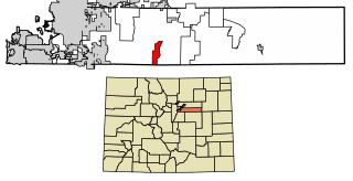
<span class="mw-page-title-main">Brick Center, Colorado</span> Census Designated Place in Colorado, United States

Brick Center is an unincorporated community and a census-designated place (CDP) located in and governed by Arapahoe County, Colorado, United States. The CDP is a part of the Denver–Aurora–Lakewood, CO Metropolitan Statistical Area. The population of the Brick Center CDP was 105 at the United States Census 2020. The Bennett post office serves the area.
<span class="mw-page-title-main">Dove Valley, Colorado</span> Human settlement in Colorado, United States of America

Dove Valley is an unincorporated community and a census-designated place (CDP) located in and governed by Arapahoe County, Colorado, United States. The CDP is a part of the Denver–Aurora–Lakewood, CO Metropolitan Statistical Area. The population of the Dove Valley CDP was 5,640 at the United States Census 2020. The Dove Valley Metropolitan District provides services to the area, which lies in ZIP code 80112.

<span class="mw-page-title-main">Peoria, Colorado</span> Census Designated Place in Colorado, United States

Peoria is an unincorporated community and a census-designated place (CDP) located in and governed by Arapahoe County, Colorado, United States. The CDP is a part of the Denver–Aurora–Lakewood, CO Metropolitan Statistical Area. The population of the Peoria CDP was 153 at the United States Census 2020. The Byers post office serves the area.

<span class="mw-page-title-main">Front Range urban corridor</span> Megaregion in Colorado and Wyoming, United States

The Front Range Urban Corridor is an oblong region of urban population located along the eastern face of the Southern Rocky Mountains, encompassing 18 counties in the US states of Colorado and Wyoming. The corridor derives its name from the Front Range, the mountain range that defines the western boundary of the corridor which serves as a gateway to the Rocky Mountains. The region comprises the northern portion of the Southern Rocky Mountain Front geographic area, which in turn comprises the southern portion of the Rocky Mountain Front geographic area of Canada and the United States. The Front Range Urban Corridor had a population of 5,055,344 at the 2020 Census, an increase of +16.65% since the 2010 Census.

<span class="mw-page-title-main">Four Square Mile, Colorado</span> Census Designated Place in Colorado, United States

Four Square Mile is an unincorporated community and a census-designated place (CDP) located in and governed by Arapahoe County, Colorado, United States. The population was 22,872 at the 2020 census. The CDP is a part of the Denver–Aurora–Lakewood, CO Metropolitan Statistical Area. The CDP is surrounded by Denver on the north, west, and south and by Aurora on the east. The name is derived from the four square miles bounded by Quebec Street, Mississippi Avenue, Havana Street and Yale Avenue. Annexation of the Arapahoe County enclave was contested between Denver and Aurora in the early 1970s, with Denver annexing east from Quebec Street and Aurora west from Havana Street. Denver’s annexations were ultimately stopped by the Poundstone Amendment; Aurora is not similarly limited but made its most recent annexation to Dayton Street in 1984, leaving nearly three of the four square miles unincorporated. The Four Square Mile CDP includes Sullivan, a previous unincorporated community designation. The area lies in ZIP codes 80231 and 80247.

References

  1. 1 2 3 4 "Active Colorado Municipalities". State of Colorado, Colorado Department of Local Affairs, Division of Local Government. Retrieved January 27, 2021.
  2. "Colorado Counties". State of Colorado, Colorado Department of Local Affairs, Division of Local Government. Retrieved January 27, 2021.
  3. 1 2 3 Bonita Hutchenson (2002). "A History of Sheridan, Colorado". Sheridan Historical Society. Retrieved February 25, 2007.
  4. "Colorado Municipal Incorporations". State of Colorado, Department of Personnel & Administration, Colorado State Archives. December 1, 2004. Retrieved September 2, 2007.
  5. "Member Terms & Ward Maps". City of Sheridan, Colorado . Retrieved January 24, 2018.
  6. "2019 U.S. Gazetteer Files". United States Census Bureau. Retrieved July 1, 2020.
  7. "US Board on Geographic Names". United States Geological Survey. October 25, 2007. Retrieved January 31, 2008.
  8. 1 2 United States Census Bureau. "Sheridan city; Colorado" . Retrieved April 29, 2023.
  9. "ZIP Code Lookup" (JavaScript/HTML). United States Postal Service . Retrieved January 1, 2008.
  10. Hulse, D. F. (2004). "Littleton History: Biographies, McBroom Family". City of Littleton . Retrieved February 25, 2007.
  11. Dorward, R. (2004). "Littleton History: Biographies, Peter Magnes". City of Littleton . Retrieved February 25, 2007.
  12. "General Philip Henry Sheridan". Sheridan Historical Society. 2001. Retrieved February 25, 2007.
  13. "US Gazetteer files: 2010, 2000, and 1990". United States Census Bureau. February 12, 2011. Retrieved April 23, 2011.
  14. "Geographic Identifiers: 2010 Demographic Profile Data (G001): Sheridan city, Colorado". U.S. Census Bureau, American Factfinder. Archived from the original on February 12, 2020. Retrieved May 6, 2013.
  15. "2020 CENSUS - SCHOOL DISTRICT REFERENCE MAP: Arapahoe County, CO" (PDF). U.S. Census Bureau. p. 1 (PDF p. 2/6). Retrieved November 1, 2024. - Text list.
  16. Source: E-mail from Bill Dial, co-creator, dated 1996