Dove Valley, Colorado

Last updated
Dove Valley, Colorado
Dove Valley, Colorado.JPG
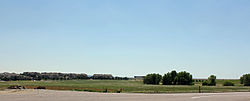
A view of Dove Valley looking southeast from Potomac Street near the courthouse.
Arapahoe County Colorado Incorporated and Unincorporated areas Dove Valley Highlighted 0821330.svg
Location of the Dove Valley CDP in Arapahoe County, Colorado.
Usa edcp relief location map.png
Red pog.svg
Dove Valley
Location of the Dove Valley CDP, Colorado.
USA Colorado relief location map.svg
Red pog.svg
Dove Valley
Dove Valley (Colorado)
Coordinates: 39°34′40″N104°49′46″W / 39.5777°N 104.8294°W / 39.5777; -104.8294 (Dove Valley, Colorado) [1]
Country United States
State Colorado
County Arapahoe [2]
Government
  Type unincorporated community
  Body Arapahoe County [2]
Area
[3]
  Total
3.578 sq mi (9.267 km2)
  Land3.578 sq mi (9.267 km2)
  Water0 sq mi (0.000 km2)
Elevation
[1]
5,735 ft (1,748 m)
Population
 (2020) [4]
  Total
5,640
  Density1,580/sq mi (609/km2)
Time zone UTC−07:00 (MST)
  Summer (DST) UTC−06:00 (MDT)
ZIP code [5]
Centennial 80112
Area codes 303/720/983
GNIS place ID 2631649
GNIS CDP ID 2629985
FIPS code 08-21330

Dove Valley is an unincorporated community and a census-designated place (CDP) located in and governed by Arapahoe County, Colorado, United States. The population of the Dove Valley CDP was 5,640 at the United States Census 2020. [4] The CDP is a part of the Denver-Aurora-Centennial, CO Metropolitan Statistical Area and the Front Range Urban Corridor. The Dove Valley Metropolitan District provides services to the area, which lies in ZIP code 80112. [5]

Contents

History

The unincorporated community has never had its own post office. [6] The Centennial, Colorado, post office (ZIP code 80112) serves the area. [5]

Geography

The Dove Valley CDP has an area of 2,290 acres (9.267 km2), all land. [3]

Demographics

The United States Census Bureau initially defined the Dove Valley CDP for the United States Census 2010.

Dove Valley CDP, Colorado
YearPop.±%
2010 5,243    
2020 5,640+7.6%
Source: United States Census Bureau

Economy

Centennial Airport Centennial Airport.JPG
Centennial Airport

The headquarters and training camp of the Denver Broncos, as well as Centennial Airport, are located in Dove Valley. Air Methods and Key Lime Air have their corporate headquarters in the CDP as well. [7] [8] The indoor tennis facility the Randy Ross Tennis Center is also right in the heart of Dove Valley.

Air Methods's headquarters were previously in the CDP, [9] on the airport property; it moved to Greenwood Village, Colorado in 2017. [10]

Education

Dove Valley is in Cherry Creek School District 5. [11]

School zones are as follows: [12] Much of Dove Valley is zoned to Red Hawk Ridge Elementary School, Liberty Middle School, and Grandview High School. Some western portions are zoned to Walnut Hills Elementary School, Campus Middle School, and Cherry Creek High School. [13]

See also

References

  1. 1 2 "Dove Valley, Colorado". Geographic Names Information System . United States Geological Survey, United States Department of the Interior . Retrieved October 16, 2025.
  2. 1 2 "Colorado Counties". Colorado Department of Local Affairs . Retrieved October 16, 2025.
  3. 1 2 "State of Colorado Census Designated Places - BAS20 - Data as of January 1, 2020". United States Census Bureau . Retrieved December 12, 2020.
  4. 1 2 United States Census Bureau. "Dove Valley CDP, Colorado" . Retrieved April 19, 2023.
  5. 1 2 3 "ZIP Code Lookup". United States Postal Service . Retrieved October 16, 2025.
  6. Bauer, William H.; Ozment, James L.; Willard, John H. (1990). Colorado Post Offices 1859–1989. Golden, Colorado: Colorado Railroad Historical Foundation. ISBN   0-918654-42-4.
  7. "About." Key Lime Air. Retrieved on April 2, 2015. "Based at Centennial Airport in Englewood Colorado, Key Lime Air is strategically positioned to be able to offer convenient service to either the West coast, Central or East coast of the United States." and "13252 E. Control Tower Rd. Englewood, CO 80112"
  8. "2010 CENSUS - CENSUS BLOCK MAP: Dove Valley CDP, CO" (Archive). U.S. Census Bureau. Retrieved on April 1, 2015.
  9. The postal designation of “Englewood”, a city some seven miles west, appears in the company’s mailing address and is referenced as its headquarters location: "Contact Us." Air Methods. Retrieved on April 2, 2015. "Corporate Headquarters 7211 S. Peoria Englewood, CO 80112" and "Air Methods’ headquarters are located on the north side of Centennial Airport in Englewood – West side of Peoria Street, just south of Easter Avenue."
  10. Miler, Ben (2017-05-25). "After sale is complete, Air Methods is moving its headquarters". Denver Business Journal . Retrieved 2018-09-14.
  11. "2020 CENSUS - SCHOOL DISTRICT REFERENCE MAP: Arapahoe County, CO" (PDF). U.S. Census Bureau. pp. 1-2 (PDF pp. 2-3/6). Retrieved 2024-11-01. - Text list.
  12. "2020 CENSUS - CENSUS BLOCK MAP: Dove Valley CDP, CO" (PDF). U.S. Census Bureau . Retrieved 2024-11-02.
  13. "District Map". Cherry Creek School District . Retrieved 2024-11-02. - PDF