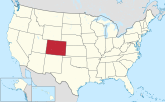
The U.S. State of Colorado has many adopted symbols and emblems. Most of these symbols and emblems were adopted by acts of the Legislative Assembly of the Territory of Colorado, and after statehood, the General Assembly of the State of Colorado. [1] A few of these symbols were adopted by executive action of the Governor. Federal agencies designated some of these symbols in honor of the state. Each entry explains the manner and date of adoption.
The first insignia of Colorado, the territorial motto: Nil sine numine , [2] was adopted by the First Session of the Territorial Legislature on November 6, 1861. The seal and coat of arms of the Territory of Colorado were specified by the First Session of the Territorial Legislature but not created until November 11, 1861. [3]
Type | Symbol | Image | Adopted |
---|---|---|---|
Coat of arms | Coat of Arms of the State of Colorado [lower-alpha 1] | November 11, 1861 March 15, 1877 CRS 24-80-901 [1] | |
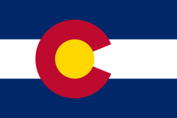
Flag | Flag of the State of Colorado [4] | June 5, 1911 SB 118-1911 February 28, 1928 SB 152-1929 March 31, 1964 | |
Logo | Colorado state government logo [5] | See Colorado state logo. | March 26, 2019 [5] |
Motto | Nil sine numine [2] (Latin: Nothing without providence) | NIL SINE NVMINE | November 6, 1861 November 6, 1876 CRS 24-80-901 [1] |
Nickname | Centennial State [6] [lower-alpha 2] | The Centennial State | Statehood on August 1, 1876 [7] |
Seal | Great Seal of the State of Colorado [3] | November 11, 1861 March 15, 1877 CRS 24-80-901 [1] | |
Slogan | Colorful Colorado [6] | 1950 unofficial |
Type | Symbol | Image | Adopted |
---|---|---|---|
Fossil | Stegosaurus [19] | April 28, 1982 Executive Order | |
Gemstone | Aquamarine [20] | April 30, 1971 HB 1104-1971 CRS 24-80-912 [1] | |
Mineral | Rhodochrosite [21] | April 17, 2002 CRS 24-80-912.5 [1] | |
Rock | Yule Marble [22] | March 9, 2004 HB04-1023 CRS 24-80-912.7 [1] | |
Soil | Seitz soil [23] | United States Department of Agriculture |
Type | Symbol | Image | Adopted |
---|---|---|---|
Folk dance | Square dance [24] | March 16, 1992 HB 1058-1992 CRS 24-80-909.5 [1] | |
Songs | "Where the Columbines Grow" [25] | May 8, 1915 SB 308-1915 CRS 24-80-909 [1] | |
"Rocky Mountain High" [25] | March 12, 2007 SJR07-023 CRS 24-80-909 [1] | ||
Summer sport | Pack burro racing [26] | May 8, 2012 HJR12-1021 | |
Tartan | Colorado state tartan [27] | March 3, 1997 HJR97-1016 | |
Winter sport | Skiing and snowboarding [28] | April 8, 2008 |
Type | Symbol | Image | Adopted |
---|---|---|---|
State highways | Colorado state highway route marker [29] | 1967 Colorado Highway Commission | |
Scenic byways | Colorado Scenic and Historic Byway route marker [29] | 1989 Colorado Scenic and Historic Byways Commission |
Type | Symbol | Image | Adopted |
---|---|---|---|
License plate | Colorado passenger automobile registration plate [30] | 1913 2018 Colorado Department of Revenue |
Type | Symbol | Image | Commissioned |
---|---|---|---|
Screw frigate | USS Colorado (1856) [31] [lower-alpha 4] | March 13, 1858 to June 8, 1875 United States Navy | |
Armored cruiser | USS Colorado (ACR-7) [36] | January 19, 1905 renamed USS Pueblo [lower-alpha 5] November 9, 1916 to September 28, 1927 United States Navy | |
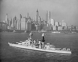
Battleship | USS Colorado (BB-45) [37] | August 30, 1923 to January 1947 United States Navy | |
Nuclear submarine | USS Colorado (SSN-788) [38] | Commissioned March 17, 2018 United States Navy |
Type | Symbol | Image | Issued |
---|---|---|---|
U.S. postage stamp | Colorado state centennial stamp [39] | May 21, 1977 [lower-alpha 6] United States Postal Service |
Type | Symbol | Image | Released |
---|---|---|---|
U.S. quarter dollar | Colorado State Quarter [40] | June 14, 2006 United States Mint |
Colorado is a landlocked state in the Mountain West subregion of the Western United States. Colorado borders Wyoming to the north, Nebraska to the northeast, Kansas to the east, Oklahoma to the southeast, New Mexico to the south, Utah to the west, and meets Arizona to the southwest at the Four Corners. Colorado is noted for its landscape of mountains, forests, high plains, mesas, canyons, plateaus, rivers, and desert lands. Colorado is one of the Mountain States and is often considered to be part of the southwestern United States. The high plains of Colorado may be considered a part of the midwestern United States. It encompasses most of the Southern Rocky Mountains, as well as the northeastern portion of the Colorado Plateau and the western edge of the Great Plains. Colorado is the eighth most extensive and 21st most populous U.S. state. The United States Census Bureau estimated the population of Colorado at 5,877,610 as of July 1, 2023, a 1.80% increase since the 2020 United States census.
The Colorado River is one of the principal rivers in the Southwestern United States and in northern Mexico. The 1,450-mile-long (2,330 km) river, the 5th longest in the United States, drains an expansive, arid watershed that encompasses parts of seven U.S. states and two Mexican states. The name Colorado derives from the Spanish language for "colored reddish" due to its heavy silt load. Starting in the central Rocky Mountains of Colorado, it flows generally southwest across the Colorado Plateau and through the Grand Canyon before reaching Lake Mead on the Arizona–Nevada border, where it turns south toward the international border. After entering Mexico, the Colorado approaches the mostly dry Colorado River Delta at the tip of the Gulf of California between Baja California and Sonora.
The region that is today the U.S. State of Colorado has been inhabited by Native Americans and their Paleoamerican ancestors for at least 13,500 years and possibly more than 37,000 years. The eastern edge of the Rocky Mountains was a major migration route that was important to the spread of early peoples throughout the Americas. The Lindenmeier site in Larimer County contains artifacts dating from approximately 8720 BCE.
The flags of the U.S. states, territories, and the District of Columbia exhibit a variety of regional influences and local histories, as well as different styles and design principles. Modern U.S. state flags date from the turn of the 20th century, when states considered distinctive symbols for the 1893 World's Columbian Exposition in Chicago, Illinois. Most U.S. state flags were designed and adopted between 1893 and World War I.
The Territory of Utah was an organized incorporated territory of the United States that existed from September 9, 1850, until January 4, 1896, when the final extent of the territory was admitted to the Union as the State of Utah, the 45th state. At its creation, the Territory of Utah included all of the present-day State of Utah, most of the present-day state of Nevada save for Southern Nevada, much of present-day western Colorado, and the extreme southwest corner of present-day Wyoming.
The Great Seal of the State of Colorado is an adaptation of the territorial seal which was adopted by the First Territorial Assembly on November 6, 1861. The only changes made to the territorial seal design being the substitution of the words "State of Colorado" and the figures "1876" for the corresponding inscriptions on the territorial seal. The first General Assembly of the State of Colorado approved the adoption of the state seal on March 15, 1877. The Colorado Secretary of State alone is authorized to affix the Great Seal of Colorado to any document whatsoever.
There are more than 1,500 properties and historic districts in the U.S. State of Colorado listed on the National Register of Historic Places. They are distributed over 63 of Colorado's 64 counties; only the City and County of Broomfield currently has none.
The North Central Colorado Urban Area comprises the four contiguous metropolitan statistical areas in the north central region of the State of Colorado: the Denver–Aurora Metropolitan Statistical Area, the Boulder Metropolitan Statistical Area, the Fort Collins-Loveland Metropolitan Statistical Area, and the Greeley Metropolitan Statistical Area. With the exception of southeastern Elbert County, southeastern Park County, and tiny portions of southern Douglas County, the entire North Central Colorado Urban Area is drained by the South Platte River and its tributaries. The North Central Colorado Urban Area is the central, and the most populous, of the three primary subregions of the Front Range Urban Corridor.
This is an alphabetical list of articles related to the U.S. State of Colorado.
The following outline is provided as an overview of and topical guide to the U.S. state of Colorado:
This timeline is a chronology of significant events in the history of the U.S. State of Colorado and the historical area now occupied by the state.
The coats of arms of the U.S. states are coats of arms, that are an official symbol of the state, alongside their seal. Eighteen states have officially adopted coats of arms. The former independent Republic of Texas and Kingdom of Hawaii each had a separate national coat of arms, which are no longer used.