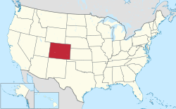

This is a list of rivers and streams in the U.S. State of Colorado .


This is a list of rivers and streams in the U.S. State of Colorado .
The following alphabetical list includes many important streams that flow through the State of Colorado, including all 158 named rivers. Where available, the total extent of the stream's drainage basin [1] is shown after the name. The names of the 17 Colorado rivers with a drainage basin of more than 10,000 square kilometers (3,900 sq mi), about three times the area of Rhode Island, are shown in bold.
Of the 158 named rivers that flow through the State of Colorado, all but the Green River [c] and Cimarron River [a] have their headwaters in that state.
As of February 1, 2008, the U.S. Board on Geographic Names had identified 5,564 natural streams in the State of Colorado. Of this number, 147 larger streams (2.6%) were named river and 11 (0.2%) were named rio. The vast majority of the Colorado streams (5082 or 91.3%) were named creek . Of the remaining Colorado streams, 122 (2.2%) were named arroyo , 60 (1.1%) were named wash , 44 (0.8%) were named fork, 18 (0.3%) were named branch, 17 (0.3%) were named brook, 17 (0.3%) were named run, 15 (0.3%) were named rito, 10 (0.2%) were named slough , but not a single stream was named stream . Perhaps the most unusual river name in Colorado belongs to the West Fork East Fork Williams Fork located in Garfield County.
Many streams in Colorado share a name with another stream in the same state. In addition to the Canadian River that is the largest tributary of the Arkansas River, there is also a Canadian River that is a tributary of the North Platte River. In addition to the Cimarron River that is another major tributary of the Arkansas River, there is also a Cimarron River that is a tributary of the Gunnison River. There is a Fall River that is a tributary of the Big Thompson River as well as a Fall River that is a tributary of Clear Creek.
There are 72 streams in the State of Colorado that are named Willow Creek, 71 streams named Spring Creek, 53 streams named Cottonwood Creek, 49 streams named Bear Creek, 49 streams named Beaver Creek, 48 streams named Dry Creek, 33 streams named Rock Creek, 33 streams named Sand Creek, and 32 streams named Mill Creek. The Arkansas River and the Colorado River flow through Colorado, as do a Florida River, an Idaho Creek, an Illinois River, an Indiana Creek, a Maryland Creek, a Michigan River, a Minnesota Creek, six Missouri Creeks, a Montana Creek, two New York Creeks, two Ohio Creeks, two Pennsylvania Creeks, two Tennessee Creeks, seven Texas Creeks, and a Virginia Creek.
The following tributary chart shows many important streams that flow through the State of Colorado including all 158 named rivers. The chart is arranged by tributary and area of the drainage basin. [1] The names of the 17 Colorado rivers with a drainage basin of more than 10,000 square kilometers (3,900 sq mi) are shown in bold. Oceans and streams outside of Colorado are shown in italics.
Pacific Ocean
Atlantic Ocean