Roaring Fork River is a tributary of the Colorado River, approximately 70 miles (110 km) long, in west central Colorado in the United States. The river drains a populated and economically vital area of the Colorado Western Slope called the Roaring Fork Valley or Roaring Fork Watershed, which includes the resort city of Aspen and the resorts of Aspen/Snowmass.

The Sawatch Range is a high and extensive mountain range in central Colorado which includes eight of the twenty highest peaks in the Rocky Mountains, including Mount Elbert, at 14,440 feet (4,401 m) elevation, the highest peak in the Rockies.

The Roaring Fork Valley is a geographical region in western Colorado in the United States. The Roaring Fork Valley is one of the most affluent regions in Colorado and the U.S. as well as one of the most populous and economically vital areas of the Colorado Western Slope. The Valley is defined by the valley of the Roaring Fork River and its tributaries, including the Crystal and Fryingpan River. It includes the communities of Aspen, Snowmass Village, Basalt, Carbondale, and Glenwood Springs. Mount Sopris and the Roaring Fork River serve as symbols of the Roaring Fork Valley.

The Collegiate Peaks Wilderness is a 168,000-acre (680 km2) area located in central Colorado between Leadville and Buena Vista to the east and Aspen to the west and Crested Butte to the southwest. Most of the area is in the San Isabel and Gunnison National Forests, with a smaller area in the White River National Forest southeast of Aspen. Most of the area is in northwest Chaffee County with smaller portions in Gunnison, Pitkin, and Lake counties.
KAJX and KCJX(88.9 FM) are radio stations simulcasting a Variety format. The stations are licensed to Roaring Fork Public Radio, Inc. in Aspen, Colorado (KAJX) and Carbondale, Colorado (KCJX). Located in Aspen, the non-commercial station is governed by a board of directors. It serves Roaring Fork, Crystal, Fryingpan, and Eagle River valleys in the state of Colorado.
Roaring Fork Conservancy is the watershed conservation organization for the Roaring Fork Watershed in west central Colorado, which operates to raise public awareness of the protection of the Roaring Fork Watershed. Roaring Fork Conservancy programs include water quality monitoring, river and water research, land and water conservation, river stewardship, and river and water education for students and adults. Roaring Fork Conservancy works collaboratively with local citizens, governments, agencies and partner organizations to protect rivers and streams of the Roaring Fork Watershed.

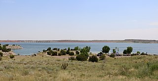
Lake Pueblo State Park is a state park located in Pueblo County, Colorado. It includes 60 miles (97 km) of shoreline and 10,000 acres (40 km2) of land. Activities it offers include two full-service marinas, recreational fishing, hiking, camping and swimming at a special swim beach.

The Hunter–Fryingpan Wilderness is a U.S. Wilderness Area located in White River National Forest east of Aspen, Colorado. The 82,026-acre (331.95 km2) wilderness established in 1978 includes the headwaters of Hunter Creek and the Fryingpan River plus many peaks of the Williams Mountains. It borders on the Mount Massive Wilderness to the east, separated only by the continental divide. There are 50 miles (80 km) of trails in the wilderness area.

Ruedi Reservoir is a reservoir on the West Slope of the Continental Divide on the Fryingpan River. It sits about 15 miles (24 km) upstream of the town of Basalt, Colorado, near Aspen. The reservoir is located within the White River National Forest, and straddles the county line between Pitkin County and Eagle County.

Water in Colorado is of significant importance, as the American state of Colorado is the 7th-driest state in America. As result, water rights generate conflict, with many water lawyers in the state.

Sugar Loaf Dam is a dam in Lake County of mid-Colorado, 4 miles (6.4 km) west of Leadville.

Independence Lake is an alpine lake in Pitkin County, Colorado, United States, located high in the Sawatch Range in the Hunter-Fryingpan Wilderness of White River National Forest. It is the source of the Roaring Fork River and is located south and over a pass from Lost Man Lake and north of Twining Peak. The lake is accessible via a trail from State Highway 82 west of Independence Pass.
North Fork Fryingpan River is a tributary of the Fryingpan River in Pitkin and Eagle counties in Colorado. The stream flows west from a source in the White River National Forest through Savage Lakes to a confluence with the Fryingpan River.

Bill Williams Peak is in White River National Forest in the U.S. state of Colorado. Also known as the Williams Mountains Highpoint as it is the highest peak in the Williams Mountains, an offshoot of the Sawatch Range. The peak is within the Hunter–Fryingpan Wilderness.


