
The San Juan Mountains is a high and rugged mountain range in the Rocky Mountains in southwestern Colorado and northwestern New Mexico. The area is highly mineralized and figured in the gold and silver mining industry of early Colorado. Major towns, all old mining camps, include Creede, Lake City, Silverton, Ouray, and Telluride. Large scale mining has ended in the region, although independent prospectors still work claims throughout the range. The last large scale mines were the Sunnyside Mine near Silverton, which operated until late in the 20th century and the Idarado Mine on Red Mountain Pass that closed down in the 1970s. Famous old San Juan mines include the Camp Bird and Smuggler Union mines, both located between Telluride and Ouray.

Dolores County is a county located in the U.S. state of Colorado. As of the 2020 census, the population was 2,326. The county seat is Dove Creek.

Archuleta County is a county located in the U.S. state of Colorado. As of the 2020 census, the population was 13,359. The county seat and the only incorporated municipality in the county is Pagosa Springs.
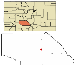
Saguache is a Statutory Town in and the county seat of Saguache County, Colorado, United States. The population was 539 at the United States Census 2020.

The Colorado River is an approximately 862-mile (1,387 km) long river in the U.S. state of Texas. It is the 11th longest river in the United States and the longest river with both its source and its mouth within Texas.

Clear Creek is a tributary of the South Platte River, approximately 66 miles (106 km) long, in north central Colorado in the United States. The creek flows through Clear Creek Canyon in the Rocky Mountains directly west of Denver, descending through a long gorge to emerge at the town of Golden, finally ending in the Colorado Eastern Plains where it joins the South Platte. Clear Creek is unusual in that it is a stream named "creek" fed by a stream named "river"; typically "rivers" are fed by "creeks", and are larger bodies of water, although the nomenclature is ambiguous and there is no clear system. Fall River empties into Clear Creek along I-70 west of Idaho Springs, Colorado.

St. Vrain Creek is a tributary of the South Platte River, approximately 32.2 miles (51.8 km) long, in north central Colorado in the United States. It drains part of the foothills north of Boulder and the Colorado Piedmont area in the vicinity of Longmont.
The Powderhorn Wilderness is a 62,050-acre (251.1 km2) wilderness area in Hinsdale and Gunnison counties, Colorado, United States, located 5 miles (8.0 km) northeast of Lake City.

The Old Spanish Trail is a historical trade route that connected the northern New Mexico settlements of Santa Fe, New Mexico with those of Los Angeles, California and southern California. Approximately 700 mi (1,100 km) long, the trail ran through areas of high mountains, arid deserts, and deep canyons. It is considered one of the most arduous of all trade routes ever established in the United States. Explored, in part, by Spanish explorers as early as the late 16th century, the trail was extensively used by traders with pack trains from about 1830 until the mid-1850s.

The Midland Trail, also called the Roosevelt Midland Trail, was a national auto trail spanning the United States from Washington, D.C., west to Los Angeles, California and San Francisco, California. First road signed in 1913, it was one of the first, if not the first, marked transcontinental auto trails in America.

Interstate 70 (I-70) is a mainline route of the Interstate Highway System in the United States connecting Utah and Maryland. The Utah section runs east–west for approximately 232 miles (373 km) across the central part of the state. Richfield is the largest Utah city served by the freeway, which does not serve or connect any urban areas in the state. The freeway was built as part of a system of highways connecting Los Angeles and the Northeastern United States. I-70 was the second attempt to connect southern California to the east coast of the United States via central Utah, the first being a failed attempt to construct a transcontinental railroad. Parts of that effort were reused in the laying out of the route of I-70.

State Highway 141 (SH 141) is a 162.297 mi (261.192 km) long state highway in far western Colorado, United States. Though nominally oriented north–south, SH 141 winds around a considerable amount due to the rugged terrain and ultimately forms a giant S shape. SH 141's southern terminus is at U.S. Route 491 (US 491) near Dove Creek, and the northern terminus is at Interstate 70 Business in Grand Junction. SH 141 is the longest three-digit state highway in Colorado.
Cochetopa Pass is a mountain pass in the Rocky Mountains of south-central Colorado. It lies on the Continental Divide between the city of Gunnison to the northwest and the town of Saguache to the southeast. It also lies on the boundary between the Gunnison and Rio Grande National Forests. Its name is taken from the Cochetopa Hills that it lies within, Cochetopa being the Ute Indian word for "pass of the buffalo". The original pass is traversed by Saguache County Road NN14, a maintained gravel road. Another crossing, sometimes called North Cochetopa Pass and more often simply North Pass, is located nearby on State Highway 114, which is paved and reaches a slightly higher elevation.

The Cochetopa Hills are a ridge of uplands on the Continental Divide in Saguache County, southern Colorado, United States.

The Piedra River is a river in the U.S. state of Colorado. It drains parts of Archuleta, Hinsdale, and Mineral counties along a mainstem length of about 40 miles (64 km). The river flows through a series of isolated box canyons, emptying into the San Juan River at Navajo Lake. Its name stems from the Spanish word, piedra, meaning rock.

State Route 162 (SR-162) is a state highway located in San Juan County, Utah, United States. It begins at US-191 east of Bluff. It then follows the former alignment of SR-163 to Montezuma Creek. There, it intersects UT-262 at its southern terminus. Afterwards, it follows SR-262's former alignment past Aneth to the Colorado state line. Colorado State Highway 41 takes over in the Centennial State, ending at a junction with US-160 6 miles east of the Four Corners Monument.

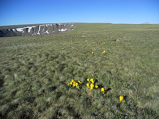
The La Garita Wilderness is a U.S. Wilderness Area located in the La Garita Mountains of southern Colorado. The 129,626-acre (524.58 km2) wilderness established in 1964 in Gunnison and Rio Grande National Forests includes segments of the Colorado Trail and the Continental Divide Trail. At 14,014 feet (4,271 m), San Luis Peak is the highest point in the wilderness area.

Tomichi Creek is a 71.8-mile-long (115.6 km) tributary of the Gunnison River in Gunnison County, Colorado, United States.
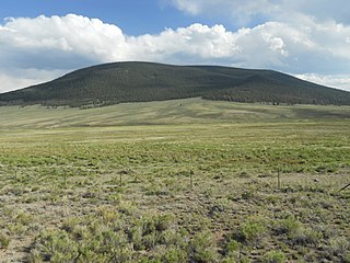
Cochetopa Dome is a mountain in the San Juan Mountains, in Saguache County, Colorado. The 11,138 ft (3,395 m) mountain is located in the Gunnison National Forest. With a prominence of 1,752 feet (534 m), Cochetopa Dome is the 110th most prominent summit in the state of Colorado.
