Parlin, Colorado | |
|---|---|
 Entering Parlin | |
 Parlin  Parlin | |
| Coordinates: 38°30′10″N106°43′42″W / 38.50278°N 106.72833°W | |
| Country | |
| State | |
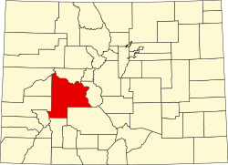
| County | Gunnison County [1] |
| Elevation | 7,933 ft (2,418 m) |
| Time zone | UTC-7 (MST) |
| • Summer (DST) | UTC-6 (MDT) |
| ZIP code [2] | 81239 |
| GNIS feature ID | 189019 [1] |
Parlin is an unincorporated community and a U.S. Post Office in Gunnison County, Colorado, United States. The Parlin Post Office has the ZIP Code 81239. [2]