Almont, Colorado | |
|---|---|
 The business section of Almont | |
 Almont Location of Almont, Colorado.  Almont Almont (Colorado) | |
| Coordinates: 38°39′53″N106°50′46″W / 38.6647°N 106.8462°W [1] | |
| Country | United States |
| State | Colorado |
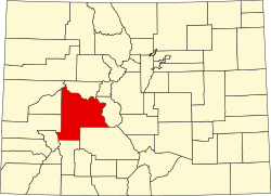
| County | Gunnison [2] |
| Platted | 1881 [3] |
| Government | |
| • Type | unincorporated community |
| • Body | Gunnison County [2] |
| Elevation | 8,022 ft (2,445 m) |
| Time zone | UTC−07:00 (MST) |
| • Summer (DST) | UTC−06:00 (MDT) |
| ZIP Code | 81210 [4] |
| GNIS pop ID | 188934 |
Almont is an unincorporated community and U.S. Post Office in Gunnison County, Colorado, United States. The ZIP Code of the Almont Post Office is 81210. [4]