Mount Crested Butte, Colorado

Last updated

Mt. Crested Butte, Colorado
Welcome to Mt Crested Butte sign.JPG
Welcome to Mt. Crested Butte, elevation 9,375 feet (2,858 m)
Gunnison County Colorado Incorporated and Unincorporated areas Mount Crested Butte Highlighted 0852570.svg
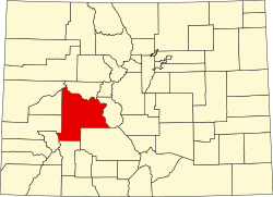
Location of Mount Crested Butte in Gunnison County, Colorado.
Coordinates: 38°54′30″N106°57′38″W / 38.90833°N 106.96056°W / 38.90833; -106.96056
Country Flag of the United States (23px).png  United States
State Flag of Colorado.svg  Colorado
County [1] Gunnison
Incorporated (town) 1973 [2]
Government
  Type Home rule municipality [1]
Area
[3]
  Total
2.05 sq mi (5.30 km2)
  Land2.05 sq mi (5.30 km2)
  Water0.00 sq mi (0.00 km2)
Elevation
[4]
9,738 ft (2,968 m)
Population
 (2020) [5]
  Total
941
  Density460/sq mi (180/km2)
Time zone UTC-7 (MST)
  Summer (DST) UTC-6 (MDT)
ZIP code [6]
Area code 970
FIPS code 08-52570
GNIS feature ID 2413018 [4]
Website mtcb.colorado.gov

Mt. Crested Butte is a home rule municipality in Gunnison County, Colorado, United States. Mount Crested Butte is the home of the Crested Butte Mountain Resort. The population was 941 at the 2020 census. [5] ZIP code 81225 serves post office boxes for Mount Crested Butte and for neighboring Crested Butte; mail must be addressed to Crested Butte. [6]

Contents

Geography

Mt. Crested Butte Town of Mt. Crested Butte.JPG
Mt. Crested Butte

Mt. Crested Butte is in north-central Gunnison County in the Gunnison National Forest, 2 miles (3 km) north of the town of Crested Butte on Gothic Road. The town sits at the northern and western base of Crested Butte, a 12,162-foot (3,707 m) summit that is the site of the Crested Butte Mountain Resort.

According to the United States Census Bureau, the town of Mt. Crested Butte covers a total area of 2.22 square miles (5.75 km2), all of it land. [7]

Demographics

Historical population
CensusPop.Note
1980 272
1990 264−2.9%
2000 707167.8%
2010 80113.3%
2020 94117.5%
U.S. Decennial Census

See also

References

  1. 1 2 "Active Colorado Municipalities". State of Colorado, Department of Local Affairs. Archived from the original on December 12, 2009. Retrieved September 1, 2007.
  2. "Colorado Municipal Incorporations". State of Colorado, Department of Personnel & Administration, Colorado State Archives. December 1, 2004. Retrieved September 2, 2007.
  3. "2019 U.S. Gazetteer Files". United States Census Bureau. Retrieved July 1, 2020.
  4. 1 2 U.S. Geological Survey Geographic Names Information System: Mount Crested Butte, Colorado
  5. 1 2 United States Census Bureau. "Mount Crested Butte town; Colorado" . Retrieved April 23, 2023.
  6. 1 2 "ZIP Code Lookup". United States Postal Service. Archived from the original (JavaScript/HTML) on November 4, 2010. Retrieved November 22, 2007.
  7. "Geographic Identifiers: 2010 Demographic Profile Data (G001): Mount Crested Butte town, Colorado". American Factfinder. U.S. Census Bureau. Retrieved November 18, 2016.[ dead link ]