Marble, Colorado

Last updated

Town of Marble, Colorado
DSCN2642 marbleblocksinmarble 600.jpg
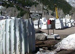
Blocks of cut marble at the historic quarry in Marble
Gunnison County Colorado Incorporated and Unincorporated areas Marble Highlighted 0848555.svg
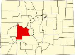
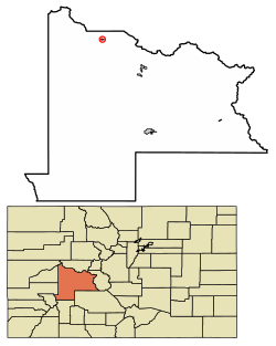
Location of Marble in Gunnison County, Colorado.
Coordinates: 39°04′18″N107°11′27″W / 39.07167°N 107.19083°W / 39.07167; -107.19083
Country Flag of the United States (23px).png  United States
State Flag of Colorado.svg  Colorado
County [1] Gunnison
Incorporated1899
Government
  Type Statutory Town [1]
Area
[2]
  Total0.36 sq mi (0.93 km2)
  Land0.36 sq mi (0.93 km2)
  Water0.00 sq mi (0.00 km2)
Elevation
[3]
8,009 ft (2,441 m)
Population
 (2020)
  Total133
  Density370/sq mi (140/km2)
Time zone UTC-7 (Mountain (MST))
  Summer (DST) UTC-6 (MDT)
ZIP code [4]
81623
Area code 970
FIPS code 08-48555
GNIS feature ID 2412952 [3]
Website www.townofmarble.com

The Town of Marble is a Statutory Town in Gunnison County, Colorado, United States. The town population was 133 at the 2020 United States Census. [5]

Contents

History

The Town of Marble was first incorporated in 1899. Marble remains a statutory town of the State of Colorado today.

The quarry

The town is the location of a historic Yule Marble quarry along the mountains that began operations in the late 19th century, and from which the town draws its name. It has been used for the Tomb of the Unknowns, as well as for parts of the Lincoln Memorial in Washington, D.C., and civic buildings in San Francisco. It was also used for the construction of the Equitable Building, a historically important early skyscraper in New York City.

The marble of the quarry is considered to be of exceptional quality, praised as one of the purest marbles ever quarried and a rival to classical Italian and Greek marble. It is nearly pure calcite marble with minor inclusions of mica, quartz, and feldspar, and has irregularly shaped calcite grains ranging from 100 to 600 micrometers in diameter. According to physical tests of the marble, its strength is comparable to marble typically used in building construction. [6]

The quarry has enjoyed a renaissance since its acquisition in 2004 by Polycor, a Canadian-based dimension stone company, and subsequent sale to Italian group R.E.D. Graniti S.p.A. In spite of significant transportation costs, this high-quality stone is now exported in large quantities to Europe and Asia for transformation and use throughout the world, as well as being sold into the US market. [7]

Tourism

In the late 20th century and the 21st century, Marble has become a summer tourist destination. It is also the gateway to the nearby Crystal townsite. It is the site of the Marble/marble sculpting symposium held every summer since 1988. [8]

Seven sites within Marble have been listed on the National Register of Historic Places. [9]

Geography

According to the United States Census Bureau, the town has a total area of 0.4 square miles (1.0 km2), all of it land.

The community is located in a valley of the upper Crystal River along the Elk Mountains, accessible by a paved road from State Highway 133. Unlike most of Gunnison County, the town is located on the north side of Schofield Pass which is inaccessible to most cars and thus is separated geographically from the rest of Gunnison County.

Demographics

Historical population
CensusPop.Note
1900 101
1910 782674.3%
1920 81−89.6%
1930 217167.9%
1940 24010.6%
1950 8−96.7%
1960 5−37.5%
1970 13160.0%
1980 30130.8%
1990 64113.3%
2000 10564.1%
2010 13124.8%
2020 1331.5%

Education

Marble Charter School (MCS) is a public, tuition-free charter school located in Marble. The school serves K-8 students in the Crystal River Valley. [10]

See also

Related Research Articles

<span class="mw-page-title-main">Ouray County, Colorado</span> County in Colorado, United States

Ouray County is a county located in the U.S. state of Colorado. As of the 2020 census, the population was 4,874. The county seat is Ouray. Because of its rugged mountain topography, Ouray County is also known as the "Switzerland of America".

<span class="mw-page-title-main">Montrose County, Colorado</span> County in Colorado, United States

Montrose County is a county located in the U.S. state of Colorado. As of the 2020 census, the population was 42,679. The county seat is Montrose, for which the county is named.

<span class="mw-page-title-main">Gunnison County, Colorado</span> County in Colorado, United States

Gunnison County is a county located in the U.S. state of Colorado. As of the 2020 census, the population was 16,918. The county seat is Gunnison. The county was named for John W. Gunnison, a United States Army officer and captain in the Army Topographical Engineers, who surveyed for the transcontinental railroad in 1853.

<span class="mw-page-title-main">Delta County, Colorado</span> County in Colorado, United States

Delta County is a county located in the U.S. state of Colorado. As of the 2020 census, the population was 31,196. The county seat is Delta.

<span class="mw-page-title-main">Salida, Colorado</span> City in Colorado, United States

Salida is the statutory city that is the county seat and the most populous municipality of Chaffee County, Colorado, United States. The population was 5,666 at the 2020 census.

<span class="mw-page-title-main">Paonia, Colorado</span> Town in Colorado, United States

Paonia is a statutory town in Delta County, Colorado, United States. The population was 1,447 at the 2020 census.

<span class="mw-page-title-main">Crested Butte, Colorado</span> Town in Colorado, United States

Crested Butte is a home rule municipality located in Gunnison County, Colorado, United States. The town population was 1,639 at the 2020 United States Census. A former coal mining town nestled in the Slate River Valley, Crested Butte is now known as a destination for skiing, mountain biking, and outdoor activities.

<span class="mw-page-title-main">Gunnison, Colorado</span> City in Colorado, United States

Gunnison is a home rule municipality that is the county seat and the most populous municipality of Gunnison County, Colorado. The city population was 6,560 at the 2020 United States Census. The city was named in honor of John W. Gunnison, a United States Army officer who surveyed for a transcontinental railroad in 1853. Gunnison is a college town, home to Western Colorado University.

<span class="mw-page-title-main">Mount Crested Butte, Colorado</span> Town in Colorado, United States

Mt. Crested Butte is a home rule municipality in Gunnison County, Colorado, United States. Mount Crested Butte is the home of the Crested Butte Mountain Resort. The population was 941 at the 2020 census. ZIP code 81225 serves post office boxes for Mount Crested Butte and for neighboring Crested Butte; mail must be addressed to Crested Butte.

<span class="mw-page-title-main">Crystal River (Colorado)</span> River in Gunnison and Pitkin counties Colorado, United States

The Crystal River is a tributary of the Roaring Fork River. It is approximately 40 miles (64 km) long and is located in Gunnison, Pitkin and Garfield counties in Colorado, United States.

<span class="mw-page-title-main">Colorado State Capitol</span> State capitol building of the U.S. state of Colorado

The Colorado State Capitol Building, located at 200 East Colfax Avenue in Denver, Colorado, United States, is the home of the Colorado General Assembly and the offices of the Governor of Colorado, Lieutenant Governor of Colorado, and the Colorado State Treasurer.

<span class="mw-page-title-main">Elk Mountains (Colorado)</span> Mountain range in Colorado, United States

The Elk Mountains are a high, rugged mountain range in the Rocky Mountains of west-central Colorado in the United States. The mountains sit on the western side of the Continental Divide, largely in southern Pitkin and northern Gunnison counties, in the area southwest of Aspen, south of the Roaring Fork River valley, and east of the Crystal River. The range sits west of the Sawatch Range and northeast of the West Elk Mountains. Much of the range is located within the White River National Forest and the Gunnison National Forest, as well as the Maroon Bells-Snowmass Wilderness and Raggeds Wilderness. The Elk Mountains rise nearly 9,000 ft. above the Roaring Fork Valley to the north.

<span class="mw-page-title-main">Yule Marble</span> Marble from Colorado

Yule Marble is a marble of metamorphosed Leadville Limestone found only in the Yule Creek Valley, in the West Elk Mountains of Colorado, 2.8 miles (4.5 km) southeast of the town of Marble, Colorado. First discovered in 1873, it is quarried underground at an elevation of 9,300 feet (2,800 m) above sea level—in contrast to most marble, which is quarried from an open pit and at much lower elevations.

<span class="mw-page-title-main">Curecanti National Recreation Area</span> National Park Service in Colorado, US

Curecanti National Recreation Area is a National Park Service unit located on the Gunnison River in western Colorado. Established in 1965, Curecanti National Recreation Area is responsible for developing and managing recreational facilities on three reservoirs, Blue Mesa Reservoir, Morrow Point Reservoir and Crystal Reservoir, constructed on the upper Gunnison River in the 1960s by the U.S. Bureau of Reclamation to better utilize the vital waters of the Colorado River and its major tributaries. A popular destination for boating and fishing, Curecanti offers visitors two marinas, traditional and group campgrounds, hiking trails, boat launches, and boat-in campsites. The state's premiere lake trout and Kokanee salmon fisheries, Curecanti is a popular destination for boating and fishing, and is also a popular area for ice-fishing in the winter months.

<span class="mw-page-title-main">Crystal, Gunnison County, Colorado</span> Ghost town in Colorado, United States

Crystal is a ghost town on the upper Crystal River in Gunnison County, Colorado, United States. It is located in the Elk Mountains along a four-wheel-drive road 6 miles (9.7 km) east of Marble and 20 miles (32 km) northwest of Crested Butte. Crystal was a mining camp established in 1881 and after several decades of robust existence, was all but abandoned by 1917. The Crystal post office operated from July 28, 1882, until October 31, 1909. Many buildings still stand in Crystal, but its few residents live there only in the summer.

<span class="mw-page-title-main">Treasure Mountain (Colorado)</span> Mountain in Colorado, United States

Treasure Mountain, elevation 13,535 ft (4,125 m), is a summit in the Elk Mountains of western Colorado. The mountain is in the Raggeds Wilderness southeast of Marble. The massif has been the site of marble mining and a legend of lost French gold.

<span class="mw-page-title-main">Marble High School</span> United States historic place

Marble High School is a school and historical site preserved by the National Register of Historic Places located in Marble, Colorado. It was built in 1910, and is the only surviving building in Marble that utilizes marble in its construction, despite the name of the town. It is currently owned by Marble Historical Society, who operate the building as a museum.

<span class="mw-page-title-main">Aberdeen Quarry</span> Granite quarry in Colorado

The Aberdeen Quarry is an abandoned granite quarry in Gunnison County, Colorado. It is located along South Beaver Creek, 7 mi (11 km) south-southwest of Gunnison.

<span class="mw-page-title-main">West Elk Loop Scenic and Historic Byway</span> Colorado Scenic and Historic Byway

The West Elk Loop Scenic and Historic Byway is a 205-mile (330 km) National Forest Scenic Byway and Colorado Scenic and Historic Byway located in Delta, Garfield, Gunnison, Montrose, and Pitkin counties Colorado, USA. The byway reaches its zenith at Kebler Pass, elevation 10,007 feet (3,050 m), between Crested Butte and Paonia.

References

  1. 1 2 "Active Colorado Municipalities". State of Colorado, Department of Local Affairs. Archived from the original on December 12, 2009. Retrieved September 1, 2007.
  2. "2019 U.S. Gazetteer Files". United States Census Bureau. Retrieved July 1, 2020.
  3. 1 2 U.S. Geological Survey Geographic Names Information System: Marble, Colorado
  4. "ZIP Code Lookup". United States Postal Service. Archived from the original (JavaScript/HTML) on November 4, 2010. Retrieved November 18, 2007.
  5. "Race, Hispanic or Latino, Age, and Housing Occupancy: 2020 Census Redistricting Data (Public Law 94-171) Summary File (QT-PL), Marble town, Colorado". United States Census Bureau . Retrieved August 16, 2011.
  6. McGee, Elaine S. (1999). "Colorado Yule Marble—Building Stone of the Lincoln Memorial" (PDF). U.S. Geological Survey Bulletin (2162): 1. Archived from the original (PDF) on July 9, 2017. Retrieved September 8, 2018.
  7. "A diamond in the rough : R.E.D. Graniti".
  8. "MARBLE/marble Symposium". Marble Institute of Colorado. n.d. Retrieved August 15, 2022.
  9. "National Register Information System". National Register of Historic Places . National Park Service. July 9, 2010.
  10. "Welcome to Marble Charter School". Intrado Corporation. 2022. Retrieved August 15, 2022.