El Jebel, Colorado | |
|---|---|
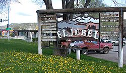 El Jebel sign. | |
 Location of the El Jebel CDP in Eagle County, Colorado. | |
 El Jebel Location of the El Jebel CDP, Colorado.  El Jebel El Jebel (Colorado) | |
| Coordinates: 39°23′42″N107°05′25″W / 39.3950°N 107.0903°W [1] | |
| Country | United States |
| State | Colorado |
| County | Eagle [2] |
| Government | |
| • Type | unincorporated community |
| • Body | Eagle County [2] |
| Area | |
• Total | 5.359 sq mi (13.880 km2) |
| • Land | 5.305 sq mi (13.739 km2) |
| • Water | 0.054 sq mi (0.141 km2) |
| Elevation | 6,483 ft (1,976 m) |
| Population | |
• Total | 4,130 |
| • Density | 779/sq mi (301/km2) |
| Time zone | UTC−07:00 (MST) |
| • Summer (DST) | UTC−06:00 (MDT) |
| ZIP code [5] | (Carbondale) 81623 |
| Area codes | 970/748 |
| GNIS place ID | 174858 |
| GNIS CDP ID | 2408058 |
| FIPS code | 08-23795 |
El Jebel is an unincorporated community and a census-designated place (CDP) located in and governed by Eagle County, Colorado, United States. The CDP is a part of the Edwards, CO Micropolitan Statistical Area and the Edwards-Rifle, CO Combined Statistical Area. The population of the El Jebel CDP was 4,130 at the United States Census 2020. [4]

