Minturn, Colorado

Last updated

Minturn, Colorado
Pine Street in Minturn, Colorado.JPG
Looking northwest along Pine Street
Eagle County Colorado Incorporated and Unincorporated areas Minturn Highlighted 0850920.svg
Location of Minturn in Eagle County, Colorado.
Coordinates: 39°32′45″N106°23′13″W / 39.54583°N 106.38694°W / 39.54583; -106.38694
Country Flag of the United States (23px).png  United States
State Flag of Colorado.svg  Colorado
County [1] Eagle
Incorporated (town) November 23, 1904 [2]
Government
  Type Home rule municipality [1]
Area
[3]
  Total8.20 sq mi (21.23 km2)
  Land8.02 sq mi (20.77 km2)
  Water0.18 sq mi (0.47 km2)
Elevation
[4]
10,250 ft (3,120 m)
Population
 (2020) [5]
  Total1,033
  Density130/sq mi (49/km2)
Time zone UTC-7 (Mountain (MST))
  Summer (DST) UTC-6 (MDT)
ZIP code [6]
81645 (PO Box)
Area code 970
FIPS code 08-50920
GNIS feature ID2413005 [4]
Website www.minturn.org

Minturn is a home rule municipality in Eagle County, Colorado, United States. The town population was 1,033 at the 2020 United States Census. [5]

Contents

Geography

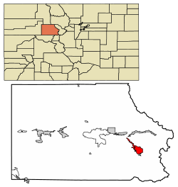
Minturn is located in southeastern Eagle County on the Eagle River between the resort communities of Vail and Beaver Creek. The town limits extend 2 miles (3 km) northwest along U.S. Route 24 to Interstate 70 at Exit 171, from which point it is 5 miles (8 km) east to Vail and 5 miles west to Avon at the base of Beaver Creek Resort. Eagle, the county seat, is 25 miles (40 km) to the west, and Denver is 101 miles (163 km) to the east. US 24 leads south 30 miles (48 km) over the Continental Divide at Tennessee Pass to Leadville.

According to the United States Census Bureau, the town has a total area of 7.8 square miles (20.1 km2), of which 7.6 square miles (19.6 km2) is land and 0.2 square miles (0.5 km2), or 2.32%, is water. [7]

Minturn is surrounded on three sides by White River National Forest, with the Holy Cross Wilderness bordering the southwest side of the town. The national forest offers hiking, biking, snowshoeing, cross country skiing, and other recreational opportunities. Five huts operated by the Tenth Mountain Hut Association along with their associated trail systems are found in the local Eagle-Holy Cross ranger district. Camp Hale, a World War II winter training site now on the National Register of Historic Places, is situated toward the south end of the district. [8]

The Holy Cross District lies on the northern extent of the Sawatch Range and the western flank of the Gore Range. It includes the forest areas surrounding the towns of Vail, Minturn, Red Cliff and Avon. To the north, the district takes in much of the Piney River and Sheephorn Creek drainages.

The upper Eagle River provides a variety of scenic, outdoor recreation opportunities along its 20+ mile stretch from Tennessee Pass to Dowd Junction. For river enthusiasts, fishing, rafting, kayaking and canoeing are plentiful. Floating season generally occurs from late May through July. Access to the river is available from several public access points along Highway 24.

Lionshead Rock Trail Lionshead Rock Trail.JPG
Lionshead Rock Trail

Demographics

Historical population
CensusPop.Note
1910 241
1920 29823.7%
1930 40034.2%
1940 59649.0%
1950 509−14.6%
1960 66230.1%
1970 7066.6%
1980 1,06050.1%
1990 1,0660.6%
2000 1,0680.2%
2010 1,027−3.8%
2020 1,0330.6%
U.S. Decennial Census

The census of 2020 reported that Minturn had 1,033 people living in 365 households. The racial makeup of the town was 82.00% White, 0.48% African American, 1.74% Native American, 0.38% Asian, 0.00% Pacific Islander, 6.10% from other races, and 9.49% from two or more races. Hispanic and Latino people of any race made up 21.58% of the population.

Of the 561 housing units, 80.21% were occupied. The homeownership rate was 61%, and the median rent was $1,898. The median household income was $101,950, while the median family income was $109,196. 4.8% of the population was in poverty.

As for education, 13.8% reached high school or equivalent, 21.1% had some college but no degree, 4.1% had an associate's degree, 38.9% had a bachelor's degree, and 21.3% had a graduate degree. The average travel time to work was 17 minutes, and the employment rate was 79.2%.

Town of Minturn Town of Minturn.JPG
Town of Minturn
Minturn Summer Market Minturn Summer Market.jpg
Minturn Summer Market

History

The town is named for Robert Bowne Minturn, Jr., who was vice president of the Denver and Rio Grande Western Railroad that founded the town. [9] He was also a member of Grinnell, Minturn & Co.

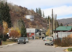
Minturn's oldest families settled at the confluence of Gore Creek and the Eagle River in the late 1800s. Some created homesteads and farmed the land, while others mined silver in the mountains high above town. With the arrival of the Denver & Rio Grande Railroad in 1887, Minturn quickly developed into a booming crossroads for transportation and industry. By the turn of the century, a growing population of mining and railroad workers and their families raised the demand for business and services in town. In response, Minturn was incorporated on November 15, 1904.

Minturn has adapted to several major changes in the local economy over the decades, including the development of Vail and Beaver Creek ski resorts, the closing of the Gilman mine, and the abandonment of rail lines through Minturn. Despite this transformation from the Old West to the new, Minturn maintains its distinctive character, architecture and quality of life.

Transportation

Minturn is served by Eagle County Regional Airport near Gypsum, 30 miles (48 km) to the west.

Eagle County provides bus service from the Dowd Junction Transit Stop with service to Minturn, Vail, Leadville, Eagle-Vail, Avon, Beaver Creek, Edwards, Eagle, Gypsum and Dotsero.

Interstate 70 runs east–west two miles north of Minturn. Highway 24 runs east–west through Minturn, and to the east leading to the towns of Red Cliff and eventually Leadville.

See also

Related Research Articles

<span class="mw-page-title-main">Leadville, Colorado</span> City in Colorado, United States

Leadville is a statutory city that is the county seat, the most populous community, and the only incorporated municipality in Lake County, Colorado, United States. The city population was 2,633 at the 2020 census. It is situated at an elevation of 10,158 feet (3,096 m). Leadville is the highest incorporated city in the United States and is surrounded by two of the tallest peaks in the state.

<span class="mw-page-title-main">Lake County, Colorado</span> County in Colorado, United States

Lake County is a county located in the U.S. state of Colorado. As of the 2020 census, the population was 7,436. The county seat and the only municipality in the county is Leadville. The highest natural point in Colorado and the entire Rocky Mountains is the summit of Mount Elbert in Lake County at 14,440 feet elevation.

<span class="mw-page-title-main">Eagle County, Colorado</span> County in Colorado, United States

Eagle County is a county located in the U.S. state of Colorado. As of the 2020 census, the population was 55,731. The county seat is the Town of Eagle and the most populous community is Edwards. The county is named for the Eagle River.

<span class="mw-page-title-main">Avon, Colorado</span> Town in Colorado, United States

Avon is a home rule municipality located in Eagle County, Colorado, United States. The town population was 6,072 at the 2020 United States Census. The town is a part of the Edwards, CO Micropolitan Statistical Area. Avon is the gateway to the Beaver Creek Resort which lies about two miles (3 km) south of the town. It was the previous site of Vail Resorts before the company moved its physical headquarters to Broomfield, Colorado, in 2006. The town is the home of Liberty Skis, an independent ski manufacturing company.

<span class="mw-page-title-main">Eagle, Colorado</span> Town in Colorado, United States

Eagle is the Statutory Town that is the county seat of Eagle County, Colorado, United States. The town population was 7,511 at the 2020 United States Census, a +15.41% increase since the 2010 United States Census. Eagle is the part of the Edwards, CO Micropolitan Statistical Area.

<span class="mw-page-title-main">Edwards, Colorado</span> Census Designated Place in Colorado, United States

Edwards is an unincorporated town, a post office, and a census-designated place (CDP) located in and governed by Eagle County, Colorado, United States. Edwards is the principal town of the Edwards, CO Micropolitan Statistical Area. The Edwards post office has the ZIP Code 81632. At the United States Census 2020, the population of the Edwards CDP was 11,246. The Edwards Metropolitan District provides services.

<span class="mw-page-title-main">Gypsum, Colorado</span> Town in Colorado, United States

The Town of Gypsum is the home rule municipality that is the most populous municipality in Eagle County, Colorado, United States. The town population was 8,040 at the 2020 United States Census, a +24.13% increase since the 2010 United States Census. Gypsum is a part of the Edwards, CO Micropolitan Statistical Area. Gypsum is the home of an American Gypsum drywall plant and mine.

<span class="mw-page-title-main">Red Cliff, Colorado</span> Town in Colorado, United States

Red Cliff is a statutory town in Eagle County, Colorado, United States. The population was 257 at the 2020 census. The town is a former mining camp situated in the canyon of the upper Eagle River just off U.S. Highway 24 north of Tennessee Pass. The town site is concealed below the highway and is accessible by a side road leading to Shrine Pass in the Sawatch Range.

<span class="mw-page-title-main">Vail, Colorado</span> Town in Colorado, United States

Vail is a home rule municipality in Eagle County, Colorado, United States. The population of the town was 4,835 in 2020. Home to Vail Ski Resort, the largest ski mountain in Colorado, the town is known for its hotels, dining, and for the numerous events the city hosts annually, such as the Vail Film Festival, Vail Resorts Snow Days, and Bravo! Vail.

<span class="mw-page-title-main">Winter Park, Colorado</span> Town in Colorado, United States

Winter Park is a home rule municipality in Grand County, Colorado, United States. The permanent population was 1,033 at the 2020 census, although with 2,572 housing units within the town limits the seasonal population can be much higher.

<span class="mw-page-title-main">Mount of the Holy Cross</span> Mountain in Colorado, United States

Mount of the Holy Cross is a high and prominent mountain summit in the northern Sawatch Range of the Rocky Mountains of North America. The 14,011-foot (4270.5 m) fourteener is located in the Holy Cross Wilderness of White River National Forest, 6.6 miles (10.7 km) west-southwest of the Town of Red Cliff in Eagle County, Colorado, United States. The summit of Mount of the Holy Cross is the highest point in Eagle County and the northern Sawatch Range.

<span class="mw-page-title-main">White River National Forest</span> National forest in northwest Colorado

White River National Forest is a National Forest in northwest Colorado. It is named after the White River that passes through its northern section. It is the most visited National Forest in the United States, primarily from users of the twelve ski areas within its boundaries.

<span class="mw-page-title-main">Beaver Creek Resort</span> Ski area in Colorado, United States

Beaver Creek Resort is a major ski resort in the western United States, near Avon, Colorado. The resort comprises three villages, the main Beaver Creek Village, Bachelor Gulch, and Arrowhead to the west. The resort is owned and operated by Vail Resorts which operates multiple additional resorts. Beaver Creek is a regular host of World Cup events, usually in early December.

<span class="mw-page-title-main">Colorado's 2nd congressional district</span> U.S. House district for Colorado

Colorado's 2nd congressional district is a congressional district in the U.S. state of Colorado. The district is located in the north-central part of the state and encompasses the northwestern suburbs of Denver including Boulder and Fort Collins. The district also includes the mountain towns of Vail, Granby, Steamboat Springs, and Idaho Springs. Redistricting in 2011 moved Larimer County, including the cities of Fort Collins and Loveland, to the 2nd from the 4th district. Meanwhile, redistricting in 2021 moved Loveland back to the 4th district and Broomfield and western Jefferson County to the 7th district.

<span class="mw-page-title-main">Beaver Creek, Colorado</span> Unincorporated community in Colorado, U.S.

Beaver Creek is an unincorporated community in Eagle County, Colorado, United States. Beaver Creek is located immediately south of the town of Avon and encompasses the Beaver Creek Resort and adjacent business, lodging, golf course, and residential areas. The U.S. Post Office at Avon serves Beaver Creek postal addresses.

Rocky Mountain Airways was an American commuter airline headquartered in Hangar No. 6 of Stapleton International Airport in Denver, Colorado. It was sold to Texas Air Corporation/Continental Airlines in 1986 and was operated as a Continental Express subsidiary until its operations were merged with Britt Airways in 1991. The airline flew from Denver's Stapleton International Airport to a variety of destinations in Colorado, Nebraska and Wyoming. The airline operated out of the old commuter terminal in Concourse A at Stapleton.

<span class="mw-page-title-main">Vail Ski Resort</span> Ski resort in Colorado, USA

Vail Ski Resort is a ski resort in the western United States, located near the town of Vail in Eagle County, Colorado. At 5,289 acres, it is the third-largest single-mountain ski resort in the U.S., behind Big Sky and Park City, featuring seven bowls and intermediate gladed terrain in Blue Sky Basin.

<span class="mw-page-title-main">Holy Cross Wilderness</span> National forest wilderness area in Colorado, United States

The Holy Cross Wilderness is a U.S. Wilderness Area located in San Isabel and White River national forests near Leadville, Minturn, Avon, Edwards, Eagle, and Vail. The 122,797-acre (496.94 km2) wilderness with 164 miles (264 km) of trails was established in 1980. The wilderness was named after its highest peak, 14,005-foot (4,269 m) Mount of the Holy Cross.

<span class="mw-page-title-main">Vail Health Hospital</span> Hospital in Colorado, United States

Vail Health Hospital is a regional hospital in Vail, Colorado, in Eagle County. Originally established as a small clinic in 1965, the hospital now has 56 beds. The hospital is a Level III trauma center.

References

  1. 1 2 "Active Colorado Municipalities". State of Colorado, Department of Local Affairs. Archived from the original on December 12, 2009. Retrieved September 1, 2007.
  2. "Colorado Municipal Incorporations". State of Colorado, Department of Personnel & Administration, Colorado State Archives. December 1, 2004. Retrieved September 2, 2007.
  3. "2019 U.S. Gazetteer Files". United States Census Bureau. Retrieved July 1, 2020.
  4. 1 2 U.S. Geological Survey Geographic Names Information System: Minturn, Colorado
  5. 1 2 United States Census Bureau. "Minturn town; Colorado" . Retrieved April 25, 2023.
  6. "ZIP Code Lookup". United States Postal Service. Archived from the original (JavaScript/HTML) on January 1, 2008. Retrieved November 23, 2007.
  7. "Geographic Identifiers: 2010 Demographic Profile Data (G001): Minturn town, Colorado". American Factfinder. U.S. Census Bureau. Archived from the original on February 13, 2020. Retrieved January 22, 2016.
  8. "Eagle-Holy Cross Ranger District". White River National Forest. USDA Forest Service. Retrieved January 22, 2016.
  9. "Town History: Minturn's Timeline". Town of Minturn. Archived from the original on August 14, 2007. Retrieved November 23, 2007.