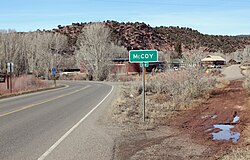
McCoy, Colorado | |
---|---|
Location of the McCoy CDP in the United States. | |
Coordinates: 39°54′52″N106°43′33″W / 39.91444°N 106.72583°W [1] | |
Country | United States |
State | Colorado |
County | Eagle County |
Area | |
• Total | 0.294 sq mi (0.761 km2) |
• Land | 0.294 sq mi (0.761 km2) |
• Water | 0.000 sq mi (0.000 km2) |
Elevation | 6,683 ft (2,037 m) |
Population | |
• Total | 30 |
• Density | 100/sq mi (39/km2) |
Time zone | UTC-7 (MST) |
• Summer (DST) | UTC-6 (MDT) |
ZIP Code [4] | 80463 |
Area code | 970 |
GNIS feature | 2583263 [1] |
McCoy is an unincorporated town, a census-designated place (CDP), and a post office located in and governed by Eagle County, Colorado, United States. The CDP is a part of the Edwards, CO Micropolitan Statistical Area. The McCoy post office has the ZIP Code 80463. [4] At the United States Census 2020, the population of the McCoy CDP was 30. [3]
The McCoy Post Office has been in operation since 1891. [5] The community was named after Charles H. McCoy, a cattleman. [6]
McCoy is located along the northern border of Eagle County in the valley of Rock Creek, less than one mile north of its mouth at the Colorado River. Colorado State Highway 131 passes through the community, leading south 20 miles (32 km) to Interstate 70 at Wolcott and north 52 miles (84 km) to Steamboat Springs.
The McCoy CDP has an area of 188 acres (0.761 km2), all land. [2]
The United States Census Bureau initially defined the McCoy CDP for the United States Census 2010.
Year | Pop. | ±% |
---|---|---|
2010 | 24 | — |
2020 | 30 | +25.0% |
Source: United States Census Bureau |
Louviers is an unincorporated town, a post office, and a census-designated place (CDP) located in and governed by Douglas County, Colorado, United States. The CDP is a part of the Denver–Aurora–Lakewood, CO Metropolitan Statistical Area. The Louviers post office has the ZIP Code 80131. At the United States Census 2020, the population of the Louviers CDP was 293.
Sedalia is an unincorporated town, a post office, and a census-designated place (CDP) located in and governed by Douglas County, Colorado, United States. The CDP is a part of the Denver–Aurora–Lakewood, CO Metropolitan Statistical Area. The Sedalia post office has the ZIP Code 80135. At the United States Census 2020, the population of the Sedalia CDP was 177.
Edwards is an unincorporated town, a post office, and a census-designated place (CDP) located in and governed by Eagle County, Colorado, United States. Edwards is the principal town of the Edwards, CO Micropolitan Statistical Area. The Edwards post office has the ZIP Code 81632. At the United States Census 2020, the population of the Edwards CDP was 11,246. The Edwards Metropolitan District provides services.
El Jebel is an unincorporated community and a census-designated place (CDP) located in and governed by Eagle County, Colorado, United States. The CDP is a part of the Edwards, CO Micropolitan Statistical Area. The population of the El Jebel CDP was 4,130 at the United States Census 2020. The Carbondale Post Office serves El Jebel postal addresses.
Kittredge is an unincorporated town, a post office, and a census-designated place (CDP) located in and governed by Jefferson County, Colorado, United States. The CDP is a part of the Denver–Aurora–Lakewood, CO Metropolitan Statistical Area. The Kittredge post office has the ZIP code 80457. At the United States Census 2020, the population of the Kittredge CDP was 1,308.
Atwood is an unincorporated town, a post office, and a census-designated place (CDP) located in and governed by Logan County, Colorado, United States. The CDP is a part of the Sterling, CO Micropolitan Statistical Area. The Atwood post office has the ZIP Code 80722. At the United States Census 2020, the population of the Atwood CDP was 138.
Padroni is an unincorporated town, a census-designated place (CDP), and a post office located in and governed by Logan County, Colorado, United States. The CDP is a part of the Sterling, CO Micropolitan Statistical Area. The Padroni post office has the ZIP Code 80745. At the United States Census 2020, the population of the Padroni CDP was 75.
Clifton is a census-designated place (CDP) and post office in and governed by Mesa County, Colorado, United States. It is part of the Grand Junction, CO Metropolitan Statistical Area. The Clifton post office has the ZIP Code 81520. As of the 2020 census, the population of the Clifton CDP was 20,413.
Heeney is an unincorporated community and a census-designated place (CDP) located in and governed by Summit County, Colorado, United States. The CDP is a part of the Breckenridge, CO Micropolitan Statistical Area. The population of the Heeney CDP was 74 at the United States Census 2020. The Silverthorne post office (Zip Code 80498) serves Heeney postal addresses.
Dotsero is an unincorporated community and a census-designated place (CDP) located in and governed by Eagle County, Colorado, United States. The CDP is a part of the Edwards, CO Micropolitan Statistical Area. The population of the Dotsero CDP was 1,172 at the United States Census 2020. The Gypsum post office serves the area.
Conejos is an unincorporated town, a post office, a census-designated place (CDP), and the county seat of Conejos County, Colorado, United States. The Conejos post office has the ZIP Code 81129. At the United States Census 2020, the population of the Conejos CDP was 46. Conejos is the only unincorporated county seat in the State of Colorado.
Coaldale is a census-designated place (CDP) and post office located in and governed by Fremont County, Colorado, United States. The CDP is a part of the Cañon City, CO Micropolitan Statistical Area. The Coaldale post office has the ZIP Code 81222. At the United States Census 2020, the population of the Coaldale CDP was 343.
Howard is a census-designated place (CDP) and post office in and governed by Fremont County, Colorado, United States. The CDP is a part of the Cañon City, CO Micropolitan Statistical Area. The Howard post office has the ZIP Code 81233. At the United States Census 2020, the population of the Howard CDP was 852.
Orchard is an unincorporated town, a post office, and a census-designated place (CDP) located in and governed by Morgan County, Colorado, United States. The CDP is a part of the Fort Morgan, CO Micropolitan Statistical Area. The Orchard post office has the ZIP Code 80649. As of the 2020 census, the population of the Orchard CDP was 76.
Phippsburg is a census-designated place (CDP) and a post office in and governed by Routt County, Colorado, United States. The population was 234 at the 2020 census. The CDP is a part of the Steamboat Springs, CO Micropolitan Statistical Area. The Phippsburg post office has the ZIP Code 80469.
Redvale is an unincorporated town, a post office, and a census-designated place (CDP) located in and governed by Montrose County, Colorado, United States. The CDP is a part of the Montrose, CO Micropolitan Statistical Area. The Redvale post office has the ZIP Code 81431. At the 2020 census, the population of the Redvale CDP was 172, down from 236 in 2010.
Snyder is an unincorporated town, a post office, and a census-designated place (CDP) located in and governed by Morgan County, Colorado, United States. The CDP is a part of the Fort Morgan, CO Micropolitan Statistical Area. The Snyder post office has the ZIP Code 80750. As of the 2020 census, the population of the Snyder CDP was 136.
Weldona is an unincorporated town, a post office, and a census-designated place (CDP) located in and governed by Morgan County, Colorado, United States. The CDP is a part of the Fort Morgan, CO Micropolitan Statistical Area. The Weldona post office has the ZIP Code 80653. At the United States Census 2020, the population of the Weldona CDP was 113.
Wolcott is an unincorporated town, a post office, and a census-designated place (CDP) located in and governed by Eagle County, Colorado, United States. The CDP is a part of the Edwards, CO Micropolitan Statistical Area. The Wolcott post office has the ZIP Code 81655. At the United States Census 2020, the population of the Wolcott CDP was 20.
Colona is a census-designated place (CDP) located in and governed by Ouray County, Colorado, United States. The CDP is a part of the Montrose, CO Micropolitan Statistical Area. The population of the Colona CDP was 36 at the United States Census 2020. The Montrose post office (Zip Code 81401) serves the area.