Somerset, Colorado

Last updated
Somerset, Colorado
Coal Train - Somerset Colorado 08-16-2011.JPG
Coal train near Somerset, August 2011
USA Colorado location map.svg
Red pog.svg
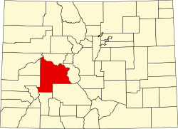
Somerset
Location of the Somerset CDP in the State of Colorado.
Coordinates: 38°55′36″N107°28′21″W / 38.9267242°N 107.4725129°W / 38.9267242; -107.4725129 (Somerset CDP, Colorado) Coordinates: 38°55′36″N107°28′21″W / 38.9267242°N 107.4725129°W / 38.9267242; -107.4725129 (Somerset CDP, Colorado) [1]
Country Flag of the United States.svg  United States
State Flag of Colorado.svg  Colorado
County Gunnison County
Government
[2]
  Type unincorporated town
Area
[1]
  Total0.190 sq mi (0.492 km2)
  Land0.190 sq mi (0.492 km2)
  Water0.000 sq mi (0.000 km2)
Elevation
[2]
5,984 ft (1,824 m)
Population
 (2020) [3]
  Total55
  Density290/sq mi (110/km2)
Time zone UTC-7 (MST)
  Summer (DST) UTC-6 (MDT)
ZIP Code [4]
81434
Area code 970
GNIS feature [2] Somerset CDP

Somerset is a census-designated place (CDP) and post office located in and governed by Gunnison County, Colorado, United States. The population was 55 at the 2020 census. [3] The Somerset post office has the ZIP Code 81434. [4]

Contents

History

Somerset Post Office, July 2016 Somerset, Colorado - US Post Office (28708060921).jpg
Somerset Post Office, July 2016

Somerset was named after Somerset, Pennsylvania. [5]

In 2012, the Aspen Skiing Company built a 3-megawatt methane-to-electricity plant in Somerset at Oxbow Carbon's Elk Creek Mine. [6]

Geography

The Somerset CDP has an area of 122 acres (0.492 km2), all land. [1]

Demographics

Somerset CDP, Colorado
YearPop.±%
2020 55    
Source: United States Census Bureau

The United States Census Bureau defined the Somerset CDP for the United States Census 2020.

See also

Related Research Articles

<span class="mw-page-title-main">Byers, Colorado</span> Census Designated Place in Colorado, United States

Byers is an unincorporated town, a post office, and a census-designated place (CDP) located in and governed by Arapahoe County, Colorado, United States. The CDP is a part of the Denver–Aurora–Lakewood, CO Metropolitan Statistical Area. The Byers post office has the ZIP Code 80103. At the United States Census 2010, the population of the Byers CDP was 1,160, while the population of the 80103 ZIP Code Tabulation Area was 2,458 including adjacent areas.

<span class="mw-page-title-main">Louviers, Colorado</span> Census Designated Place in Colorado, United States

Louviers is an unincorporated town, a post office, and a census-designated place (CDP) located in and governed by Douglas County, Colorado, United States. The CDP is a part of the Denver–Aurora–Lakewood, CO Metropolitan Statistical Area. The Louviers post office has the ZIP Code 80131. At the United States Census 2010, the population of the Louviers CDP was 269, while the population of the 80131 ZIP Code Tabulation Area was 243.

<span class="mw-page-title-main">Kittredge, Colorado</span> Census Designated Place in Colorado, United States

Kittredge is an unincorporated town, a post office, and a census-designated place (CDP) located in and governed by Jefferson County, Colorado, United States. The CDP is a part of the Denver–Aurora–Lakewood, CO Metropolitan Statistical Area. The Kittredge post office has the ZIP code 80457. At the United States Census 2010, the population of the Kittredge CDP was 1,304, while the population of the 80457 ZIP Code Tabulation Area was 612.

<span class="mw-page-title-main">Padroni, Colorado</span> Census Designated Place in Colorado, United States

Padroni is an unincorporated town, a census-designated place (CDP), and a post office located in and governed by Logan County, Colorado, United States. The CDP is a part of the Sterling, CO Micropolitan Statistical Area. The Padroni post office has the ZIP Code 80745. At the United States Census 2010, the population of the Padroni CDP was 76, while the population of the 80745 ZIP Code Tabulation Area was 156 including adjacent areas.

<span class="mw-page-title-main">Avondale, Colorado</span> Census-designated place in Pueblo County, Colorado, United States

Avondale is a census-designated place (CDP) and post office in and governed by Pueblo County, Colorado, United States. The CDP is a part of the Pueblo, CO Metropolitan Statistical Area. The Avondale post office has the ZIP Code 81022. At the United States Census 2020, the population of the Avondale CDP was 594, while the population of the 81022 ZIP Code Tabulation Area was 1,624 including adjacent areas.

<span class="mw-page-title-main">Rollinsville, Colorado</span> Census-designated place in Gilpin County, Colorado, United States

Rollinsville is a census-designated place (CDP) and post office in and governed by Gilpin County, Colorado, United States. The CDP is a part of the Denver–Aurora–Lakewood, CO Metropolitan Statistical Area. The Rollinsville post office has the ZIP Code 80474. At the United States Census 2010, the population of the Rollinsville CDP was 181.

<span class="mw-page-title-main">Amherst, Colorado</span> Census-designated place in Phillips County, Colorado, United States

Amherst is a census-designated place (CDP) and a post office in and governed by Phillips County, Colorado, United States. The Amherst post office has the ZIP Code 80721. At the United States Census 2010, the population of the Amherst CDP was 47 in 2020, while the population of the 80721 ZIP Code Tabulation Area was 154 including adjacent areas.

<span class="mw-page-title-main">Cope, Colorado</span> Census Designated Place in Colorado, United States

Cope is an unincorporated town, a post office, and a census-designated place (CDP) located in and governed by Washington County, Colorado, United States. The population was 53 at the 2020 census. The Cope post office has the ZIP Code 80812.

<span class="mw-page-title-main">Gardner, Colorado</span> Census-designated place in Huerfano County, Colorado, United States

Gardner is a census-designated place (CDP) and post office in and governed by Huerfano County, Colorado, United States. The Gardner post office has the ZIP Code 81040. At the United States Census 2020, the population of the Gardner CDP was 106.

<span class="mw-page-title-main">Howard, Colorado</span> Census-designated place in Fremont County, Colorado, United States

Howard is a census-designated place (CDP) and post office in and governed by Fremont County, Colorado, United States. The CDP is a part of the Cañon City, CO Micropolitan Statistical Area. The Howard post office has the ZIP Code 81233. At the United States Census 2020, the population of the Howard CDP was 852.

<span class="mw-page-title-main">Joes, Colorado</span> Census-designated place in Yuma County, Colorado, United States

Joes is a census-designated place (CDP) and post office in and governed by Yuma County, Colorado, United States. The Joes post office has the ZIP Code 80822. At the United States Census 2010, the population of the Joes CDP was 80, while the population of the 80822 ZIP Code Tabulation Area was 260 including adjacent areas.

<span class="mw-page-title-main">Lazear, Colorado</span> Census Designated Place in Colorado, United States

Lazear is an unincorporated town, a census-designated place (CDP), and a post office located in and governed by Delta County, Colorado, United States. The Lazear post office has the ZIP Code 81420. The population was 168 at the 2020 census.

<span class="mw-page-title-main">Matheson, Colorado</span> Census-designated place in Elbert County, Colorado, United States.

Matheson is a census-designated place (CDP) and post office in and governed by Elbert County, Colorado, United States. The CDP is a part of the Denver–Aurora–Lakewood, CO Metropolitan Statistical Area. The Matheson post office has the ZIP Code 80830. At the United States Census 2020, the population of the Matheson CDP was 79.

<span class="mw-page-title-main">McCoy, Colorado</span> Census Designated Place in Colorado, United States

McCoy is an unincorporated town, a census-designated place (CDP), and a post office located in and governed by Eagle County, Colorado, United States. The CDP is a part of the Edwards, CO Micropolitan Statistical Area. The McCoy post office has the ZIP Code 80463. At the United States Census 2010, the population of the McCoy CDP was 24, while the population of the 80463 ZIP Code Tabulation Area was 136 including adjacent areas.

<span class="mw-page-title-main">Phippsburg, Colorado</span> Census-designated place in Routt County, Colorado, United States

Phippsburg is a census-designated place (CDP) and a post office in and governed by Routt County, Colorado, United States. The CDP is a part of the Steamboat Springs, CO Micropolitan Statistical Area.

<span class="mw-page-title-main">Vernon, Colorado</span> Unincorporated community in Colorado, United States

Vernon is an unincorporated town, a post office, and a census-designated place (CDP) located in and governed by Yuma County, Colorado, United States. The Vernon post office has the ZIP Code 80755. At the United States Census 2010, the population of the Vernon CDP was 29, while the population of the 80755 ZIP Code Tabulation Area was 163 including adjacent areas.

<span class="mw-page-title-main">Weldona, Colorado</span> Census Designated Place in Colorado, United States

Weldona is an unincorporated town, a post office, and a census-designated place (CDP) located in and governed by Morgan County, Colorado, United States. The CDP is a part of the Fort Morgan, CO Micropolitan Statistical Area. The Weldona post office has the ZIP Code 80653. At the United States Census 2020, the population of the Weldona CDP was 113.

<span class="mw-page-title-main">Goldfield, Colorado</span> Census Designated Place in Colorado, United States

Goldfield is an unincorporated community and a census-designated place (CDP) located in and governed by Teller County, Colorado, United States. The CDP is a part of the Colorado Springs, CO Metropolitan Statistical Area. The population of the Goldfield CDP was 49 at the United States Census 2010. The Cripple Creek post office (Zip Code 80813) serves the area.

<span class="mw-page-title-main">Colona, Colorado</span> Census-designated place in Colorado, United States

Colona is a census-designated place (CDP) located in and governed by Ouray County, Colorado, United States. The CDP is a part of the Montrose, CO Micropolitan Statistical Area. The population of the Colona CDP was 30 at the United States Census 2010. The Montrose post office (Zip Code 81401) serves the area.

<span class="mw-page-title-main">El Moro, Colorado</span> Census Designated Place in Colorado, United States

El Moro is an unincorporated community and a census-designated place (CDP) located in and governed by Las Animas County, Colorado, United States. The population of the El Moro CDP was 221 at the United States Census 2010. The Trinidad post office serves the area.

References

  1. 1 2 3 "State of Colorado Census Designated Places - BAS20 - Data as of January 1, 2020". United States Census Bureau . Retrieved December 22, 2020.
  2. 1 2 3 "U.S. Board on Geographic Names: Domestic Names". United States Geological Survey . Retrieved December 19, 2020.
  3. 1 2 United States Census Bureau. "Somerset CDP, Colorado" . Retrieved April 9, 2023.
  4. 1 2 "Look Up a ZIP Code". United States Postal Service . Retrieved December 19, 2020.
  5. Dawson, John Frank. Place names in Colorado: why 700 communities were so named, 150 of Spanish or Indian origin. Denver, CO: The J. Frank Dawson Publishing Co. p. 47.
  6. Ward, Bob (November 21, 2014). "How Aspen Skiing Co. became a power company". Aspen Times . Retrieved 2019-12-21.{{cite web}}: CS1 maint: url-status (link)