Whitepine | |
|---|---|
 Entering on Road 888 | |
 Whitepine Location within the state of Colorado  Whitepine Whitepine (the United States) | |
| Coordinates: 38°32′29.99″N106°23′37.09″W / 38.5416639°N 106.3936361°W | |
| Country | United States |
| State | Colorado |
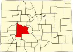
| County | Gunnison |
| Elevation | 9,712 ft (2,960 m) |
| ZIP codes | 81248 |
| [1] | |
Whitepine, also spelled White Pine, is a ghost town in Gunnison County, Colorado, United States. [2] Whitepine was a mining camp established in 1880 along the headwaters of Tomichi Creek. The town lies south of Tomichi Pass along Gunnison County Road 888 about ten miles (16 kilometers) north of Sargents, Colorado. [3] [4]