Snake River (Colorado)

Last updated
Snake River
River
Snake River mit Anglerschild.jpg
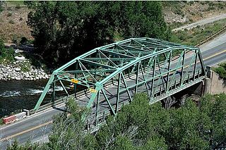
Snake River near Keystone
Tributaries
 - left Deer Creek, Soda Creek
 - right North Fork Snake River
Source
 - location Summit County, Colorado
 - coordinates 39°32′01″N105°51′16″W / 39.53361°N 105.85444°W / 39.53361; -105.85444
Mouth Dillon Reservoir
 - location Confluence with Blue at Dillon Reservoir
 - elevation 9,022 ft (2,750 m)
 - coordinates 39°36′55″N106°03′15″W / 39.61528°N 106.05417°W / 39.61528; -106.05417 Coordinates: 39°36′55″N106°03′15″W / 39.61528°N 106.05417°W / 39.61528; -106.05417 [1]
Length 15 mi (24 km)

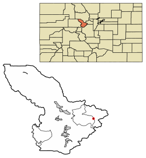
The Snake River is a short tributary of the Blue River, approximately 15 miles (24 km) long, in central Colorado in the United States. It drains a mountainous area on the west side of the Front Range in southeastern Summit County east of Keystone.

Blue River (Colorado) tributary of the Colorado River in Colorado, USA

The Blue River is a tributary of the Colorado River, approximately 65 miles (105 km) long, in the U.S. state of Colorado.
Colorado State of the United States of America

Colorado is a state of the Western United States encompassing most of the southern Rocky Mountains as well as the northeastern portion of the Colorado Plateau and the western edge of the Great Plains. It is the 8th most extensive and 21st most populous U.S. state. The estimated population of Colorado was 5,695,564 on July 1, 2018, an increase of 13.25% since the 2010 United States Census.

United States federal republic in North America

The United States of America (USA), commonly known as the United States or America, is a country composed of 50 states, a federal district, five major self-governing territories, and various possessions. At 3.8 million square miles, the United States is the world's third or fourth largest country by total area and is slightly smaller than the entire continent of Europe's 3.9 million square miles. With a population of over 327 million people, the U.S. is the third most populous country. The capital is Washington, D.C., and the largest city by population is New York. Forty-eight states and the capital's federal district are contiguous in North America between Canada and Mexico. The State of Alaska is in the northwest corner of North America, bordered by Canada to the east and across the Bering Strait from Russia to the west. The State of Hawaii is an archipelago in the mid-Pacific Ocean. The U.S. territories are scattered about the Pacific Ocean and the Caribbean Sea, stretching across nine official time zones. The extremely diverse geography, climate, and wildlife of the United States make it one of the world's 17 megadiverse countries.

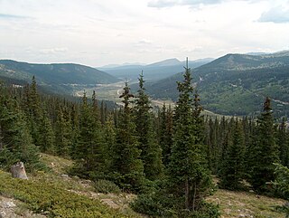
It rises near the continental divide near Webster Pass along the Summit-Park county line and descends through a steep canyon to the north past the former mining camp of Montezuma, then turns west to flow past Keystone, where it joins the Blue from the east as an arm of Dillon Reservoir.

A continental divide is a drainage divide on a continent such that the drainage basin on one side of the divide feeds into one ocean or sea, and the basin on the other side either feeds into a different ocean or sea, or else is endorheic, not connected to the open sea. Every continent on earth except Antarctica which has no free-flowing water has at least one continental drainage divide; islands, even small ones like Killiniq Island on the Labrador Sea in Canada, may also host part of a continental divide or have their own island-spanning divide.

Webster Pass (Colorado)

Webster Pass, elevation 12,103 ft (3,689 m), is a mountain pass that crosses the Continental Divide in the Front Range of the Rocky Mountains of Colorado in the United States. Originally known as Handcart Pass, the name changed in the 1870s after the Webster brothers constructed a toll road.

Park County, Colorado county in Colorado, United States

Park County is one of the 64 counties in the U.S. state of Colorado. As of the 2010 census, the population was 16,206. The county seat is Fairplay. The county was named after the large geographic region known as South Park, which was named by early fur traders and trappers in the area.

See also

Related Research Articles

Summit County, Colorado county in Colorado

Summit County is one of the 64 counties in the U.S. state of Colorado. As of the 2010 census, the population was 27,994. The county seat is Breckenridge.

Montezuma, Colorado Statutory Town in State of Colorado, United States

The Town of Montezuma is a statutory town located in eastern Summit County, Colorado, United States. The town population was 65 at 2010 United States Census. The town is a former mining camp that sits at an elevation of 10,200 feet (3,110 m), just west of the Continental Divide, nestled among mountains that reach an elevation of 12,000-13,000 feet around it. It is situated in the upper valley of the Snake River above the ski resort of Keystone in the Rocky Mountains.

Little Snake River watercourse in the United States of America

The Little Snake River is a tributary of the Yampa River, approximately 155 miles (249 km) long, in southwestern Wyoming and northwestern Colorado in the United States.

Eagle River (Colorado)

The Eagle River is a tributary of the Colorado River, approximately 60.5 miles (97.4 km) long, in west central Colorado in the United States.

Malheur River river in the United States of America

The Malheur River is a 190-mile-long (306 km) tributary of the Snake River in eastern Oregon in the United States. It drains a high desert area, between the Harney Basin and the Blue Mountains and the Snake.

Powder River (Oregon) river in the United States of America

The Powder River is a tributary of the Snake River, approximately 153 miles (246 km) long, in northeast Oregon in the United States. It drains an area of the Columbia Plateau on the eastern side of the Blue Mountains. It flows almost entirely within Baker County but downstream of the city of North Powder forms part of the border between Baker County and Union County.

Fremont Pass (Colorado) mountain pass

Fremont Pass is a 11,318-foot (3,450 m) mountain pass in the Rocky Mountains of central Colorado in the United States.

Vail Pass mountain pass

Vail Pass is a 10,662-foot-high (3,250 m) mountain pass in the Rocky Mountains of central Colorado. The pass was named for Charles Vail, a highway engineer and director of the Colorado State Highway Department from 1930 to 1945.

Hoosier Pass

Hoosier Pass elevation 11,542 ft (3,518 m) is a high mountain pass in the Rocky Mountains of central Colorado in the United States. The name derives from Indiana, nicknamed the "Hoosier State," which was the original home of many pioneers.

The Swan River is a short tributary of the Blue River, approximately 10 miles (16 km) long, located in the Rocky Mountains of central Colorado in the United States. The river drains a mountainous area in the upper basin of the Blue River in southern Summit County. It rises in three short forks along the continental divide in the Arapaho National Forest east of Breckenridge. It descends through a narrow valley to the west, joining the Blue from the east approximately 5 miles (8 km) north Breckenridge, along State Highway 9 between Breckenridge and Frisco. The valley of the river was historical site of mining camps during the late 19th century, with many remains of early camps and mine tailings remaining along the canyon walls.

Uncompahgre Peak mountain

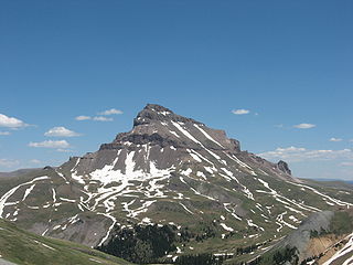
Uncompahgre Peak is the sixth highest summit of the Rocky Mountains of North America and the U.S. state of Colorado. The prominent 14,321-foot (4365.0 m) fourteener is the highest summit of the San Juan Mountains and the highest point in the drainage basin of the Colorado River and the Gulf of California. It is located in the Uncompahgre Wilderness in the northern San Juans, in northern Hinsdale County approximately 7 miles (11 km) west of the town of Lake City.

Plateau Creek (Colorado) river in the United States of America

Plateau Creek is a tributary of the Colorado River, approximately 50 miles (80 km) long, located in western Colorado in the United States. It drains a cattle ranching valley, known as Plateau Valley, north of the Grand Mesa and east of Grand Junction.

Dillon Reservoir

Dillon Reservoir, sometimes referred to as Lake Dillon, is a large fresh water reservoir located in Summit County, Colorado, south of I-70 and bordered by the towns of Frisco, Silverthorne, and Dillon. It is a reservoir for the city of Denver, and its waters are under the control of Denver Water. Popular ski areas are close to the reservoir, including Copper Mountain, Keystone, Arapahoe Basin, and Breckenridge.

West Branch Pine Creek tributary of Pine Creek in Pennsylvania

West Branch Pine Creek is a tributary of Pine Creek in Potter County, in Pennsylvania, in the United States. It is approximately 17.0 miles (27.4 km) long and flows through Summit Township, West Branch Township, and Galeton.

Windom Peak mountain in United States of America

Windom Peak is the highest summit of the Needle Mountains range of the Rocky Mountains of North America. The prominent 14,093-foot (4,296 m) fourteener is located in the Weminuche Wilderness of San Juan National Forest, 28.2 miles (45.4 km) northeast by north of the City of Durango in La Plata County, Colorado, United States. The summit of Windom Peak is the highest point in La Plata County and the entire San Juan River drainage basin. The mountain was named in honor of Minnesota senator William Windom.

Big Wood River river in the United States of America

The Big Wood River is a 137-mile-long (220 km) river in central Idaho. It is a tributary of the Malad River, which in turn is tributary to the Snake River and Columbia River.

Burnt River (Oregon) river in Oregon, United States

The Burnt River is a 98-mile-long (158 km) tributary of the Snake River in eastern Oregon, United States. It enters the Snake near Huntington, Oregon, at a point upstream of the Powder River and downstream of the Malheur River, slightly more than 327 miles (526 km) from the Snake's confluence with the Columbia River. Draining 1,090 square miles (2,800 km2), it flows predominately west to east.

Grizzly Peak (Summit County, Colorado)

Grizzly Peak is a high mountain summit in the Front Range of the Rocky Mountains of North America. Also known as Grizzly Peak D, the 13,433-foot (4,094 m) thirteener is located in Arapaho National Forest, 2.1 miles (3.4 km) southeast by east of Loveland Pass, Colorado, United States, on the Continental Divide between Clear Creek and Summit counties. Its proximate parent peak is Torreys Peak.

The North Fork Snake River is a tributary of the Snake River in central Colorado in the United States. It flows from a source near Loveland Pass to a confluence with the Snake River in Keystone. Pass Lake is a secondary source of the river.

References