
Roaring Fork River is a tributary of the Colorado River, approximately 70 miles (110 km) long, in west central Colorado in the United States. The river drains a populated and economically vital area of the Colorado Western Slope called the Roaring Fork Valley or Roaring Fork Watershed, which includes the resort city of Aspen and the resorts of Aspen/Snowmass.
Willow Creek is a tributary of the Colorado River, approximately 35 miles (56 km) long, in north central Colorado in the United States.
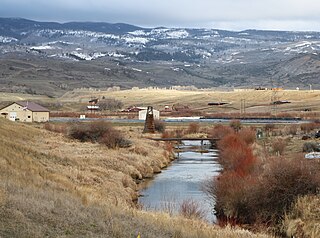
Muddy Creek is a tributary of the Colorado River, approximately 60.5 miles (97.4 km) long, in north central Colorado in the United States.

White River is a river, approximately 195 miles (314 km) long, in the U.S. states of Colorado and Utah and is a tributary of the Green River.

The Uncompahgre River is a tributary of the Gunnison River, approximately 75 mi (121 km) long, in southwestern Colorado in the United States. Lake Como at 12,215 ft (3723m) in northern San Juan County, in the Uncompahgre National Forest in the northwestern San Juan Mountains is the headwaters of the river. It flows northwest past Ouray, Ridgway, Montrose, and Olathe and joins the Gunnison at Confluence Park in Delta.

Fremont River is 95-mile (153 km) long river in southeastern Utah, United States that flows from the Johnson Valley Reservoir, which is located on the Wasatch Plateau near Fish Lake, southeast through Capitol Reef National Park to the Muddy Creek near Hanksville where the two rivers combine to form the Dirty Devil River, a tributary of the Colorado River.

Clear Creek is a tributary of the South Platte River, approximately 66 miles (106 km) long, in north central Colorado in the United States. The creek flows through Clear Creek Canyon in the Rocky Mountains directly west of Denver, descending through a long gorge to emerge on the Colorado Eastern Plains where it joins the South Platte. Clear Creek is unusual in that it is a stream named "creek" fed by a stream named "river". Fall River empties into Clear Creek along I-70 west of Idaho Springs, Colorado.

Plateau Creek is a tributary of the Colorado River, approximately 50 miles (80 km) long, located in western Colorado in the United States. It drains a cattle ranching valley, known as Plateau Valley, north of the Grand Mesa and east of Grand Junction.
The Roan Cliffs are a series of desert mountains and cliffs in eastern Utah and western Colorado, in the western United States that are distinct from the Book Cliffs.

Roan Creek is a tributary of the Watauga River that rises near the border between the U.S. states of Tennessee and North Carolina. Its source is located along the slopes of Snake Mountain near Trade in Johnson County, Tennessee. From its source, Roan Creek flows north, then turns west around the northern end of Stone Mountain. Then it flows south and west through Cherokee National Forest in the valley between Stone Mountain and Doe Mountain, until entering the Watauga River and Watauga Lake, the reservoir behind Watauga Dam. Its waters eventually flow through the Watauga River, the Holston River, the Tennessee River, the Ohio River, and the Mississippi River to the Gulf of Mexico.

Kanab Creek is one of the many tributaries of the Grand Canyon. It begins in Kane County, Utah, just south of the watershed to the Great Basin and flows 125 miles (201 km) south to the Colorado River. It passes Kanab, Utah, crossing the border to Arizona near Fredonia. It flows through the Kaibab Indian Reservation of the Paiute people and the 1984-designated Kanab Creek Wilderness, a wilderness area, before its mouth in the Grand Canyon National Park.
Crow Creek is a 153-mile-long (246 km) waterway of southeastern Wyoming and northern Colorado. Crow Creek is formed by the merger of the South Fork of Crow Creek with the Middle fork of Crow Creek, with the quick addition of the North Fork of Crow Creek about 1.5 miles (2.4 km) downstream. All the major tributaries of Crow Creek begin in the Laramie Range and flow eastward. The headwaters of the North Fork are dammed to form North Crow reservoir, which supplies the city of Cheyenne. The middle fork is also dammed forming Granite and Crystal reservoirs, also supplying water for Cheyenne. The South Fork is the only unobstructed section and flows most of the year but not all the way to Cheyenne. Other tributaries of Crow Creek below the reservoirs are Sand Creek, Spring Creek and Brush Creek, none of which flow year round. Crow Creek continues in an eastward direction passing through the city of Cheyenne, and then heads east and south into Colorado where it eventually meets the South Platte River.
Parachute Creek is a 14.7-mile-long (23.7 km) tributary of the Colorado River in Garfield County, Colorado.
Middle Fork Elk River is a 3.5-mile-long (5.6 km) stream in Colorado. It flows from a confluence of Gilpin Creek and Gold Creek in Routt National Forest north of Steamboat Springs to a confluence with the North Fork Elk River that forms the Elk River.
Vermillion Creek is a 67.5-mile-long (108.6 km) tributary of the Green River. It flows south from Sweetwater County, Wyoming to a confluence with the Green River just north of the Gates of Lodore in Moffat County, Colorado.
Yellow Creek is a 24.7-mile-long (39.8 km) tributary of the White River in Rio Blanco County, Colorado.
Kiowa Creek is a 123-mile-long (198 km) tributary that flows northeast into the South Platte River in Morgan County, Colorado near Orchard. The creek's source is in the Black Forest of El Paso County, northeast of Colorado Springs, Colorado. Kiowa Creek rises in the highlands of the Colorado Piedmont and is subject to occasional flash floods.
North Fork Elk River, or North Fork Elk Creek is a 15.2-mile-long (24.5 km) tributary of the Elk River in Routt County, Colorado. It flows from a source on the northeast slopes of Big Agnes Mountain in the Mount Zirkel Wilderness to a confluence with the Middle Fork Elk River that forms the Elk River.

The Williams Fork is a tributary of the Colorado River, approximately 33.8 miles (54.4 km) long, in north central Colorado in the United States. It flows through Grand County between the valleys of the Fraser River and the Blue River. It rises at the juncture of McQueary and Bobtail creeks just west of the Continental Divide 8 miles (13 km) west of Berthoud Pass and 7 miles (11 km) north of the Eisenhower Tunnel in the Arapaho National Forest. It flows north-northwest to the Williams Fork Reservoir, then turns northeast and joins the Colorado at Parshall.

Willow Creek is a major north-flowing stream in Utah, United States, and is a tributary of the Green River. The creek drains a large remote area of the East Tavaputs Plateau, flowing into the Green River south of Ouray.


