The San Luis Valley is a region in south-central Colorado with a small portion overlapping into New Mexico. It is the headwaters of the Rio Grande. It contains 6 counties and portions of 3 others. The San Luis Valley was ceded to the United States by Mexico following the Mexican–American War. Hispanic settlers began moving north and settling in the valley after the United States made a treaty with the Utes and established a fort. Prior to the Mexican war the Spanish and Mexican governments had reserved the valley to the Utes, their allies. During the 19th century Anglo settlers settled in the valley and engaged in mining, ranching, and irrigated agriculture. Today the valley has a diverse Anglo and Hispanic population.

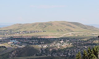
Castle Rock is a home rule municipality that is the county seat of Douglas County, Colorado, United States. The most populous municipality of the county, it had a population of 48,231 at the 2010 United States Census, with an estimated population of 64,484 as of 2019. It is named for the prominent, castle-tower-shaped butte near the center of town. Midway between Denver and Colorado Springs, Castle Rock is part of the Denver metropolitan area and the Front Range Urban Corridor.

Summit County is one of the 64 counties in the U.S. state of Colorado. As of the 2010 census, the population was 27,994. The county seat is Breckenridge.

Rio Grande County is one of the 64 counties of the U.S. state of Colorado. As of the 2010 census, the population was 11,982. The county seat is Del Norte. The county is named for the Rio Grande, which flows through the county.

Las Animas County is one of the 64 counties in the U.S. state of Colorado. As of the 2010 census, the population was 15,507. The county seat is Trinidad. The county takes its name from the Mexican Spanish name of the Purgatoire River, originally called El Río de las Ánimas Perdidas en el Purgatorio, which means "River of the Lost Souls in Purgatory."

Ridgway, coined Gateway to the San Juans, is a Home Rule Municipality in Ouray County, in the southwestern portion of the U.S. State of Colorado. The town is a former railroad stop on the Uncompaghre River in the northern San Juan Mountains. The town population was 713 at the 2000 census and 924 according to the 2010 census.

The Gunnison River is a tributary of the Colorado River, 180 miles (290 km) long, in the Southwestern state of Colorado. It is the largest tributary of the Colorado River in Colorado, with a mean flow of 2,570 cu ft/s (73 m3/s).

There are more than 1,500 properties and historic districts in Colorado listed on the National Register of Historic Places. They are distributed over 63 of Colorado's 64 counties; only Broomfield County has none.

The Rio Chama, a major tributary river of the Rio Grande, is located in the U.S. states of Colorado and New Mexico. The river is about 130 miles (210 km) long altogether. From its source to El Vado Dam its length is about 50 miles (80 km), from El Vado Dam to Abiquiu Dam is about 51 miles (82 km), and from Abiquiu Dam to its confluence with the Rio Grande is about 34 miles (55 km).

The Cochiti Dam is an earthen fill dam located on the Rio Grande in Sandoval County, New Mexico, approximately 50 miles (80 km) north of Albuquerque, New Mexico, in the United States. By volume of material, it is the 23rd largest dam in the world at 62,849,000 yd3 of material, one of the ten largest such dams in the United States, and the eleventh largest such dam in the world. Cochiti Dam is one of the four United States Army Corps of Engineers projects for flood and sediment control on the Rio Grande system, operating in conjunction with Abiquiu Dam, Galisteo Dam and Jemez Canyon Dam.

The Piedra River is a river in the U.S. state of Colorado. It drains parts of Archuleta, Hinsdale, and Mineral counties along a mainstem length of about 40 miles (64 km). The river flows through a series of isolated box canyons, emptying into the San Juan River at Navajo Lake. Its name stems from the Spanish word, piedra, meaning rock.

Vega State Park is a 1,823-acre (738 ha) Colorado state park in Mesa County, Colorado in the United States. Vega Reservoir is a fishing destination and is located at an elevation of 7,696 feet (2,346 m). Year-round recreational activities at Vega State Park include boating, hiking, snowmobiling and camping. The park was established in 1967 in cooperation with the Bureau of Reclamation which was responsible for the construction of Vega Dam and Vega Reservoir.

Lakewood is a Home Rule Municipality which is the most populous municipality in Jefferson County, Colorado, United States. Lakewood is the fifth most populous city in the State of Colorado and the 172nd most populous city in the United States. The city population was 142,980 at the 2010 United States Census. Lakewood is west of Denver and is part of the Denver-Aurora-Lakewood, CO Metropolitan Statistical Area.

The Trinchera Cave Archeological District (5LA9555) is an archaeological site in Las Animas County, Colorado with artifacts primarily dating from 1000 BC to AD 1749, although there were some Archaic period artifacts found. The site was added to the National Register of Historic Places in 2001 and is located on State Trust Lands.

The Colorado Parks and Wildlife division of the U.S. State of Colorado manages more than 300 state wildlife areas with a total area of more than 860 square miles (2,230 km2) in the state. The Colorado state wildlife areas are managed for hunting, fishing, observation, management, and preservation of wildlife.

Mountain Home Reservoir is a reservoir and state wildlife area in Costilla County, Colorado, near Fort Garland. Frozen in winter, the reservoir lies at 2,483 meters elevation on the western slope of the Culebra Range of the Sangre de Cristo Mountains in southern Colorado.

Grape Creek is a tributary of the Arkansas River that flows through Custer and Fremont counties in South-Central Colorado. The creek drains much of the Wet Mountain Valley, located between the Sangre de Cristo Mountains and the Wet Mountains in Custer County.
Fishing in Colorado has brought in a large amount of revenue for the state. In 2019 Colorado Parks and Wildlife estimated outdoor recreation contributed roughly 62 billion dollars to the state economy. Fishing was reported to be the 5th most popular outdoor activity and 110, 511 fishing and hunting combination licenses were sold. Ice fishing makes up part of this total fishing revenue and is a common annual sport for Colorado residents and out-of-state visitors. There is no legal definition of ice fishing season. Rather, people begin to ice fish once the lakes freeze over with thick enough ice. Colorado Parks and Wildlife also recommend that people always ice-fish with another person. Typically, this starts in December and ends in April for Colorado. Lakes size, depth, elevation, and seasonal weather can cause variance to the season. Once the lakes freeze over with thick enough ice, anglers go out onto the ice, drill holes through the ice, and fish for a variety of species.

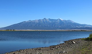
Smith Reservoir is located in Costilla County, Colorado, south of Blanca in the San Luis Valley. The reservoir is owned by the Trinchera Irrigation Company.


