Blanca, Colorado | |
---|---|
Location of the Town of Blanca in the United States. | |
Coordinates: 37°26′21″N105°30′49″W / 37.43917°N 105.51361°W [2] | |
Country | United States |
State | Colorado |
County | Costilla County [1] |
Incorporated (town) | September 07, 1900 [3] |
Government | |
• Type | Statutory Town [1] |
Area | |
• Total | 1.833 sq mi (4.747 km2) |
• Land | 1.833 sq mi (4.747 km2) |
• Water | 0.000 sq mi (0.000 km2) |
Elevation | 7,763 ft (2,366 m) |
Population | |
• Total | 322 |
• Density | 176/sq mi (68/km2) |
Time zone | UTC−07:00 (MST) |
• Summer (DST) | UTC−06:00 (MDT) |
ZIP code | 81123 [5] |
Area code | 719 |
FIPS code | 08-07190 |
GNIS feature ID | 2411696 [2] |
Blanca is a Statutory Town located in Costilla County, Colorado, United States. [1] The town population was 322 at the 2020 census. [4] Blanca is located in the enormous San Luis Valley.
The town, named for Blanca Peak, [6] was founded in August 1908 from a land lottery in the San Luis Valley of south central Colorado. It was incorporated in 1909. [7]
In the mid-1990s Polish settlers set up shop at the Red Rocks General Store selling liquor, beer, polish sausages, and other eastern European goods. Blanca is the region's main supplier of bilberry syrup. [8] Blanca is known for elk hunting and alpine trout fishing.
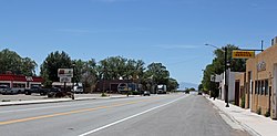
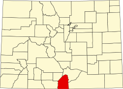
Blanca is located in the east of the San Luis Valley and northern Costilla County. The town lies along U.S. Route 160, 20 miles (32 km) east of Alamosa and 52 miles (84 km) west of Walsenburg.
At the 2020 United States Census, the town had an area of 1,173 acres (4.747 km2), all of it land. [4]
The region has a cool, dry climate, with 107 frost-free days each year. Temperatures range from −30 °F (−34 °C) to 85 °F (29 °C). Annual rainfall is about 7 inches (180 mm).
In areas not irrigated, dunes carry sparse vegetation such as greasewood, rubber rabbitbrush, salt grass, sandhill muhly and sand dropseed. The dunes are intermingled with depressions and basins of historical playas. The Blanca Wetlands, an Area of Critical Environmental Concern, lies northwest of the town. The wetlands receive groundwater for irrigation from the Closed Basin Project, which delivers groundwater to the Rio Grande. [9]
Census | Pop. | Note | %± |
---|---|---|---|
1920 | 380 | — | |
1930 | 252 | −33.7% | |
1940 | 407 | 61.5% | |
1950 | 376 | −7.6% | |
1960 | 233 | −38.0% | |
1970 | 212 | −9.0% | |
1980 | 252 | 18.9% | |
1990 | 272 | 7.9% | |
2000 | 391 | 43.8% | |
2010 | 385 | −1.5% | |
2020 | 322 | −16.4% | |
U.S. Decennial Census |
As of the census [10] of 2000, there were 391 people, 142 households, and 105 families in the town. The population density was 219.6 inhabitants per square mile (84.8/km2). There were 183 housing units at an average density of 102.8 per square mile (39.7/km2). The racial makeup was 53.45% White, 0.77% African American, 1.28% Native American, 2.81% Asian, 39.64% from other races, and 2.05% from two or more races. Hispanic or Latino of any race were 67.01%.
There were 142 households, of which 35.2% had children under 1, 63.4% were married couples living together, 7.7% a female householder with no husband present, and 25.4% were non-families. 21.1% of households were of individuals and 9.9% had someone living alone who was 65 or older. The average household size was 2.75 and the average family size 3.26.
In the town, the population was 27.9% under 18, 8.2% from 18 to 24, 27.9% from 25 to 44, 21.7% from 45 to 64, and 14.3% 65 or older. The median age was 37. For every 100 females, there were 106.9 males. For every 100 females 18 and over, there were 102.9 males.
The median income for a household in the town was $22,875, and the median income for a family $22,411. Males had a median income of $20,125 versus $15,833 for females. The per capita income for the town was $10,200. About 19.5% of families and 21.6% of the population were below the poverty line, including 29.1% of those under 18 and 11.3% of those 65 or over.
The San Luis Valley is a region in south-central Colorado with a small portion overlapping into New Mexico. The valley is approximately 122 miles (196 km) long and 74 miles (119 km) wide, extending from the Continental Divide on the northwest rim into New Mexico on the south. It contains 6 counties and portions of 3 others. It is an extensive high-elevation depositional basin of approximately 8,000 square miles (21,000 km2) with an average elevation of 7,664 feet (2,336 m) above sea level. The valley is a section of the Rio Grande Rift and is drained to the south by the Rio Grande, which rises in the San Juan Mountains to the west of the valley and flows south into New Mexico. The San Luis Valley has a cold desert climate but has substantial water resources from the Rio Grande and groundwater.
Alamosa is a home rule municipality and the county seat of Alamosa County, Colorado, United States. The city population was 9,806 in the 2020 United States Census. The city is the commercial center of the San Luis Valley in south-central Colorado, and is the home of Adams State University.
Taos County is a county in the U.S. state of New Mexico. As of the 2020 census, the population was 34,489. Its county seat is Taos. The county was formed in 1852 as one of the original nine counties in New Mexico Territory.
Colfax County is a county in the U.S. state of New Mexico. As of the 2020 census, the population was 12,387. Its county seat is Raton. It is south from the Colorado state line. This county was named for Schuyler Colfax (1823–1885), seventeenth Vice President of the United States under U.S. President Ulysses S. Grant.
Saguache County is a county located in the U.S. state of Colorado. As of the 2020 census, the population was 6,368. The county seat is Saguache.
Rio Grande County is a county located in the U.S. state of Colorado. As of the 2020 census, the population was 11,539. The county seat is Del Norte. The county is named for the Rio Grande, which flows through the county.
Las Animas County is a county located in the U.S. state of Colorado. As of the 2020 census, the population was 14,555. The county seat is Trinidad. The county takes its name from the Mexican Spanish name of the Purgatoire River, originally called El Río de las Ánimas Perdidas en el Purgatorio, which means "River of the Lost Souls in Purgatory."
Huerfano County is a county located in the U.S. state of Colorado. As of the 2020 census, the population was 6,820. The county seat is Walsenburg. The county, whose name comes from the Spanish huérfano meaning "orphan", was named for the Huerfano Butte, a local landmark. The area of Huerfano County boomed early in the 1900s with the discovery of large coal deposits. After large scale World War II coal demand ended in the 1940s Walsenburg and Huerfano saw a steady economic decline through 2015.
Costilla County is a county located in the U.S. state of Colorado. As of the 2020 census, the population was 3,499. The county seat is San Luis, the oldest continuously occupied town in Colorado.
Conejos County is a county located in the U.S. state of Colorado. As of the 2020 census, the population was 7,461. The county seat is the unincorporated community of Conejos.
Alamosa County is a county located in the U.S. state of Colorado. As of the 2020 census, the population was 16,376. The county seat is Alamosa. The county name is the Spanish language word for a grove of cottonwood trees.
Oceano is a census-designated place (CDP) in San Luis Obispo County, California, United States. The population was 7,183 at the 2020 census, down from 7,286 at the 2010 census.
Antonito is a Statutory Town located in Conejos County, Colorado, United States. The town population was 647 at the 2020 United States Census.
Founded in 1851, the Town of Manassa is a Statutory Town and is the most populous municipality in Conejos County, Colorado, United States. The town's population was 947 at the 2020 United States Census.
Fort Garland is an unincorporated town, a post office, and a census-designated place (CDP) located in and governed by Costilla County, Colorado, United States. The Fort Garland post office has the ZIP Code 81133. At the United States Census 2020, the population of the Fort Garland CDP was 464.
Naturita is a statutory town in Montrose County, Colorado, United States. The population was 485 at the 2020 census, down from 546 in 2010.
The Town of Center is a Statutory Town located in Saguache and Rio Grande counties in Colorado, United States. The town's population was 1,929 at the 2020 United States Census with 1,885 residing in Saguache County and 44 residing in Rio Grande County.
The Town of Moffat is a statutory town in Saguache County, Colorado, United States. The town population was 108 at the 2020 United States Census.
St. Paul is a town in Russell and Wise counties in the U.S. state of Virginia. The population was 970 at the 2010 census. Virginia City Hybrid Energy Center, which powers 150,000 homes, is located in St. Paul.
San Luis is a city in Yuma County, Arizona, United States. The population was 35,257 at the 2020 census. It is part of the Yuma Metropolitan Statistical Area. San Luis, located in the southwest corner of the state directly adjacent to Mexico's Federal Highway 2 at San Luis Rio Colorado, was the second fastest-growing city or town in Arizona from 1990 to 2000. According to 2022 Census Bureau estimates, the population of the city is 35,770.