Mesita, Colorado

Last updated
Mesita, Colorado
Mesita, Colorado.JPG
Mesita, viewed from the east along CR H.
USA Colorado location map.svg
Red pog.svg
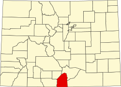
Location in Costilla County and the state of Colorado
Usa edcp location map.svg
Red pog.svg
Mesita, Colorado (the United States)
Coordinates: 37°05′52″N105°36′08″W / 37.09778°N 105.60222°W / 37.09778; -105.60222
Country Flag of the United States.svg  United States
State Flag of Colorado.svg  Colorado
County Costilla [1]
Elevation
[1]
7,674 ft (2,339 m)
Time zone UTC-7 (MST)
  Summer (DST) UTC-6 (MDT)
ZIP Code [2]
81152
Area code 719
GNIS feature [3] 0204792

Mesita (Spanish for "small table") is an unincorporated community located in Costilla County, Colorado, United States. The San Luis post office (Zip Code 81152) serves Mesita postal addresses. [2]

Contents

Reported UFO Activity

Mesita is reportedly the site of some of the San Luis Valley cow mutilations. Two cows and one horse were found east of Mesita with unexplainable mutilations, including a rectal coring, and signs of being dropped from a great height. [4]

Geography

Mesita is located at 37°05′52″N105°36′08″W / 37.09778°N 105.60222°W / 37.09778; -105.60222 (37.097908,-105.602131).

Related Research Articles

<span class="mw-page-title-main">Hooper, Colorado</span> Town in Colorado, United States

The Town of Hooper is a Statutory Town located in the San Luis Valley in Alamosa County, Colorado, United States. The population was 81 at the 2020 census.

<span class="mw-page-title-main">Manassa, Colorado</span> Town in Colorado, United States

The Town of Manassa is the Statutory Town that is the most populous municipality in Conejos County, Colorado, United States. The town population was 947 at the 2020 United States Census.

<span class="mw-page-title-main">Romeo, Colorado</span> Town in Colorado, United States

Romeo is a Statutory Town in Conejos County, Colorado, United States. The population was 302 at the 2020 census. A post office called Romeo was established in 1901. The community derives its name from the surname Romero.

<span class="mw-page-title-main">Sanford, Colorado</span> Town in Conejos County, Colorado, United States

Sanford is a statutory town in Conejos County, Colorado, United States. The population was 879 at the 2020 census.

<span class="mw-page-title-main">Blanca, Colorado</span> Town in Colorado, United States

The Town of Blanca is a Statutory Town located in Costilla County, Colorado, United States. The town population was 322 at the 2020 census. Blanca is located in the enormous San Luis Valley.

<span class="mw-page-title-main">San Luis, Colorado</span> Town in Colorado, United States

San Luis is a statutory town that is the county seat and the most populous town of Costilla County, Colorado, United States. Formerly known as San Luis de la Culebra, it is the oldest continuously occupied town in Colorado. The population was 598 at the 2020 census.

<span class="mw-page-title-main">Monte Vista, Colorado</span> City in Rio Grande County, Colorado, United States

The City of Monte Vista is the home rule municipality that is the most populous municipality in Rio Grande County, Colorado, United States. The city population was 4,247 at the 2020 Census.

<span class="mw-page-title-main">Jefferson, Colorado</span> Unincorporated community in Park County, Colorado, United States

Jefferson is an unincorporated community in Park County, Colorado, United States.

<span class="mw-page-title-main">Jaroso, Colorado</span> Unincorporated community in Colorado, United States

Jaroso is an unincorporated community and a U.S. Post Office located in Costilla County, Colorado, United States. The Jaroso Post Office has the ZIP Code 81138.

<span class="mw-page-title-main">Mosca, Colorado</span> Unincorporated community in Colorado, United States

Mosca is an unincorporated community and a U.S. Post Office in Alamosa County, Colorado, United States. It was named for the nearby Mosca Pass, which was named for the Spanish explorer, Luis de Moscoso Alvarado. The Mosca Post Office has the ZIP Code 81146.

<span class="mw-page-title-main">Chama, Colorado</span> Unincorporated community in State of Colorado, United States

Chama is an unincorporated community and U.S. Post Office in Costilla County, Colorado, United States. The ZIP Code of the Chama Post Office is 81126.

<span class="mw-page-title-main">Garcia, Colorado</span> Unincorporated community in Colorado, United States

Garcia is an unincorporated community located in Costilla County, Colorado, United States. The San Luis post office (Zip Code 81152) serves Garcia postal addresses.

<span class="mw-page-title-main">Masonville, Colorado</span> Unincorporated community in Colorado, United States

Masonville is an unincorporated community and a U.S. Post Office in Larimer County, Colorado, United States. The Masonville Post Office has the ZIP Code 80541.

<span class="mw-page-title-main">Model, Colorado</span> Unincorporated community in Colorado, United States

Model is an abandoned unincorporated village in Las Animas County, Colorado, United States. The Model Post Office serving ZIP Code 81059 was in operation from 1912 to 2021, and was the last business or service standing there for many years. The community originally was a planned, or "model" community, hence the name.

Pinecliffe is a U.S. Post Office and an unincorporated community located in Boulder County and Gilpin County, Colorado, United States. The Pinecliffe Post Office, in Boulder County, has the ZIP Code 80471.

San Pablo is an unincorporated community located in Costilla County, Colorado, United States. The San Luis post office (Zip Code 81152) serves San Pablo postal addresses. San Pablo is located in the Rio Culebra valley of the Sangre de Cristo Land Grant which was awarded to the family of Carlos Beaubien in 1843.

<span class="mw-page-title-main">Wetmore, Colorado</span> Unincorporated community in Custer County, Colorado, United States

Wetmore is an unincorporated community and a U.S. Post Office located in Custer County, Colorado, United States.

<span class="mw-page-title-main">Costilla, New Mexico</span> Census-designated place in New Mexico, United States

Costilla is a census-designated place in Taos County, New Mexico, United States. Its population was 205 as of the 2010 census. Costilla has a post office with ZIP code 87524. State roads 196 and 522 intersect in the community.

<span class="mw-page-title-main">San Cristobal, New Mexico</span> Census-designated place in New Mexico, United States

San Cristobal is a census-designated place in Taos County, New Mexico. Its population was 273 as of the 2010 census. San Cristobal has a post office with ZIP code 87564, which opened on February 16, 1932.

<span class="mw-page-title-main">San Luis Hills</span>

The San Luis Hills are a group of small mountain ranges in Conejos and Costilla counties in the San Luis Valley in southern Colorado. The individual mountain ranges that make up the San Luis Hills include the Fairy Hills, the Brownie Hills, the Piñon Hills, and the South Piñon Hills. The San Luis Hills' highest point is Flat Top, elevation 9,206 feet

References

  1. 1 2 "US Board on Geographic Names". United States Geological Survey. 2007-10-25. Retrieved 2008-01-31.
  2. 1 2 "Look Up a ZIP Code". United States Postal Service . Retrieved February 19, 2021.
  3. "U.S. Board on Geographic Names: Domestic Names". United States Geological Survey . Retrieved February 19, 2021.
  4. O'Brien, Christopher (June 2007). Secrets of the Mysterious Valley. Ventures Unlimited Press. p. 441. ISBN   1-931882-66-5.