San Pablo, Colorado | |
|---|---|
 Looking southeast along County Road 21 in San Pablo | |
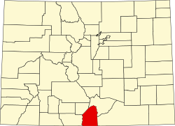
 Location in Costilla County and the state of Colorado  San Pablo, Colorado (the United States) | |
| Coordinates: 37°08′57″N105°23′49″W / 37.14917°N 105.39694°W | |
| Country | |
| State | |
| County | Costilla County [1] |
| Elevation | 8,094 ft (2,467 m) |
| Time zone | UTC-7 (MST) |
| • Summer (DST) | UTC-6 (MDT) |
| ZIP Code [2] | 81152 |
| Area code | 719 |
| GNIS feature | 193028 [1] |
San Pablo is an unincorporated community located in Costilla County, Colorado, United States. The San Luis post office (Zip Code 81152) serves San Pablo postal addresses. [2] San Pablo is located in the Rio Culebra valley of the Sangre de Cristo Land Grant which was awarded to the family of Carlos Beaubien in 1843.