List of rivers of Maryland

Last updated

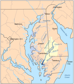
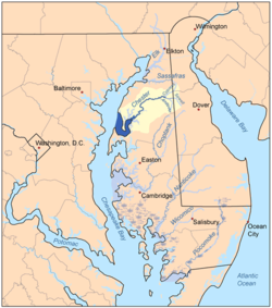
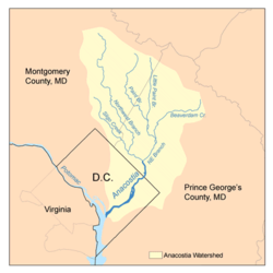
List of rivers of Maryland (U.S. state).

The list is arranged by drainage basin from east to west, with respective tributaries indented under each larger stream's name and ordered from downstream to upstream.

Contents

By drainage basin

Pocomoke River watershed Pocomokemap.png
Pocomoke River watershed

Delaware River

Atlantic Ocean

Chesapeake Bay Eastern Shore

Nanticoke River watershed Nanticokemap.png
Nanticoke River watershed
Choptank River watershed Choptankmap.png
Choptank River watershed
Chester River watershed Chestermdmap.png
Chester River watershed
Susquehanna River watershed Sub-watersheds of the Susquehanna River.png
Susquehanna River watershed
Oblique view of Susquehanna River in Maryland Susquehanna River mouth Maryland June 2021.jpg
Oblique view of Susquehanna River in Maryland

Susquehanna River

Chesapeake Bay Western Shore

Patapsco River watershed Patapscomap.png
Patapsco River watershed
Patuxent River watershed Patuxentrivermap.png
Patuxent River watershed

Potomac River

Potomac River watershed Potomac watershed.png
Potomac River watershed

Mississippi River

Alphabetically

See also

Related Research Articles

<span class="mw-page-title-main">Potomac River</span> River in the Mid-Atlantic United States

The Potomac River is a major river in the Mid-Atlantic region of the United States that flows from the Potomac Highlands in West Virginia to the Chesapeake Bay in Maryland. It is 405 miles (652 km) long, with a drainage area of 14,700 square miles (38,000 km2), and is the fourth-largest river along the East Coast of the United States and the 21st-largest in the United States. More than 5 million people live within its watershed.

<span class="mw-page-title-main">Monocacy River</span> River in Maryland, United States

The Monocacy River is a free-flowing left tributary to the Potomac River, which empties into the Atlantic Ocean via the Chesapeake Bay. The river is 58.5 miles (94.1 km) long, with a drainage area of about 970 square miles (2,500 km2). It is the largest Maryland tributary to the Potomac.

<span class="mw-page-title-main">Conococheague Creek</span> Stream in the U.S. states of Pennsylvania and Maryland

Conococheague Creek, a tributary of the Potomac River, is a free-flowing stream that originates in Pennsylvania and empties into the Potomac River near Williamsport, Maryland. It is 80 miles (129 km) in length, with 57 miles (92 km) in Pennsylvania and 23 miles (37 km) in Maryland. The watershed of Conococheague Creek has an area of approximately 566 square miles (1,470 km2), out of which only 65 square miles (170 km2) are in Maryland.

<span class="mw-page-title-main">Casselman River</span> Stream in Pennsylvania, USA

The Casselman River is a 56.5-mile-long (90.9 km) tributary of the Youghiogheny River in western Maryland and Pennsylvania in the United States. The Casselman River drains an area of 576 square miles.

<span class="mw-page-title-main">Goose Creek (Potomac River tributary)</span> River in Virginia, United States

Goose Creek is a 53.9-mile-long (86.7 km) tributary of the Potomac River in Fauquier and Loudoun counties in northern Virginia. It comprises the principal drainage system for the Loudoun Valley.

<span class="mw-page-title-main">Great Indian Warpath</span> Trails in eastern North America used by Native Americans

The Great Indian Warpath (GIW)—also known as the Great Indian War and Trading Path, or the Seneca Trail—was that part of the network of trails in eastern North America developed and used by Native Americans which ran through the Great Appalachian Valley. The system of footpaths extended from what is now upper New York to deep within Alabama. Various Native peoples traded and made war along the trails, including the Catawba, numerous Algonquian tribes, the Cherokee, and the Iroquois Confederacy. The British traders' name for the route was derived from combining its name among the northeastern Algonquian tribes, Mishimayagat or "Great Trail", with that of the Shawnee and Delaware, Athawominee or "Path where they go armed".

<span class="mw-page-title-main">Double Pipe Creek</span> Stream in the U.S. state of Maryland

Double Pipe Creek, sometimes called Pipe Creek, is a major tributary of the Monocacy River in Carroll County and Frederick County in Maryland, located several miles north and west of Westminster. The creek is only 1.6 miles (2.6 km) long, but is formed by the confluence of two much longer streams, Big Pipe Creek and Little Pipe Creek.

Tuscarora Creek is a 7.7-mile-long (12.4 km) tributary of the Monocacy River in Frederick County, Maryland, in the United States.

The Chesapeake and Ohio Canal (C&O) used 11 navigable aqueducts to carry the canal over rivers and streams that were too wide for a culvert to contain. Aqueducts, like locks and other masonry structures, were called "works of art" by the canal board of directors.

Seneca Dam was the last in a series of dams proposed on the Potomac River in the area of the Great Falls of the Potomac. Apart from small-scale dams intended to divert water for municipal use in the District of Columbia and into the Chesapeake and Ohio Canal, no version of any scheme was ever built. In most cases the proposed reservoir would have extended upriver to Harpers Ferry, West Virginia. The project was part of a program of as many as sixteen major dams in the Potomac watershed, most of which were never built.

References

  1. "Rivers, Maryland". Maryland Manual On-line. Maryland . Retrieved 20 October 2015.