Fishing Bay | |
---|---|
Location | Dorchester County, Maryland [1] |
Coordinates | 38°18′11″N76°01′14″W / 38.30306°N 76.02056°W |
Type | Bay |
Part of | Chesapeake Bay [1] |
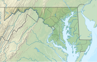
Fishing Bay is a large saltwater bay in Dorchester County, Maryland. From tributaries to its north in the Blackwater National Wildlife Refuge and Fishing Bay Wildlife Management Area, it flows south into the Chesapeake Bay. Its borders are formed by Elliot's Island to the east, and the greater bulk of Dorchester County to the west.
Dorchester County is a county located in the U.S. state of Maryland. At the 2020 census, the population was 32,531. Its county seat is Cambridge. The county was formed in 1669 and named for the Earl of Dorset, a family friend of the Calverts. The county is part of the Mid-Eastern Shore region of the state.
The Delmarva Peninsula, or simply Delmarva, is a large peninsula on the East Coast of the United States, occupied by the vast majority of the state of Delaware and parts of the Eastern Shore of Maryland and Eastern Shore of Virginia.
Berkeley County is a county in the U.S. state of South Carolina. As of the 2020 census, its population was 229,861. Its county seat is Moncks Corner, and the largest community is Goose Creek. After two previous incarnations of Berkeley County, the current county was created in 1882. Berkeley County is included in the Charleston-North Charleston, SC Metropolitan Statistical Area.
The River Frome is a river in Dorset in the south of England. At 30 miles (48 km) long it is the major chalkstream in southwest England. It is navigable upstream from Poole Harbour as far as the town of Wareham.
San Pablo Bay is a tidal estuary that forms the northern extension of the San Francisco Bay in the East Bay and North Bay regions of the San Francisco Bay Area in northern California.
The Eastern Shore of Maryland is a part of the U.S. state of Maryland that lies mostly on the east side of the Chesapeake Bay. Nine counties are normally included in the region. The Eastern Shore is part of the larger Delmarva Peninsula that Maryland shares with Delaware and Virginia.
The Tiger Bay State Forest is in the U.S. state of Florida. The 27,330-acre (11,060 ha) forest is located in Volusia County, Florida, between Daytona Beach and DeLand.
Maryland Route 335 is a state highway in the U.S. state of Maryland. The state highway runs 16.36 miles (26.33 km) from the upper end of Hooper's Island north to MD 16 in Church Creek. MD 335 provides access to several communities along the Honga River in southern Dorchester County. The state highway also passes through Blackwater National Wildlife Refuge. MD 335 was designated as one of the original state roads, but only the portion of the highway from Crossroads to the Blackwater River was completed by the early 1920s. The highway was constructed from Crossroads to Golden Hill in the mid-1920s, from Crossroads to Church Creek in the late 1920s, and from Golden Hill to Hooper's Island with the completion of a modern bridge over Fishing Creek in 1934.
Taylors Island is an unincorporated community and census-designated place in Dorchester County, Maryland, United States, in the state's Eastern Shore region. The population was 173 at the 2010 census. It is known for hunting, crabbing and fishing. Ridgeton Farm was listed on the National Register of Historic Places in 1977. Bethlehem Methodist Episcopal Church and Grace Episcopal Church Complex were listed in 1979.
Tobico Marsh, located just north of Bay City, Michigan, is part of the Bay City Recreation Area. Tobico Marsh was designated as a registered National Natural Landmark in 1976 because of its large size, relatively undisturbed condition and variety of aquatic plant life. With nearly 2,000 acres (8.1 km2) of wetland woods, wet meadows, cattail marshlands and oak savannah prairies, Tobico Marsh is one of the largest remaining freshwater, coastal wetlands on the Great Lakes.
The Blackwater River is a 25.8-mile-long (41.5 km) saltwater river in Dorchester County, Maryland. It has many twists and bends and flows through Blackwater National Wildlife Refuge. It runs through Robbins, where there is a boat ramp called Shorter's Wharf and a bridge.
Hoopers Island is a chain of islands in Dorchester County, Maryland, United States. Upper Hoopers Island and Lower Hoopers Island are surrounded by water with the Chesapeake Bay on the left side and the Honga River on the right side. The remote set of islands has much wildlife and is well known for sport fishing and crabbing industries. Hoopers Island was issued one of the earliest land grants in Dorchester County, Maryland.
Fishing Bay Wildlife Management Area is a Wildlife Management Area in Dorchester County, Maryland. The area is the largest wildlife management area in Maryland. Adjoining Blackwater National Wildlife Refuge, the area is about 80 percent tidal marshland.
Bill Burton Fishing Pier State Park is a public recreation area on the Choptank River in Trappe, Maryland. The state park preserves portions of the former Choptank River Bridge as a pier, and includes 25 acres (10 ha) of land upriver from the pier in Talbot County.
Glenn Martin National Wildlife Refuge includes the northern half of Smith Island, which lies 11 miles (18 km) west of Crisfield, Maryland, and Watts Island, which is located between the eastern shore of Virginia and Tangier Island. Both islands are situated in the lower Chesapeake Bay.
Pocomoke Sound is a bay of the Chesapeake Bay that forms part of the boundary between the Eastern Shores of Maryland and Virginia. The Pocomoke River is the largest stream feeding into the Sound, which is bounded by Somerset County, Maryland on the north, Worcester County, Maryland, Accomack County, Virginia, and Beasley Bay on the east, the Chesapeake Bay on the south, and Tangier Sound on the west. Its southwesternmost point may be considered to be Watts Island, Virginia.
Colonial Dorchester State Historic Site sits along the Ashley River, near the town of Summerville in Dorchester County, South Carolina. In 1969, the site was donated to the South Carolina State Park Service and was added to the National Register of Historic Places on December 2, 1969. Currently the site of a 325-acre park, Old Dorchester State Park offers visitors a glimpse into South Carolina's Colonial past. The park boasts one of the most well-preserved oyster-shell tabby forts in the country, St. George's Bell Tower, log shipping wharves, burial sites and cemeteries, as well as on-going archaeological digs that are still unearthing the settlement's history.
Assawoman Wildlife Area is a state wildlife area located in Sussex County, Delaware located near Frankfort, Delaware and Little Assawoman Bay. It is made up of three large tracts of land that total 3,100 acres (1,300 ha) that were originally former farms that were lost due to the Great Depression, and managed by the Delaware Department of Natural Resources and Environmental Control (DNREC). The wildlife areas name came from the nearby Little Assawoman Bay which was originally named Assateague, an Algonkian word meaning "stream or inlet in the middle" before it was changed to another Algonkian name which means "midway fishing stream."
The Chicamacomico River is a 16.3-mile-long (26.2 km) river in southern Maryland in the United States. It starts in northern Dorchester County and flows to the southwest ending within the Blackwater National Wildlife Refuge, approximately 152 feet (46 m) wide at its mouth on the east bank of the Transquaking River, near the Chesapeake Bay to the west. The Chicamacomico River has a watershed area of about 51.6 square miles (134 km2).
The Transquaking River is a 23.2-mile-long (37.3 km) river in southern Maryland in the United States. It starts in northern Dorchester County and flows south-southwest ending just outside of the Blackwater National Wildlife Refuge, approximately 2,828 feet (862 m) wide at its mouth on the north bank of the Fishing Bay, near the Chesapeake Bay to the southwest. The Transquaking River has a watershed area of about 110.8 square miles (287 km2).