Dalecarlia Reservoir | |
---|---|
Location | Bethesda, Maryland / Washington, D.C., U.S. |
Coordinates | 38°56′33.0216″N77°6′36.1548″W / 38.942506000°N 77.110043000°W |
Type | Reservoir |
Primary inflows | Washington Aqueduct |
Basin countries | United States |
Surface area | 50 acres (20 ha) |
Surface elevation | 148 ft (45 m) [1] |
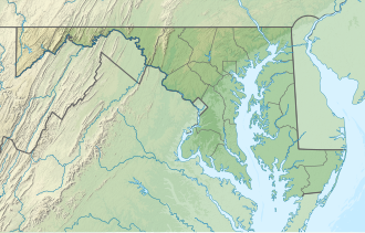
Dalecarlia Reservoir is the primary storage basin for drinking water in Washington, D.C., and Arlington County, Virginia. The reservoir is fed by an underground aqueduct in turn fed by low dams which divert portions of the Potomac River near Great Falls and Little Falls. [2] The reservoir is located between Spring Valley and the Palisades, two neighborhoods in Northwest Washington, D.C., and Brookmont, a neighborhood in Montgomery County, Maryland.
The 50-acre (200,000 m2) reservoir was completed in 1858 by the United States Army Corps of Engineers (USACE) as part of the Washington Aqueduct project. [3] It began providing water on January 3, 1859. [4] Initially the reservoir provided water to the city from the adjacent Little Falls Branch until the aqueduct construction was completed. Regular water service from the Potomac River source through the aqueduct commenced in 1864. The reservoir was modified in 1895 and 1935 to improve water quality and increase water supply. [5] : 75, 99
In the 1920s a water purification plant was built adjacent to the reservoir. The rapid sand filter plant began operation in 1927. [5] : 101–105 [6]
In 1942, the headquarters of the Army Map Service was established on the grounds adjacent to the reservoir; several buildings constructed in the 1940s still exist. In 1946, its headquarters moved to the nearby Sumner Site, which is today the Intelligence Community Campus-Bethesda. [7]
Until the early 21st century, the semi-solid residuals (sludge) produced by the treatment plant were periodically discharged to the Potomac River. The U.S. Environmental Protection Agency (EPA) required USACE to halt most of these discharges, and a residuals handling facility was built on site, which went into operation in 2012. [8] [9]
The reservoir and water treatment plant are operated by the Washington Aqueduct, Baltimore District, U.S. Army Corps of Engineers. [10]
According to the Köppen Climate Classification system, the area has a humid subtropical climate, abbreviated "Cfa" on climate maps. The hottest temperature recorded at Dalecarlia Reservoir was 105 °F (40.6 °C) on August 17, 1997, while the coldest temperature recorded was −11 °F (−23.9 °C) on January 21, 1985. [11]
Climate data for Dalecarlia Reservoir, Maryland, 1991–2020 normals, extremes 1948–present | |||||||||||||
---|---|---|---|---|---|---|---|---|---|---|---|---|---|
Month | Jan | Feb | Mar | Apr | May | Jun | Jul | Aug | Sep | Oct | Nov | Dec | Year |
Record high °F (°C) | 79 (26) | 82 (28) | 91 (33) | 95 (35) | 98 (37) | 100 (38) | 103 (39) | 105 (41) | 99 (37) | 95 (35) | 87 (31) | 82 (28) | 105 (41) |
Mean maximum °F (°C) | 65.7 (18.7) | 68.0 (20.0) | 77.9 (25.5) | 87.1 (30.6) | 91.9 (33.3) | 96.0 (35.6) | 98.0 (36.7) | 96.6 (35.9) | 92.1 (33.4) | 84.4 (29.1) | 75.3 (24.1) | 67.2 (19.6) | 99.3 (37.4) |
Mean daily maximum °F (°C) | 42.9 (6.1) | 46.4 (8.0) | 54.8 (12.7) | 67.6 (19.8) | 75.7 (24.3) | 84.0 (28.9) | 88.2 (31.2) | 86.2 (30.1) | 79.4 (26.3) | 68.0 (20.0) | 56.4 (13.6) | 46.9 (8.3) | 66.4 (19.1) |
Daily mean °F (°C) | 34.2 (1.2) | 36.8 (2.7) | 44.2 (6.8) | 55.6 (13.1) | 64.7 (18.2) | 73.4 (23.0) | 78.1 (25.6) | 76.3 (24.6) | 69.3 (20.7) | 57.4 (14.1) | 46.4 (8.0) | 38.3 (3.5) | 56.2 (13.5) |
Mean daily minimum °F (°C) | 25.5 (−3.6) | 27.3 (−2.6) | 33.5 (0.8) | 43.6 (6.4) | 53.7 (12.1) | 62.8 (17.1) | 68.0 (20.0) | 66.3 (19.1) | 59.2 (15.1) | 46.8 (8.2) | 36.4 (2.4) | 29.6 (−1.3) | 46.1 (7.8) |
Mean minimum °F (°C) | 9.2 (−12.7) | 13.2 (−10.4) | 18.5 (−7.5) | 29.0 (−1.7) | 39.2 (4.0) | 50.1 (10.1) | 57.6 (14.2) | 55.3 (12.9) | 45.6 (7.6) | 31.9 (−0.1) | 22.4 (−5.3) | 16.3 (−8.7) | 7.8 (−13.4) |
Record low °F (°C) | −11 (−24) | −1 (−18) | 5 (−15) | 17 (−8) | 23 (−5) | 30 (−1) | 42 (6) | 41 (5) | 31 (−1) | 16 (−9) | 8 (−13) | −2 (−19) | −11 (−24) |
Average precipitation inches (mm) | 3.32 (84) | 3.24 (82) | 4.15 (105) | 3.53 (90) | 4.44 (113) | 4.24 (108) | 5.11 (130) | 4.42 (112) | 4.54 (115) | 4.40 (112) | 3.32 (84) | 3.81 (97) | 48.52 (1,232) |
Average snowfall inches (cm) | 2.9 (7.4) | 1.4 (3.6) | 0.7 (1.8) | 0.0 (0.0) | 0.0 (0.0) | 0.0 (0.0) | 0.0 (0.0) | 0.0 (0.0) | 0.0 (0.0) | 0.0 (0.0) | 0.0 (0.0) | 0.8 (2.0) | 5.8 (14.8) |
Average precipitation days (≥ 0.01 in) | 10.0 | 9.3 | 11.5 | 11.1 | 11.7 | 10.1 | 10.3 | 9.5 | 9.5 | 9.4 | 9.4 | 11.0 | 122.8 |
Average snowy days (≥ 0.1 in) | 1.5 | 1.1 | 0.5 | 0.0 | 0.0 | 0.0 | 0.0 | 0.0 | 0.0 | 0.0 | 0.0 | 0.7 | 3.8 |
Source 1: NOAA [12] | |||||||||||||
Source 2: National Weather Service [11] |
The Potomac River is a major river in the Mid-Atlantic region of the United States that flows from the Potomac Highlands in West Virginia to the Chesapeake Bay in Maryland. It is 405 miles (652 km) long, with a drainage area of 14,700 square miles (38,000 km2), and is the fourth-largest river along the East Coast of the United States and the 21st-largest in the United States. More than 5 million people live within its watershed.
The United States Army Corps of Engineers (USACE) is a direct reporting unit and engineer formation of the United States Army that has three primary mission areas: Engineer Regiment, military construction, and civil works. The day-to-day activities of the three mission areas are administered by a lieutenant general known as the chief of engineers/commanding general. The chief of engineers commands the Engineer Regiment, comprising combat engineer, rescue, construction, dive, and other specialty units, and answers directly to the Chief of Staff of the Army. Combat engineers, sometimes called sappers, form an integral part of the Army's combined arms team and are found in all Army service components: Regular Army, National Guard, and Army Reserve. Their duties are to breach obstacles; construct fighting positions, fixed/floating bridges, and obstacles and defensive positions; place and detonate explosives; conduct route clearance operations; emplace and detect landmines; and fight as provisional infantry when required. For the military construction mission, the chief of engineers is directed and supervised by the Assistant Secretary of the Army for installations, environment, and energy, whom the President appoints and the Senate confirms. Military construction relates to construction on military bases and worldwide installations.
The Palisades, or simply Palisades, is a neighborhood in Washington, D.C., along the Potomac River, running roughly from the edge of the Georgetown University campus to the D.C.-Maryland boundary.
The Chesapeake and Ohio Canal National Historical Park is located in the District of Columbia and the state of Maryland. The park was established in 1961 as a National Monument by President Dwight D. Eisenhower to preserve the neglected remains of the Chesapeake and Ohio Canal and many of its original structures.
Montgomery Cunningham Meigs was a career United States Army officer and civil engineer, who served as Quartermaster General of the U.S. Army during and after the American Civil War. Meigs strongly opposed secession and supported the Union. His record as Quartermaster General was regarded as outstanding, both in effectiveness and in ethical probity, and Secretary of State William H. Seward viewed Meigs' leadership and contributions as key factors in the Union victory in the war.
Jennings Randolph Lake is a reservoir of 952 acres (3.85 km2) located on the North Branch Potomac River in Garrett County, Maryland and Mineral County, West Virginia. It is approximately 8 miles (13 km) upstream of Bloomington, Maryland, and approximately 5 miles (8.0 km) north of Elk Garden, West Virginia.
The Washington Aqueduct is an aqueduct that provides the public water supply system serving Washington, D.C., and parts of its suburbs, using water from the Potomac River. One of the first major aqueduct projects in the United States, the aqueduct was commissioned by the U.S. Congress in 1852, and construction began in 1853 under the supervision of Montgomery C. Meigs and the U.S. Army Corps of Engineers. Portions of the aqueduct went online on January 3, 1859, and the full pipeline began operating in 1864.
The District of Columbia Water and Sewer Authority(DC Water) provides drinking water, sewage collection, and sewage treatment for Washington, D.C. The utility also provides wholesale wastewater treatment services to several adjoining municipalities in Maryland and Virginia, and maintains more than 9,000 public fire hydrants in Washington, D.C.
The Washington Suburban Sanitary Commission is a bi-county political subdivision of the State of Maryland that provides safe drinking water and wastewater treatment for Montgomery and Prince George's Counties in Maryland except for a few cities in both counties that continue to operate their own water facilities.
The McMillan Reservoir is a reservoir in Washington, D.C., that supplies the majority of the city's municipal water. It was originally called the Howard University Reservoir or the Washington City Reservoir, and was completed in 1902 by the U.S. Army Corps of Engineers.
The Georgetown Reservoir is a reservoir that provides water to the District of Columbia. Part of the city’s water supply and treatment infrastructure, it is located in the Palisades neighborhood, approximately two miles downstream from the Maryland–D.C. boundary.
The Pennsylvania Avenue Bridge conveys Pennsylvania Avenue across Rock Creek and the adjoining Rock Creek and Potomac Parkway, between the neighborhoods of Georgetown and Foggy Bottom in Northwest Washington, D.C. Pennsylvania Avenue terminates at M Street immediately west of the bridge.
Little Falls Branch, a 3.8-mile-long (6.1 km) tributary stream of the Potomac River, is located in Montgomery County, Maryland. In the 19th century, the stream was also called Powder Mill Branch. It drains portions of Bethesda, Somerset, Friendship Heights, and Washington, D.C., flows under the Chesapeake and Ohio Canal (C&O), and empties into the Potomac at Little Falls rapids, which marks the upper end of the tidal Potomac.
The Union Arch Bridge, also called the "Cabin John Bridge", is a historic masonry structure in Cabin John, Maryland. It was designed as part of the Washington Aqueduct. The bridge construction began in 1857 and was completed in 1864. The roadway surface was added later. The bridge was designed by Alfred Landon Rives, and built by the United States Army Corps of Engineers under the direction of Lieutenant Montgomery C. Meigs.
Little Seneca Lake is a reservoir located near the Boyds community in Montgomery County, Maryland.
Castle Gatehouse, Washington Aqueduct is a pumping station at the Georgetown Reservoir on the Washington Aqueduct in The Palisades neighborhood of Washington, D.C., United States. The building is on the National Register of Historic Places and contributes to the Washington Aqueduct National Historic Landmark.
Battery Cameron was a Union Army defensive site during the Civil War. Battery Cameron was one in a chain of fortifications in the Civil War Defenses of Washington, D.C., also known as the "Fort Circle". The battery was located atop a hill on Foxhall Road at what is now the intersection of Foxhall and Whitehaven Parkway, NW. The battery included two 100-pound Parrott rifles, placed in such a way as to sweep Aqueduct Bridge, and Virginia beyond.
MacArthur Boulevard is a road in Montgomery County, Maryland, and Washington, D.C. The road follows a northwest–southeast route from the Great Falls area of the Chesapeake and Ohio Canal National Historical Park in Potomac, Maryland, to Foxhall Road NW and 44th Street NW in the Foxhall neighborhood of Washington, D.C., near the Georgetown Reservoir. MacArthur Boulevard runs parallel to the Clara Barton Parkway and the C&O Canal for most of its route, passing through the Palisades area of the District. In Cabin John, traffic is reduced to a single alternating lane as it passes over the Union Arch Bridge, the longest span masonry arch bridge in the Western Hemisphere, and which also carries the Washington Aqueduct.
The Potomac River basin reservoir projects were U.S. Army Corps of Engineers programs that sought to regulate the flow of the Potomac River to control flooding, to assure a reliable water supply for Washington, D.C., and to provide recreational opportunities. Beginning in 1921 the Corps studied a variety of proposals for an ambitious program of dam construction on the Potomac and its tributaries, which proposed as many as sixteen major dam and reservoir projects. The most ambitious proposals would have created a nearly continuous chain of reservoirs from tidewater to Cumberland, Maryland. The 1938 program was focused on flood control, on the heels of a major flood in 1936. The reformulated 1963 program focused on water supply and quality, mitigating upstream pollution from sewage and coal mine waste.